Trestle Trail Photos


You might also consider
More like Trestle Trail
Recommended Reviews - Trestle Trail
Start your review...

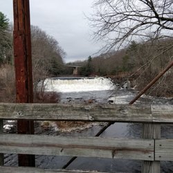
We ride the East Coast Greenway into the village of Summit where the paved pathway ends. We turn around here as we don't have dirt bikes, however, there is a dirt trail here that continues on into CT. There is a fair amount of parking here. If riding the ECG, it's a bit down hill on the way out and up hill on the way back. A small grocery and farm store is nearby if you need an deli sandwich, ice cream or cold drink. The ECG continues into CT along this little dirt path, that eventually widens into a vehicle width dirt path and further on is covered in crushed stone. So good for walkers or dirt bikers, but not for my road bike. Just FYI. Happy trails! read more


4 years ago
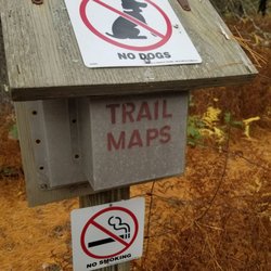
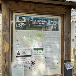
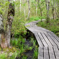
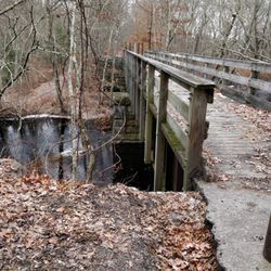
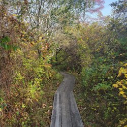
Very quiet, easy walking and mountain biking trail. Not much to see including other people. I was there on a beautiful Sunday afternoon and met 6 people while walking for over an hour. There is parking at the trail junction with the Washington and Southern bike trail. The first 100 feet of the trail is paved. The rest is not paved but mostly follows an old railroad grade so it is easy walking. At the end of the pavement there are three choices. Two are clearly marked as private property. The third which is not paved, has no markings at all. This is the one you want. read more
17 years ago
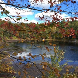
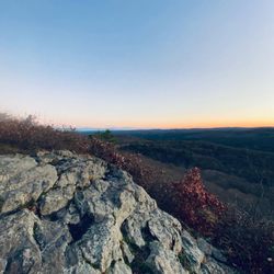
A trail with bumps Whoop de doos or simply whoopers are undulating ups and downs in a trail. Common in motor cross and other off road race tracks, they are great fun. It you happen to have a motorcycle you can jump and bounce over them; seems like you are flying. On an leg powered mountain bike things get a bit tougher. You have to roll over most of them. Up and down, up and down. Sick sickness pills might help. You just don't see too many of them on natural trails but for some reason this place has miles of them. Up and down, almost like you are on a boat in angry seas. Perhaps the ground is collapsing in places or is harder in certain spots. I'm not sure of the exact geological process that makes them but there sure are a lot of whoopers on this trail, and they seem to be getting more severe every time I ride here. Besides the whoops the trial has many other great features. Nice rocks, logs, water, hills and plenty of mud. Something for everyone. If you are a novice or want a nice mellow ride you can stay on the main trial and just relax. It's pretty wide and safe. There is a skeleton bridge you have to get across but it's not too bad. But if you want a real challenger you can go on one of the numerous side trails. Of course all the maps of the trials are virtually useless but I have heard from other bikers that you can go for days on these side trails. Deep, deep woods with no one else around. Of course we get lost every single time we come here but that's half the fun. Extremely tough single track with every obstacle and nasty thing I have ever seen on a trail. A great place to test your bike, skill and possible the local emergency medical care. I have to give this mountain bike trail five big ones. It really does have it all. Wimp out and stay on the main trial or be adventurous and get lost on the bike devouring side trails. All the rocks, hills, mud and weird stuff you could ever want in a bike ride. Or just stay and play on the endless whoopers. The choice is up to you. read more


10 years ago
9 years ago
More info about Trestle Trail
Old Sumit Rd
Kent, RI 02827
Directions
Hours
Outdoor Amenities
You might also consider


Trestle Trail - hiking - Updated June 2026
Best of Kent
People found Trestle Trail by searching for…
People who viewed Trestle Trail also viewed
Maxwell Mays Wildlife Refuge
13 reviews
River Point Park
3 reviews
Quequechan River Rail Trail
1 review
Mawney Pine Preserve
1 review
Washington Secondary Bike Path
5 reviews
Hunt River Preserve
2 reviews
Manchester Street Park
2 reviews
Esek Hopkins Field
2 reviews
Sandy Acres Recreation Area
3 reviews
Amtrak Station Park
5 reviews
Downtown