Table Mountain Photos


More like Table Mountain
Recommended Reviews - Table Mountain
Start your review...


Reviews With Photos

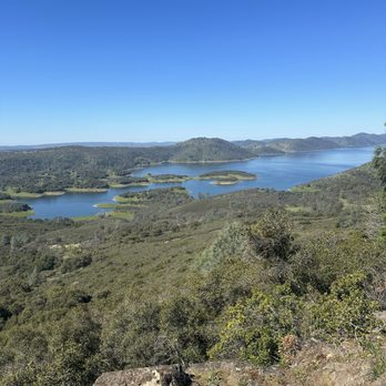
The start of the hike is relaxing and peaceful with beautiful views of the lake. If you decide to go up the mountain it's a steep and rocky uphill walk, but you can't do it! It's totally worth it. The view at the top is incredible. There's also a cave you can walk through but I would suggest bringing a flashlight, it was to dark to see with just my phones flashlight so I didn't walk the whole thing. I have no clue how far it goes. There are a lot of butterfly's and birds on the trail.


What a truly amazing hike this is with breath taking views along the trail and especially at the top. Located just outside of Jamestown and very easy to find, Tuolumne Table Mountain Trail is a must see 4 mile switchback trail that is challenging enough to satisfy the adult hiker while still being simple enough to be able to bring the entire family along with you. The trail starts out very slow and easy and builds in difficulty as you approach the top. Some areas were definitely more challenging than others. Bring plenty of water and take your time. The view at the top is worth it! The road to the trailhead is not well maintained so you may have to park another quarter mile or so away and walk in if you aren't in a 4 wheel drive vehicle.


Checked this out for the first time on Sunday, April 23rd 2017 I arrived at the trail-head around 9:30am. There were already a few cars in the very limited parking area. The Trail was very muddy and you will get your feet wet if you go after a rain. The Trail can be confusing, just remember to always go left. Bring shoes that can grip because it gets very steep as you approach the top of the mountain. The Trail is narrow at points and although dogs can make the journey up the steep terrain..if they are on a leash they may drag you down the mountain. The top of Table Mountain is huge. A lot of room to explore and take in the views. Lots of wildflowers and birds. Arrive before 9am to get a parking spot!


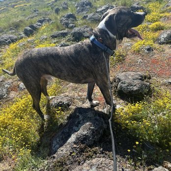
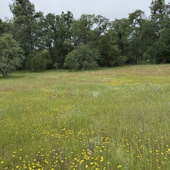
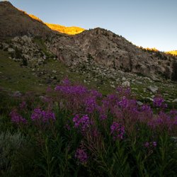
What a great hike, only a little bit of incline getting to the lake and back, but not too much so it's great for everyone . Very secluded. We only saw 2 other people all day. The dogs loved chasing the frogs into the lake, and there are stretches with beautiful yellow wild flowers everywhere. We will definitely be back!


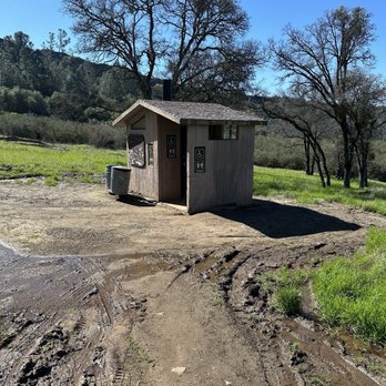
I tried this hike today around noon and got back to my car a little by 3:45. I think it was about a 5 mile hike and I spent over an hour at the top. I took the trail on Shell Rd. Basically the road dead ends where the trailhead and parking is. You'll know you made when you see a bunch of cars pulled off on the side. Parking is tight as others have mentioned. However by the time I left there were hardly any cars. You'll see a sign at the start saying table mountain trail right next to a gate. Once you go through there, just keep walking up the trail. There will be a fork in the road. Doesn't matter which direction you go in, they will meet back up shortly. Eventually you'll get to a restroom and you'll need to probably stop as there are no restrooms at the top. Then you'll cross a street and go through a gate like before. Just keep walking. The lake will be on your right. Near the top of the mountain there will be some boulders and the trail isn't exactly clear. At one point there was another fork, and I tried going right and saw a small cave. That direction didn't seem right and wasn't well worn on the ground so I turned around and went left. Another fork I came across, someone laid a large stick across the trail as if to tell hikers it wasn't the way. You'll start to see some switchbacks. You'll need to grab ahold of the rocks as you make your way up. It's not an easy hike. I saw a child aged 3 maybe having a fit and seemed tired. His mother carried their crying child down the boulders,which probably wasn't safe for anyone. You'll want to wear good shoes with traction as it gets a bit difficult towards the top. It was 5-10 min scrambling on rocks. The entire hike was one hour long each way. The top is super awesome and the hawks and birds fly around so close to you at that height. The flowers were pretty, and the view was gorgeous. I'd definitely go again.


1 year ago
Great moderate hike. Many people bring their kids and babies. The final part is a bit steep to reach the top, but it's doable. The view at the top is amazing and beautiful. read more



This was a great hike. The weather cooperated and the trail was in pretty good shape. Not too many wet spots. I was able to take my dog on this trail which was nice. Gets steep and rocky at the top but worth the climb. read more




1 year ago
The start of the hike is relaxing and peaceful with beautiful views of the lake. If you decide to go up the mountain it's a steep and rocky uphill walk, but you can't do it! It's totally worth it. The view at the top is incredible. There's also a cave you can walk through but I would suggest bringing a flashlight, it was to dark to see with just my phones flashlight so I didn't walk the whole thing. I have no clue how far it goes. There are a lot of butterfly's and birds on the trail. read more


What a truly amazing hike this is with breath taking views along the trail and especially at the top. Located just outside of Jamestown and very easy to find, Tuolumne Table Mountain Trail is a must see 4 mile switchback trail that is challenging enough to satisfy the adult hiker while still being simple enough to be able to bring the entire family along with you. The trail starts out very slow and easy and builds in difficulty as you approach the top. Some areas were definitely more challenging than others. Bring plenty of water and take your time. The view at the top is worth it! The road to the trailhead is not well maintained so you may have to park another quarter mile or so away and walk in if you aren't in a 4 wheel drive vehicle. read more


9 years ago
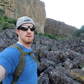
Checked this out for the first time on Sunday, April 23rd 2017 I arrived at the trail-head around 9:30am. There were already a few cars in the very limited parking area. The Trail was very muddy and you will get your feet wet if you go after a rain. The Trail can be confusing, just remember to always go left. Bring shoes that can grip because it gets very steep as you approach the top of the mountain. The Trail is narrow at points and although dogs can make the journey up the steep terrain..if they are on a leash they may drag you down the mountain. The top of Table Mountain is huge. A lot of room to explore and take in the views. Lots of wildflowers and birds. Arrive before 9am to get a parking spot! read more



7 years ago
What a great hike, only a little bit of incline getting to the lake and back, but not too much so it's great for everyone . Very secluded. We only saw 2 other people all day. The dogs loved chasing the frogs into the lake, and there are stretches with beautiful yellow wild flowers everywhere. We will definitely be back! read more


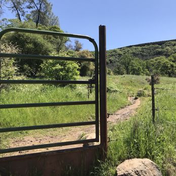
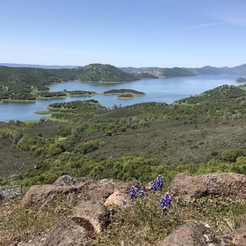
I tried this hike today around noon and got back to my car a little by 3:45. I think it was about a 5 mile hike and I spent over an hour at the top. I took the trail on Shell Rd. Basically the road dead ends where the trailhead and parking is. You'll know you made when you see a bunch of cars pulled off on the side. Parking is tight as others have mentioned. However by the time I left there were hardly any cars. You'll see a sign at the start saying table mountain trail right next to a gate. Once you go through there, just keep walking up the trail. There will be a fork in the road. Doesn't matter which direction you go in, they will meet back up shortly. Eventually you'll get to a restroom and you'll need to probably stop as there are no restrooms at the top. Then you'll cross a street and go through a gate like before. Just keep walking. The lake will be on your right. Near the top of the mountain there will be some boulders and the trail isn't exactly clear. At one point there was another fork, and I tried going right and saw a small cave. That direction didn't seem right and wasn't well worn on the ground so I turned around and went left. Another fork I came across, someone laid a large stick across the trail as if to tell hikers it wasn't the way. You'll start to see some switchbacks. You'll need to grab ahold of the rocks as you make your way up. It's not an easy hike. I saw a child aged 3 maybe having a fit and seemed tired. His mother carried their crying child down the boulders,which probably wasn't safe for anyone. You'll want to wear good shoes with traction as it gets a bit difficult towards the top. It was 5-10 min scrambling on rocks. The entire hike was one hour long each way. The top is super awesome and the hawks and birds fly around so close to you at that height. The flowers were pretty, and the view was gorgeous. I'd definitely go again. read more






5 years ago
8 years ago
No review since it was too hot. We turn around and left. There was no car at the main parking lot or start of trail. I did drive to the 2nd gate by the restroom. No car there too. Will try it again next year. read more


9 years ago

8 years ago
More info about Table Mountain
17926-17902 Shell Rd
Jamestown, CA 95327
Directions
Hours
Outdoor Amenities
Ask the Community - Table Mountain
Review Highlights - Table Mountain














Why does Yelp recommend reviews?
1 review that is not currently recommended
The reviews below are not factored into the business's overall star rating.
9 years ago
Table Mountain - hiking - Updated September 2026
Best of Jamestown
People found Table Mountain by searching for…
Hiking Trails in Jamestown, CA
Swimming Holes in Jamestown, CA
Dog Friendly Hiking Trails in Jamestown, CA
Walking Trails in Jamestown, CA
Hikes With Dogs in Jamestown, CA
Secluded Spots in Jamestown, CA
Off Road Trails in Jamestown, CA
Lakes & Ponds in Jamestown, CA
Beautiful Views in Jamestown, CA
Off Leash Dog Hikes in Jamestown, CA
Running Trails in Jamestown, CA
Parks for Kids in Jamestown, CA
Scenic Overlook in Jamestown, CA
Trending Searches in Jamestown, CA
Apple Orchards near Table Mountain
Apple Picking near Table Mountain
Barbershop near Table Mountain
Beautiful Views near Table Mountain
Blow Dry Bar near Table Mountain
Dog Friendly Things To Do near Table Mountain
Eyelash Extensions near Table Mountain
Haunted Houses near Table Mountain
Hiking Trails near Table Mountain
Kids Birthday Party near Table Mountain
Makeup Artists near Table Mountain
Off Road Trails near Table Mountain
Outdoor Activities near Table Mountain
Photo Spots near Table Mountain
Picnic Areas near Table Mountain
Places To Take Pictures near Table Mountain
Private Schools near Table Mountain
Public Shower near Table Mountain
Browse Articles
Browse Nearby
Browse Brands
Related Searches in Jamestown, CA
Affordable Kayak Rental Services in Jamestown, California
Affordable Paddle Board Rental in Jamestown, California
Best Dog Hiking Trails Around Jamestown, California
Best Fishing Locations and Guides in Jamestown, California
Best Places for Horseback Riding in Jamestown, California
Best Sledding Spots and Fun in Jamestown, California
Best Waterfalls and Swimming Holes in Jamestown, California
Discover Dog Friendly Trails to Explore in Jamestown, California
Discover Kid Friendly Hiking Trails in Jamestown, California
Discover Popular Bike Trails in Jamestown, California
Discover Scenic Mountain Bike Trails Near Jamestown, California
Discover Top Boat Tours in Jamestown, California for All Ages
Discover a Hiking Trail in Jamestown, California
Discover the Best Night Hike Trails in Jamestown, California
Dog-Friendly Hikes With Dogs in Jamestown, California
Enjoy Camping Adventures Around Jamestown, California
Enjoy Kayaking Adventures in Jamestown, California
Enjoy Off Leash Dog Hikes in Jamestown, California
Enjoy Water Activities and Fun in Jamestown, California
Enjoy a Beautiful Waterfall Hike in Jamestown, California
Enjoy the Best Walking Trails in Jamestown, California
Experience Thrilling White Water Rafting in Jamestown, California
Explore Beautiful Parks and Green Spaces in Jamestown, California
Explore Easy Hikes Perfect for All in Jamestown, California
Explore Fun Activities to Do in Jamestown, California
Explore Popular Campgrounds Near Jamestown, California
Explore Top Dog Parks in Jamestown, California Near You
Explore Top Water Parks in Jamestown, California Today
Explore the Best Beach Spots in Jamestown, California
Explore the Best Swimming Holes Around Jamestown, California
Family Friendly Hiking With Kids in Jamestown, California
Find Popular Ziplining Spots Around Jamestown, California
Find Top Dog Swimming Spots in Jamestown, California
Find the Best Parks BBQ Grills in Jamestown, California
Find the Best Playgrounds to Visit in Jamestown, California
Hiking Trails With Waterfalls in Jamestown, California
Off Leash Dog Hiking Trails in Jamestown, California
Popular Outdoor Activities to Try in Jamestown, California
Popular Picnic Spots to Visit in Jamestown, California
Safe River Swimming Areas in Jamestown, California
Safe and Fun Parks for Kids in Jamestown, California
Top Hiking Trails to Explore in Jamestown, California
Top Playgrounds for Kids to Enjoy in Jamestown, California
Top Running Trails to Explore in Jamestown, California
Top Swimming Lakes to Enjoy in Jamestown, California
Top Swimming Spots and Pools in Jamestown, California



