Summit Track at Mt Coot-tha Photos


Recommended Reviews - Summit Track at Mt Coot-tha
Start your review...

14 years ago
Starting at the J.C. Slaughter Falls Picnic area, the Summit Track is a moderately graded walking track that totals 3.8km up and back, and usually takes about an hour. Half an hour to the top, half an hour back down again. There's a few steeps bits, but mostly it is just steady incline that would suit people at most fitness levels. There are always lots of families with young kids walking up and down, so it's not too hard. It's a lovely walk between the trees on the way up and then you are rewarded with the panoramic view of Brisbane city and suburbs. On a clear day you can see out to Moreton Bay and Stradbroke Islands. Dogs are allowed on the track but must be on leashes. Horses and bikes are only allowed on their designated tracks, not the Summit Walking Track. There are toilets at the base, near the J.C. Slaughter Falls Picnic area that are open from 6am-7pm and there are a couple of water fountains along the way. But take a water bottle, especially in summer as it can get pretty hot. read more


14 years ago
14 years ago
More info about Summit Track at Mt Coot-tha
Sir Samuel Griffith Dr
Mt Coot-Tha Queensland 4066
Australia
Directions
Hours
Indoor Amenities
Outdoor Amenities


Summit Track at Mt Coot-tha - hiking - Updated May 2026
Browse Brands
Browse Articles
People who viewed Summit Track at Mt Coot-tha also viewed
Kangaroo Point Cliffs Park
8 reviews
Kangaroo Point
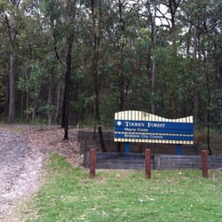
Toohey Forest Park
2 reviews
Nathan
Kangaroo Point Lookout
14 reviews
Kangaroo Point
Cornubia Forest Park
1 review
Sandgate/Shorncliffe Cycleway
4 reviews
Shorncliffe
Tingalpa Creek Track
1 review
Ransome
Sherwood Arboretum
5 reviews
Sherwood
D'Aguilar National Park
1 review
White Rock Conservation Park
1 review
Hardcastle Park
2 reviews
Hawthorne