Cancel

    Open app

    Search

    Suffolk Seaboard Coastline Trail

    5.0 (1 review)

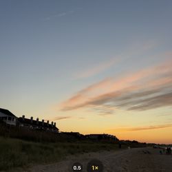
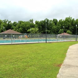
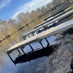
    Suffolk Seaboard Coastline Trail Photos

    You might also consider

    More like Suffolk Seaboard Coastline Trail

    Recommended Reviews - Suffolk Seaboard Coastline Trail

    Your trust is our priority, so businesses can't pay to alter or remove their reviews. Learn more about reviews.
    Yelp app icon
    Browse more easily on the app
    Review Feed Illustration

    2 years ago

    Helpful 1
    Thanks 0
    Love this 0
    Oh no 2

    Verify this business for free

    Get access to customer & competitor insights.

    Verify this business

    Captain John Smith Chesapeake National Historic Trail

    Captain John Smith Chesapeake National Historic Trail

    5.0(1 review)
    15.9 mi

    One day when I was looking around on the National Park Service website, I spotted the Captain John…read moreSmith Chesapeake National Historical Trail (JST). There is nothing I love more than trails, but when you combine history with nature, I get damn giddy! 400 years ago, Captain John Smith explored the Chesapeake Bay, and covered over 3,000 miles of trails--most of it being water. In 2006, Congress designated Smith's voyages as the first national water trail. Because of that, there is not one main trail for JST. There are several "trails" throughout Hampton Roads (HR). Each site has a sign and logo (see pictures) representing its inclusion with JST. Here is a list of the places you can visit in HR to check out JST: * Fort Boykin--Smithfield * Windsor Castle Park--Smithfield (Technically, Smithfield is not included in HR, but close enough to Suffolk, and many HR residents visit often.) * Mariners' Museum--Newport News * Virginia Living Museum--Newport News * Fort Monroe National Monument--Hampton * Hoffler Creek Wildlife Preserve--Portsmouth * First Landing State Park--Virginia Beach * Lynnhaven River NOW--Virginia Beach * Great Bridge Lock Park--Chesapeake TIPS: * Download the Chesapeake Explorer App (http://chesapeakeexplorerapp.com/) * Check out A Boater's Guide to the JST (http://goo.gl/dLi34r) * Here is the historical map from John Smith voyages: http://goo.gl/rGvgDA And here is the current map for JST: http://smithtrail.net/visit-the-trail/index * There is a Junior Ranger badge specifically for JST--ages 6 - 12. Go to this website and follow the directions: http://smithtrail.net/about-us/for-kids * Calling educators/parents! They offer lesson plans on the website: http://smithtrail.net/about-us/for-educators * Many of the water trails are accessible to kayaks and canoes! * Take a driving tour. (http://goo.gl/C4b7jk)

    Photos
    Captain John Smith Chesapeake National Historic Trail
    Captain John Smith Chesapeake National Historic Trail
    Captain John Smith Chesapeake National Historic Trail

    See all

    Mackay Island National Wildlife Refuge

    Mackay Island National Wildlife Refuge

    4.8(5 reviews)
    34.6 mi

    On this rainy Sunday newly arrived Snow Geese from Greenland and Russia have arrived. This has been…read morea bucket list for years. Hundreds of these geese, named for their white plumage, have landed in North Carolina. The snow goose is mostly covered in white feathers, but has black wing tips. They are typically native to Greenland, Canada, Alaska and the northeastern tip of Siberia. While seemingly rare to most people, there's another type of goose that's far more rare to spot along the Atlantic Coast that has also arrived- the Blue Ross Goose. Its color mutation is controlled by a single gene. This bird was the inspiration for cartoonist J.N. Darling to create the symbol of the the National Wildlife Refuge System. Populations of blue geese are found mostly in central North America and very rarely come to the east coast. Snow Geese fly to the Arctic and subarctic zone of North America, as well as marginal areas of neighboring Russia and Greenland to breed each year. They time their arrival to coincide with the melting snow and thawing ice. The tundra of the far north provides rich foraging grounds and a relatively safe place for these birds to raise their family. At such high latitudes however the summer is short-lived, and the birds must head south because they cannot survive the coming harsh winter. Once breeding is complete, the birds molt and then begin a long migration. The timing of migration is highly dependent on weather conditions, but normally begins shortly after the first snow begins in mid August and is usually completed by December. The migration is a pretty drawn out affair that lasts 3 or 4 months, making long stopovers at regularly used staging grounds to refuel for the next leg. They will begin their northward spring migration as early as February from the south and arrive at their breeding grounds by the end of May. Geese form lifelong pairs on their second northward spring migration. They will mate for life and return to the same nest site year after year.

    If you have never been to this spot - you are missing out. This summer I have made it my mission…read moreto bike all the local refuge, parks, and trails and I have found some real gems but this has been my favorite so far. Mackay Island National Wildlife Refuge is just across the Virginia/North Carolina border (through Pungo and Princess Anne Road) and takes up most of Knott's Island. There are two primary entrances and during COVID the facilities are closed but you can still adventure, hike, fish, ride bikes, bird and wildlife watch, and enjoy! Most of this refuge is made up of marsh land and I rode the loop from the end of the entrance road parking lot fully around earlier today which was around 5.5 miles total and it was beautiful. I saw huge cattails, tons of white baby's breath flowers along the trail, turtles, birds, fish, and white and blue herons! No snakes surprisingly. There is no shade on the trail so come prepared with tons of water and hats and sunscreen. Water and marsh on both sides and beautiful, beautiful, scenery is what you will be treated to here. It is a must see. My all-time favorite so far this summer!

    Photos
    Mackay Island National Wildlife Refuge
    Mackay Island National Wildlife Refuge
    Mackay Island National Wildlife Refuge

    See all

    Heroes Circle Nature Trail

    Heroes Circle Nature Trail

    5.0(1 review)
    20.1 mi

    It's quite a shame that a trail with this kind of significance, commemorating the lives lost of…read moreservice members, is located within the walls of a military base with restricted access from the general population. Hence this review, to inform those who don't have access. Heroes Circle Nature Trail is located on Joint Expeditionary Base Little Creek - Fort Story honors the service members who lost their lives while stationed here since September 11, 2001. I think this trail was built within the last few years, because I don't remember this trail being here the last time we were stationed here. There are individual markers highlighting each hero's service and sacrifice along the trail and I took a snapshot of each one and hope I didn't forget anyone. There is another little area "Hero Workout of the Day" that is dedicated to "The Murph". LT Murphy was posthumously awarded the Congressional Medal of Honor and nicknamed the workout you see on the marker, "Body Armor". The trail starts off with a slightly raised wooden platform, but does not go all the way to the end (FYI for the strollers & wheelchairs). According to the info board found at the trailhead, the trail is about 0.8 mile. The trail also serves as a bird and wildlife sanctuary with interpretive signs throughout. It's a beautiful trail, although short, with great significance, so if you have access or can get access, I recommend you stop by for a bit of exercise, fresh air and gratitude. May they rest in peace.

    Photos
    Heroes Circle Nature Trail - Trail

    Trail

    Heroes Circle Nature Trail
    Heroes Circle Nature Trail

    See all

    Eastern Shore National Wildlife Refuge

    Eastern Shore National Wildlife Refuge

    4.1(7 reviews)
    36.8 mi

    The wildlife refuge near the Chesapeake Bay Bridge-Tunnel did not seem to offer a ton of access to…read morebeachy areas, instead containing a visitor center and some trails through reasonably pleasant forest. Stopping in at the visitor center got me a lot of welcomes, including from a retired physician with a biology background (this sounds like a nice way to spend one's retirement). Among other things, I was informed that the island which the bridge runs through is only open for tours a few weeks a year, and I received information on how to pursue those tours, which I might follow through on. Otherwise, I refilled my water bottles and got in a nice little walk.

    Worthy of a stop in my book, but don't go out of your way if not passing by. There are two parts…read more The Eastern Shore Visitors Center which has its own listing and the grounds. I would recommend doing both and have enjoyed for years. The location is just a few miles from the Bay Bridge with good signage. If you plan on doing both park at the visitors center there is a grassy path to the refuge. It's approximately a mile walk. If refuge only drive past the VC and hang a right to a small lot. The entrance is under a WW II concrete bunker with a surprise upon passing through. A powerful gun originally mounted in the rear turret of the Missouri. A cool side note. The USS Missouri was the site of the 1945 Japanese surrender ceremony. The 16 inch 50 caliber gun saw extensive action in both WW II and in the Korean War. The weapon was placed inside the refuge in 2013 to represent the original that sat in the very same bunker. The 2,100 pound round could fire at a distance of 21 miles across the bay and then some. On top of the bunker is an over look and worth the climb. Stairs are located on the side and are in great shape. Unfortunately it's not the best Kodak moment with a lot of over growth that needs cleared. If you bring a selfie stick or foot ladder that's best to elevate. There is not a large trail network which is a limiting factor. However, the refugee itself is hundreds of acres all Federally protected. Along the trail to a second overlook is a small cemetery which is nothing of interest. The second overlook located just mInutes from the bunker is the ideal photo op location. It's green, it's marshy and it's expansive. So snap away. For lovers of birds you will see water fowl. I'm a bit surprised that the refuge has so few reviews with a lot of traffic that passes by nearby Highway 13. If time permits go for it. Both the ES Wildlife Refuge and Visitors Center and can be done in less than two hours easy.

    Photos
    Eastern Shore National Wildlife Refuge
    Eastern Shore National Wildlife Refuge
    Eastern Shore National Wildlife Refuge

    See all

    Dismal Swamp Canal Trail

    Dismal Swamp Canal Trail

    4.2(37 reviews)
    12.1 mi

    I lived in Deep Creek since 1973 and I have never visited this park. I was pleasantly surprised…read morethat my Sister and I ran into other Creekers who were also there with their children for the first time. I loved the displays and the information about the Enslaved People who dug out the swamp to allow others to navigate the waterways. I was so happy that we went on a brisk day when the bugs were laying low. HeeHee! We were able to walk around and look at the dock, the farm house, and a few other out buildings for the farm area. Very interesting that they were families that still lived next to the swamp area. The parking lot is well-kept and free. We found a few places to sit and eat, as well as a few water fountains for visitors. Everything was clean and tidy. We enjoyed listening to the water. Very nice visit!

    To be honest, people on insta were telling me I was actually at the wrong location for what I was…read morelooking for. I was so excited to fit in time to go hike the dismal swamp. I've been thinking about it for a while and it fit right into my timeliness this week visiting Machicomoco and Kiptopeke State Parks. I got here and it was all paved. Bikes and pet walkers. I expected some dirt trails and pine needle tails and smelly water to brave through. Cattails or pussy willows if you prefer. Instead I got hard pavement and dogs. I did walk a little ways out. It just wasn't my thing. Cheers to the people who bike and pet walk here. If you pick up poo, put the bag in the trash. Why pick it up if you try to anonymously drop it further down the trail?

    Photos
    Dismal Swamp Canal Trail
    Dismal Swamp Canal Trail
    Dismal Swamp Canal Trail - I guess I was at the wrong location

    See all

    I guess I was at the wrong location

    Suffolk Seaboard Coastline Trail - walkingtours - Updated May 2026

    Loading...
    Loading...
    Loading...