Stanley Canyon Trail Photos


More like Stanley Canyon Trail
Recommended Reviews - Stanley Canyon Trail
Start your review...




I feel this route needs a solid review from someone who is mathematically, grammatically and alpinistically (I just made that up), "inclined". First of all, this is probably the most beautiful yet somewhat challenging short hike in town. If you want a snapshot of the grandeur awaiting you beyond the I25 corridor (and cell phone range) this is it! Absolutely beautiful. The short: for the average person of moderate or lacking fitness level, it should absolutely be doable. I would say the normal person could knock it out in less than 4 hours (with picture/selfie taking along the way and up top). Decent fitness levels should be up and down in less than 2 hours... Don't bring the cat-dog looking micro mutt as you will either be carrying it or burying it somewhere about the first hour of hiking. There is water throughout the trail so regular dogs should have a blast here. There is an issue with dog poo littering the parking lot and trails (despite free poo bags being offered at trail head... This hike is no joke. Wear proper shoes with decent traction. You can get hurt here! I would bring at least a liter (Nalgene bottle) of water during hot days. Although covered with trees throughout, the sun will beat down on you throughout the hike. I only say this because I passed a family of 5 about half way with no water. As far as short local hikes go, Stanley Canyon gets a Five from me. Awesome! read more

8 years ago
This hike is not for the faint of heart. It's a pretty steep hike up and coming back down can be very difficult if you have bad knees or don't have excellent tread on your hiking boots. Scree for days! But it's a beautiful one and a great workout. read more

15 years ago
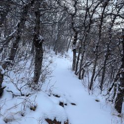
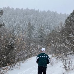
My Boyfriend, Dog and I hiked this trail about 3 weeks ago.... in December when it was 35 Degrees out. Needless to say the trail was snow covered and icy the higher we got up. Being that were from the south we were under prepared. The trail was about 8 out of 10 on a difficulty scale but with the proper gear would have been a lot less difficult. It was about a 2 mile hike one way, 4 miles roundtrip (for the mathematically inclined). I highly recommend this trail to anyone who can get onto the Air Force Academy. I know there is a lake once you reach the clearing through the mountains where you can fish, providing you can make it to the top. Whether you are a Colorado native or just a visitor this trail is a must see in Colorado Springs. Call the AFA visitor center for more information; (719)333-2025 read more


7 years ago
More info about Stanley Canyon Trail
Air Force Academy
Air Force Academy, CO 80918
Directions
(719) 333-2025
Call Now
Hours
Outdoor Amenities
Ask the Community - Stanley Canyon Trail












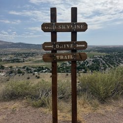


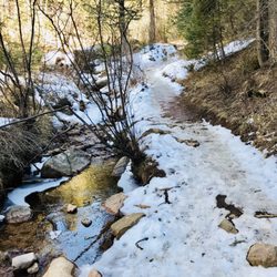


Stanley Canyon Trail - hiking - Updated October 2026
Best of Air Force Academy
People found Stanley Canyon Trail by searching for…
Lakes in Air Force Academy, CO
Things to Do in Air Force Academy, CO
Hiking Trails With Waterfalls in Air Force Academy, CO
Fishing Lake in Air Force Academy, CO
Fishing Spots in Air Force Academy, CO
Lakes & Ponds in Air Force Academy, CO
Places to Take Pictures in Air Force Academy, CO
Waterfalls in Air Force Academy, CO
Scenic View in Air Force Academy, CO
Picnic Areas in Air Force Academy, CO
Walking Trails in Air Force Academy, CO
Trout in Air Force Academy, CO
Swimming Lakes in Air Force Academy, CO
Parks With Shade in Air Force Academy, CO
Swimming Holes in Air Force Academy, CO
Running Trails in Air Force Academy, CO
Visitor Centers in Air Force Academy, CO
Dog Friendly Trails in Air Force Academy, CO
Lazy River Tubing in Air Force Academy, CO
Canyoneering in Air Force Academy, CO
Easy Hikes in Air Force Academy, CO
Trails in Air Force Academy, CO
Trending Searches in Air Force Academy, CO
Apple Orchards near Stanley Canyon Trail
Apple Picking near Stanley Canyon Trail
Archery near Stanley Canyon Trail
Attraction Farms near Stanley Canyon Trail
Bird Sanctuary near Stanley Canyon Trail
Blow Dry Bar near Stanley Canyon Trail
Boating near Stanley Canyon Trail
Corn Maze near Stanley Canyon Trail
Costume Store near Stanley Canyon Trail
Craft Fairs near Stanley Canyon Trail
Fishing Tackle Shop near Stanley Canyon Trail
Halloween Events near Stanley Canyon Trail
Haunted Houses near Stanley Canyon Trail
Hiking Trails near Stanley Canyon Trail
Lakes near Stanley Canyon Trail
Lookout Points near Stanley Canyon Trail
Men's Clothing near Stanley Canyon Trail
Off Road Trails near Stanley Canyon Trail
Parks For Parties near Stanley Canyon Trail
Photo Spots near Stanley Canyon Trail
Pick Your Own Farms near Stanley Canyon Trail
Picnic Spots near Stanley Canyon Trail
Places To Take Pictures near Stanley Canyon Trail
Pumpkin Patches near Stanley Canyon Trail
Rock Quarry near Stanley Canyon Trail
Scenic Night View near Stanley Canyon Trail
Scenic Overlook near Stanley Canyon Trail
Sunrise View near Stanley Canyon Trail
Swimming Holes near Stanley Canyon Trail
Browse Articles
Browse Nearby
BEST of Air Force Academy, Colorado Coffee near Stanley Canyon Trail
BEST of Air Force Academy, Colorado Restaurants near Stanley Canyon Trail
BEST of Air Force Academy, Colorado Breakfast near Stanley Canyon Trail
BEST of Air Force Academy, Colorado Things to Do near Stanley Canyon Trail
BEST of Air Force Academy, Colorado Museums near Stanley Canyon Trail
BEST of Air Force Academy, Colorado Shopping near Stanley Canyon Trail
Browse Brands
Related Searches in Air Force Academy, CO
Affordable Fishing Rental Services in Air Force Academy, Colorado
Affordable Kayak Rental Services in Air Force Academy, Colorado
Best Dog Hiking Trails Around Air Force Academy, Colorado
Best Fishing Locations and Guides in Air Force Academy, Colorado
Best Places for Horseback Riding in Air Force Academy, Colorado
Best Sightseeing Experiences Available in Air Force Academy, Colorado
Book Top Fishing Trips in Air Force Academy, Colorado Today
Check Out Off Road Trails in Air Force Academy, Colorado
Discover Dog Friendly Trails to Explore in Air Force Academy, Colorado
Discover Kid Friendly Hiking Trails in Air Force Academy, Colorado
Discover Lakes & Ponds to Explore in Air Force Academy, Colorado
Discover a Hiking Trail in Air Force Academy, Colorado
Discover the Best Fishing Lake in Air Force Academy, Colorado
Discover the Best Night Hike Trails in Air Force Academy, Colorado
Dog-Friendly Hikes With Dogs in Air Force Academy, Colorado
Enjoy Camping Adventures Around Air Force Academy, Colorado
Enjoy Exciting Mountain Biking Adventures in Air Force Academy, Colorado
Enjoy Fishing Pier Spots in Air Force Academy, Colorado With Scenic Views
Enjoy Fishing With Kids in Air Force Academy, Colorado Safely
Enjoy Hiking Adventures in Air Force Academy, Colorado
Enjoy Kayaking Adventures in Air Force Academy, Colorado
Enjoy Off Leash Dog Hikes in Air Force Academy, Colorado
Enjoy Sailing Adventures in Air Force Academy, Colorado
Enjoy Tent Camping Spots Around Air Force Academy, Colorado
Enjoy Water Activities and Fun in Air Force Academy, Colorado
Enjoy the Best Walking Trails in Air Force Academy, Colorado
Experience Amazing Scuba Diving in Air Force Academy, Colorado
Experience Thrilling White Water Rafting in Air Force Academy, Colorado
Experienced Fishing Guides Available in Air Force Academy, Colorado
Explore Beautiful Parks and Green Spaces in Air Force Academy, Colorado
Explore Easy Hikes Perfect for All in Air Force Academy, Colorado
Explore Fun Activities to Do in Air Force Academy, Colorado
Explore Popular Campgrounds Near Air Force Academy, Colorado
Explore Popular Picnic Areas Around Air Force Academy, Colorado
Explore Scenic Lakes to Visit in Air Force Academy, Colorado
Explore Top Dog Parks in Air Force Academy, Colorado Near You
Explore Top Marinas Near Air Force Academy, Colorado
Explore the Best Bait Shops Around Air Force Academy, Colorado
Explore the Best Beach Spots in Air Force Academy, Colorado
Explore the Best Boating Spots in Air Force Academy, Colorado
Explore the Best Swimming Holes Around Air Force Academy, Colorado
Explore the Scenic River in Air Force Academy, Colorado
Family Friendly Hiking With Kids in Air Force Academy, Colorado
Find Cozy Camping Cabins in Air Force Academy, Colorado
Find Fishing Tackle Stores in Air Force Academy, Colorado
Find Parks and Recreation Activities in Air Force Academy, Colorado
Find Popular Ziplining Spots Around Air Force Academy, Colorado
Find Top Dog Swimming Spots in Air Force Academy, Colorado
Find Top-Rated Waterfalls in Air Force Academy, Colorado Now