Cancel

    Open app

    Search

    Serrano Creek Trail

    4.4 (5 reviews)

    Serrano Creek Trail Photos

    You might also consider

    Recommended Reviews - Serrano Creek Trail

    Your trust is our priority, so businesses can't pay to alter or remove their reviews. Learn more about reviews.
    Yelp app icon
    Browse more easily on the app
    Review Feed Illustration

    Reviews With Photos

    Jasmine L.

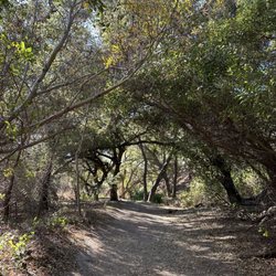
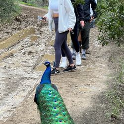
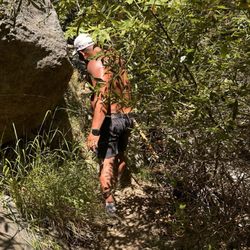
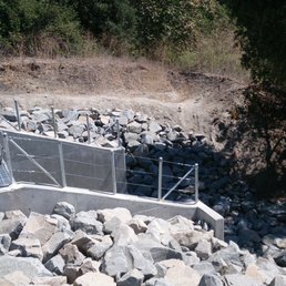
    Dog friendly - to an extent. For parking, I parked across the street in a business/industrial complex of the Lake Forest Nature Center (check the yelp review on it for the address). I didn't have time to do the full trail, due to the fact that its like 13 miles long, so I just took the north trail heading towards the Whiting Ranch Wilderness Park. Unfortunately, dogs are not allowed in the wilderness park so we had to turn around. In total, from the nature center to where we had o stop, and back, was 3.15miles. The trail itself is nice, but it is in the middle of an industrial area, luckily there are enough trees and bushes to mainly hide it, also provides good shade for that part of the trail. Would love to come back sometime to try the south end of the trail, which looks like it winds between residential areas.
    See all

    1 year ago

    Helpful 0
    Thanks 0
    Love this 0
    Oh no 0
    Photo of Javier R.
    2
    294
    3608

    27 days ago

    Helpful 0
    Thanks 0
    Love this 0
    Oh no 0

    2 years ago

    Great place to take a walk or run with your dogs. I highly recommend this place to go explore!

    Helpful 0
    Thanks 0
    Love this 0
    Oh no 0
    Photo of Jasmine L.
    80
    119
    203

    9 years ago

    Helpful 3
    Thanks 0
    Love this 0
    Oh no 0
    Photo of Shariff L.
    43
    290
    1557

    10 years ago

    Helpful 5
    Thanks 0
    Love this 2
    Oh no 0

    You might also consider

    Verify this business for free

    People searched for Hiking 9,170 times last month within 15 miles of this business.

    Verify this business

    Red Rock Canyon

    Red Rock Canyon

    4.7
    (135 reviews)
    3.1 mi

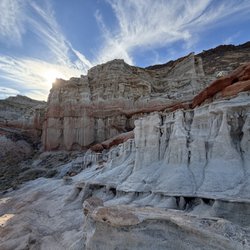
    Red Rock Canyon is located in the City of Lake Forest. Who knew one could view glimpses of red rock…read moreformations and plateaus in Orange County? When we arrived around 8:30 on a Saturday morning, the paid parking lot was already full. There are very few parking spaces overall in the paid $3 lot. We ended up as Ralph's customers that morning and found a couple of last-minute items that we needed before starting our hike. It was a nice and cool morning with a slight breeze, which was perfect to kick off our hike. We opted to take the easy trail, Borrego Canyon Trail. There is a lot of soft sand through out parts of the trail, similar to a beach like sensation for your walking pleasure. It also felt like a magical forest during some areas with trickling streams. We also experienced some parts full of various sized rocks. This is NOT a child- friendly trail for little ones. As we approached parts that were more desert like, we got closer to the red rocks. There was much anticipation to the end and the trail concludes with what feels like a small dead end as you gaze into the view of the towering red rocks. Going downhill was much quicker and fun. It was an easy trail with some sections that forced me to go slower as I didn't want to slip on some small rocks. There was so much positivity coming from other hikers and bicyclists. So many good mornings shared, it was contagious. Bicyclists are one-way so they are only coming from behind you and so many were thankful for us moving out of their way. I've never experienced such polite and friendly trail enthusiasts. I'd love to return to experience this beautiful trail again.

    What a great hike! The shade was wonderful, and everyone on the trail was so respectful of space…read more(thank you, bikers). It gets a little narrow as you get closer to the rock formations, but still highly recommend either way.

    Photos
    I'm definitely on Mars!
    I'm definitely on Mars!
    Red Rock Canyon
    Red Rock Canyon

    See all

    Oso Creek Trail

    Oso Creek Trail

    4.6
    (119 reviews)
    4.4 mi

    The Oso Creek Trail is a classic "Yuppie Nature" trail: mostly paved or manicured paths, and…read morenothing too challenging or dangerous. Exactly the kind of "outdoor" experience my wife loves! But seriously, it's a wonderful place to stretch your legs right in the heart of Mission Viejo. The trail runs along both sides of Oso Creek, hence the name, and each side of the trail is a bit different. One side is paved and the other is dirt or bark covered, for a more "natural" feel. There are also some fun points of interest along the way, including a hedgerow maze, various bear statues, and a park adjacent to the Norman P. Murray Community & Senior Center. It's great for families with small kids or strollers to push, as well as solo joggers, dog walkers, or even bikers. It's long enough and stretches at least a couple miles to get some good exercise in. If you're in the area, it's well worth a visit to enjoy. Five stars!

    This urban trail, which runs along Oso Creek for a couple of miles, has several entrances along…read morethe route. We entered at the south trailhead on Marguerite Parkway next to Del Taco. The path itself was paved for the first mile or so and then became dirt/sawdust. While the trail runs behind and below shopping centers and housing, you never really see much of the structures. We walked a good chunk of the trail to the Peace Obelisk and then turned around and went back to where we parked in a shopping center, which was approximately a 4-mile round trip. It was a good walk on a Saturday afternoon. There weren't a whole lot of people to be seen on our walk; a few families, dog walkers, a couple of joggers, a couple of bicyclists. The entire path is an easy walk and mostly flat. Again, there are several entrances to the trail and there are actually 2 separate parallel trails on either side of the creek. This is a great place to spend a little time in nature while still being in the middle of Mission Viejo.

    Photos
    Oso Creek Trail
    Oso Creek Trail
    Oso Creek Trail

    See all

    Whiting Ranch Wilderness Park

    Whiting Ranch Wilderness Park

    4.5
    (196 reviews)
    1.5 mi

    Whiting Ranch Wilderness Park is located in Lake Forest and spans 2,500 acres. There is a very…read moresmall parking where it costs $3 for a day pass (they take both $1 bills and credit card). Beware of parking at the adjacent parking lots because they are pretty strict about not parking there for hikers. There are a variety of trails at differing difficulty levels and there are select trails that are multi-use where cycling is allowed. We went on the Borrego Canyon Trail and the Red Rock Canyon trail that was a total of two miles one way. There was some shade from the tall trees but some parts were in direct sunlight. There was a good amount of flat land and didn't have too much of an incline. When you get to an intersection with multiple directions just keep going straight and follow the signs for Red Rock Canyon. You will know when you're at the end when you see signs and rocks all around you. The red rocks really reminded me of the hikes that I went to in Arizona and it was cool to see that in California. Overall it took about one hour one way to get from the parking lot through Borrego Canyon Trail and to the end of Red Rock Canyon. Overall it was an easy and enjoyable hike.

    My friends and I have been into hiking lately, and decided to hike here when it was nice and sunny…read morea few weeks ago. We did the serrano road and line shack loop, which was about 3.4 miles total. We arrived at around 8am, and spent about 1.5 hours on the hike, walking a moderate pace. I really liked that how this trail was easily marked and flat. There was also plenty of shade, on the trail, so even as the sun came up, it was still pretty cool. There's some elevation on the trail, but overall, I'd say it was pretty easy to causally walk and talk. When you get to the peak of the trail, you can oversee the Foothill Ranch area, and it looks gorgeous! We followed the parking instructions on AllTrails, which led us to a church parking lot, which connects right to the trail. I did see that this park has other more difficult hikes, so I'd definitely go back for another one!

    Photos
    Saddleback Church Hiking Group
    Saddleback Church Hiking Group
    Whiting Ranch Wilderness Park
    Whiting Ranch Wilderness Park

    See all

    Borrego Canyon Overlook Park

    Borrego Canyon Overlook Park

    4.3
    (11 reviews)
    2.2 mi

    Borrego Canyon Overlook Park is a mini neighborhood park nestled in a residential area, overlooking…read morethe Borrego Canyon. It is basically a patch of greenfield with a small playground. The park is so small that the walkway is only on one side of the park. The paved road ended at the far end of the park. Anyone feeling adventurous can follow the dirt trail all the way to the Whiting Ranch park entrance I was told. This quaint park is clearly intended for neighbors' use only as it does not have a public restroom on-site. The best asset of this park is its gorgeous view of the canyon. Clearly the Bond Fire got too close to the park when you see the wooden fence been replaced by iron stakes covered with a orange mesh, and the charred remain of trees on the other side of the fence. As small as it may be, it has more visitors than the other, larger, Borrego Park, about a mile down the hill. It seems to be very popular with dog owners walking their dog(s).

    This tiny park is a hidden gem that sits atop the Foothill Ranch community in Lake Forest. It…read moreoffers awesome views and a trail that goes down into town between two neighborhoods. In many ways, it is the perfect park for a short afternoon picnic or a hike. Going downhill, the hike is not strenuous and not too long. The trail is easy to follow and there are ways to turn to extend your journey. There is also a small playground and a decent size grass field which can be used for games of touch football, tag, a picnic, or whatever. On a clear day, the grassy area offers a perfect spot to sit and enjoy the views of Irvine, Catalina, and the Pacific Ocean. It is also quite pretty at night. Also, since this park is on top of the hill, it is a fabulous place to fly a kite! There is usually always a breeze blowing, and when it's a bit windy the conditions are perfect. Keep in mind this is in the middle of a residential neighborhood, so parking is limited and it's usually pretty quiet.

    Photos
    Cool nighttime walk pic
    Cool nighttime walk pic
    Another beautiful fall day at the park
    Another beautiful fall day at the park
    Borrego Canyon Overlook Park

    See all

    Black Star Canyon Trail

    Black Star Canyon Trail

    4.4
    (394 reviews)
    7.1 mi

    Love it! It's a lot of climbing over rocks but it's great exercise. The best part of everything is…read morereaching the falls and eating a good sandwich. I do notice that many people leave their trash behind in this particular trail. PLEASE TAKE YOUR TRASH! You'll definitely get a good nap after getting home.

    First time visiting Black Star Canyon Wilderness Park to check out the "falls" and it was just as…read moreexpected. By doing a little bit of research, we learned it was best to go early - my husband and I got there at 7:45am in October on a Saturday and the lot was already starting to fill up. When we left at 11:30, the lot was very full. There is technically plenty of parking but the busier it is, the farther you would have to go just to get to the trailhead. We had a very good weather for hiking. It was overcast for the first hour or so, and there is shade when hiking along the creek, and it was partly cloudy on our way out. If hiking during the afternoon, I would recommend bringing twice as much water as you think you would need. Overall, the trail was long but not too difficult. The first 3 miles are fairly easy/moderate and only the very end being somewhat difficult because it is steep. We think the total hike was about 7-8 miles round-trip and took 3.5-4 hours at a moderate pace. In October 2025, the falls and creek were dried out after a hot summer and only one storm in months. It made crossing the creek a non-event (only a little mud and puddles in a few areas), but it also meant the waterfalls were non-existent. The trail was still very scenic and a fun hike. The end of the trail is still very beautiful when dry. Note, there are lots of mountain bikers so be alert and stay to the right side of the trail. No bathrooms, trash cans, or water fountains but still very clean; thanks to the regular hikers who help to clean up the trails. Please be kind to others and respectful to nature. Pack it on, pack it out.

    Photos
    In the bush
    In the bush
    Big back hiking club
    Big back hiking club
    Black Star Canyon Trail

    See all

    Serrano Creek Trail - hiking - Updated July 2026

    Loading...
    Loading...
    Loading...