Get information
You can now request information from this business directly from Yelp
Services - Prayerful Path
Travel services
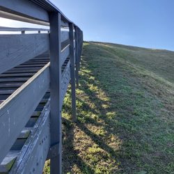
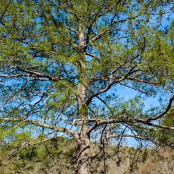
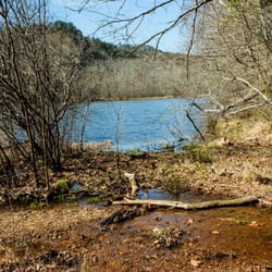
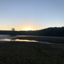
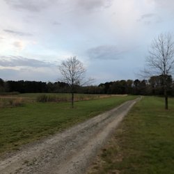
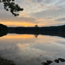
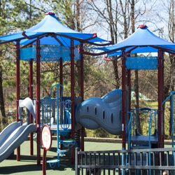
Prayerful Path Photos


You might also consider
More like Prayerful Path
Recommended Reviews - Prayerful Path
Start your review...

9 years ago


More info about Prayerful Path
159 Davis Dr
Cartersville, GA 30120
Directions
(706) 835-7994
Call Now
Visit Website
http://www.prayerfulpath.com
Hours
Outdoor Amenities
Other Amenities
From the Business
Ask the Community - Prayerful Path
You might also consider


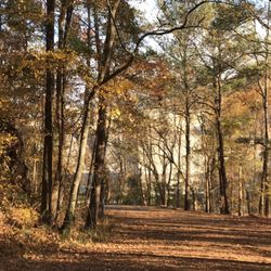
![Boot Trail, Hiking Poles Trail, and David Archer Overlook [Summit] via Pine Mountain Main St Parking & Trailhead.](https://s3-media0.fl.yelpcdn.com/bphoto/pjkowFqH5KWF9mYe5Kr02w/ls.jpg)


Prayerful Path - travelservices - Updated June 2026
Best of Cartersville
People found Prayerful Path by searching for…
Things to Do in Cartersville, Georgia
Fun Date Night Ideas in Cartersville, Georgia
Places to Take Pictures in Cartersville, Georgia
Distilleries in Cartersville, Georgia
Swimming Holes in Cartersville, Georgia
Walking Trails in Cartersville, Georgia
Scenic Drive in Cartersville, Georgia
Running Trails in Cartersville, Georgia
Scuba Diving in Cartersville, Georgia
Caves in Cartersville, Georgia
Secluded Spots in Cartersville, Georgia
Beautiful Views in Cartersville, Georgia
Transportation in Cartersville, Georgia
Hiking Trails in Cartersville, Georgia
Free Things to Do With Kids in Cartersville, Georgia
Secret Spots in Cartersville, Georgia
Things to Do at Night in Cartersville, Georgia
Scenic View in Cartersville, Georgia
Waterfalls in Cartersville, Georgia
Day Trips in Cartersville, Georgia
Ghost Tour in Cartersville, Georgia
Court Ordered Community Service in Cartersville, Georgia
Trending Searches in Cartersville, GA
Black Owned Nail Salons near Prayerful Path
Boat Rental near Prayerful Path
Cliff Jumping near Prayerful Path
Dog Friendly Trails near Prayerful Path
Fishing Spots near Prayerful Path
Gem Mining near Prayerful Path
Jet Ski Rental near Prayerful Path
Kayak Rental near Prayerful Path
Lakes & Ponds near Prayerful Path
Off Road Trails near Prayerful Path
Outdoor Activities near Prayerful Path
Public Pools near Prayerful Path
Public Shower near Prayerful Path
River Swimming near Prayerful Path
Rock Quarry near Prayerful Path
Scenic Night View near Prayerful Path
Scenic Overlook near Prayerful Path
Secluded Spots near Prayerful Path
Soccer Store near Prayerful Path
Splash Pad near Prayerful Path
Strawberry Picking near Prayerful Path
Sunrise View near Prayerful Path
Swimming Holes near Prayerful Path
Swimming Lakes near Prayerful Path
Things To Do On A Rainy Day near Prayerful Path
U Pick Farms near Prayerful Path
Watch Sunset near Prayerful Path
Browse Articles
Browse Nearby
BEST of Cartersville, Georgia Restaurants near Prayerful Path
BEST of Cartersville, Georgia Coffee near Prayerful Path
BEST of Cartersville, Georgia Things to Do near Prayerful Path
BEST of Cartersville, Georgia Hotels near Prayerful Path
BEST of Cartersville, Georgia Passport Photos near Prayerful Path
BEST of Cartersville, Georgia Breakfast near Prayerful Path
BEST of Cartersville, Georgia Museums near Prayerful Path
BEST of Cartersville, Georgia Fun Places for Teens near Prayerful Path
BEST of Cartersville, Georgia Vacation Rental Agents near Prayerful Path
Browse Brands
Related Cost Guides
Related Searches in Cartersville, GA
Affordable Airport Shuttles Available in Cartersville, Georgia
Affordable Bus Rental Services in Cartersville, Georgia
Affordable Charter Bus Services in Cartersville, Georgia
Affordable Kayak Rental Services in Cartersville, Georgia
Affordable Motorcycle Rental Services in Cartersville, Georgia
Affordable Paddle Board Rental in Cartersville, Georgia
Affordable Passport Photos Available in Cartersville, Georgia
Affordable Transportation Services in Cartersville, Georgia
Best Fishing Locations and Guides in Cartersville, Georgia
Best Fun Things to Do in Cartersville, Georgia
Best Places for Horseback Riding in Cartersville, Georgia
Best Waterfalls and Swimming Holes in Cartersville, Georgia
Book Engaging Historical Tours in Cartersville, Georgia
Book Exciting Aerial Tours Around Cartersville, Georgia
Book Shuttle Service in Cartersville, Georgia Now
Book With a Top International Travel Agency in Cartersville, Georgia
Book a Brewery Tour Experience in Cartersville, Georgia
Book a Dinner Cruise Experience in Cartersville, Georgia
Book a Winery Tour Experience in Cartersville, Georgia
Book an Exciting City Tour in Cartersville, Georgia
Book an Exciting Helicopter Tour in Cartersville, Georgia
Browse Vacation Rentals to Book in Cartersville, Georgia
Browse the Best Casinos Located in Cartersville, Georgia
Check Out Off Road Trails in Cartersville, Georgia
Compare Health Insurance Plans Available in Cartersville, Georgia
Comprehensive Passport Services in Cartersville, Georgia
Connect With Vacation Rental Agents in Cartersville, Georgia
Convenient Airport Transportation in Cartersville, Georgia
Discover Architectural Tours Available in Cartersville, Georgia
Discover Dog Friendly Trails to Explore in Cartersville, Georgia
Discover Public Transportation Services in Cartersville, Georgia
Discover Scenic Mountain Bike Trails Near Cartersville, Georgia
Discover Spooky Ghost Tour Options in Cartersville, Georgia
Discover Top Boat Tours in Cartersville, Georgia for All Ages
Discover a Hiking Trail in Cartersville, Georgia
Discover the Best Night Hike Trails in Cartersville, Georgia
Discover the Best Running Track in Cartersville, Georgia
Dog-Friendly Hikes With Dogs in Cartersville, Georgia
Enjoy Camping Adventures Around Cartersville, Georgia
Enjoy Exciting Mountain Biking Adventures in Cartersville, Georgia
Enjoy River Tubing Adventures in Cartersville, Georgia
Enjoy Scenic Cruises in Cartersville, Georgia
Enjoy Tent Camping Spots Around Cartersville, Georgia
Enjoy Thrilling Atv Riding Experiences in Cartersville, Georgia
Enjoy a Scenic Boat Ride in Cartersville, Georgia
Enjoy the Best Tubing Experiences in Cartersville, Georgia
Enjoy the Best Walking Trails in Cartersville, Georgia
Exciting Cliff Jumping Spots in Cartersville, Georgia
Experience Scenic Boat Cruises in Cartersville, Georgia
Experience Thrilling Helicopter Rides in Cartersville, Georgia
People who viewed Prayerful Path also viewed
Lake Acworth
13 reviews
Cauble Park at Acworth Beach
15 reviews
Cherokee Mill Park
1 review
Dellinger Park
14 reviews
Bartow County Parks & Recreation
1 review
Hobgood Park
10 reviews
Etowah River Park
14 reviews
Nomadic Flow Outfitters
1 review
Olde Rope Mill Park
17 reviews
Pine Mountain via Main St Parking & Trailhead
1 review