1. Pecos Historical Park

0

,

Cancel

Open app

Search

Pecos Historical Park

4.0 (12 reviews)

Pecos Historical Park Photos

Recommended Reviews - Pecos Historical Park

Your trust is our priority, so businesses can't pay to alter or remove their reviews. Learn more about reviews.
Yelp app icon
Browse more easily on the app
Review Feed Illustration

Reviews With Photos

Into the Woods

I have a few words for Azul trail. I recommend when you are injured in general to refrain from hiking. Unless you have lost the trail for three hours. In dealing with sartori tears try to go around fallen trees if you can to lessen the pain. DO NOT FOLLOW AVERAGE HIKERS.

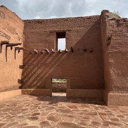
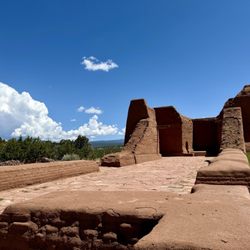
Ruins of Spanish Church

See all

14 years ago

Helpful 0
Thanks 0
Love this 0
Oh no 0

7 years ago

Helpful 0
Thanks 0
Love this 0
Oh no 0
Photo of Sam S.
493
1862
3339

14 years ago

Helpful 0
Thanks 0
Love this 2
Oh no 0

6 years ago

Helpful 0
Thanks 0
Love this 0
Oh no 0

19 years ago

Helpful 1
Thanks 0
Love this 0
Oh no 0

19 years ago

Helpful 0
Thanks 0
Love this 1
Oh no 0
Photo of J M.
0
3
0

7 years ago

Helpful 0
Thanks 0
Love this 0
Oh no 0

15 years ago

Helpful 0
Thanks 0
Love this 0
Oh no 0
Photo of Stan L.
2
112
15

12 years ago

Helpful 0
Thanks 0
Love this 0
Oh no 0
Photo of S C.
77
198
326

15 years ago

Helpful 0
Thanks 0
Love this 0
Oh no 0

14 years ago

Helpful 0
Thanks 0
Love this 0
Oh no 0

15 years ago

Helpful 0
Thanks 0
Love this 0
Oh no 0

Ask the Community - Pecos Historical Park

Review Highlights - Pecos Historical Park

“The park is not that far outside of Santa Fe, so if you have a car, it's definitely worth a half-day trip.”

Mentioned in 3 reviews

Read more highlights

Verify this business for free

People searched for Parks 178 times last month within 15 miles of this business.

Verify this business

Atalaya Trail

Atalaya Trail

4.7(15 reviews)
17.0 km

Atalaya Trail is a very serviceable and enjoyable trail.  It's just the right length for an…read moreafternoon (or morning) hike, and it offers just enough elevation gain that you won't be bored by the level of endeavor required.  That said, apart from the views you'll be rewarded with when you're here, there's not a whole lot else of interest to see during your visit. Tip: This is a popular destination for both hikers and cyclists; both of the aforementioned need to keep their eyes peeled for their opposite numbers; hikers especially need to exercise caution to avoid being hit by oblivious cyclists. I've been here several times recently, and very much enjoy myself each time.  I've found that the views (especially from the top) are very rewarding.  Because it's very easily accessible from all over the area, the trail can sometimes get very crowded; it's best to visit either in the early morning or at off-peak hours to optimize avoid the crowds. The trail winds through the Cruz Blanca neighborhood before rapidly ascending up the side of Atalaya Mountain; it eventually reaches a height of just over nine thousand feet.  While the final stretch is quite gravelly and steep, the views from the top are totally worth it!

Part of the Dale Ball trail system, that include the Dorothy Stewart and Wilderness Trailheads. The…read moreparking lot near after entry for St John's college is the largest and furthest away. Drive up Camino Cruz Blanca and save yourself the 1.5 walk along the road past $1MM homes to these other trailheads. As with everything Dale Ball creates, this is a superbly marked trail system that allows the hiker to plan and tailor their experience. I made a bee-line to the summit of Mt. Picacho. Beautiful vista, but I'll need to return for a sunset and very carefully make my way down the steeper parts of a darkening trail.

Photos
Atalaya Trail
Atalaya Trail
Atalaya Trail

See all

Kasha-Katuwe Tent Rocks National Monument - Pretty slot canyon

Kasha-Katuwe Tent Rocks National Monument

4.7(179 reviews)
61.4 km

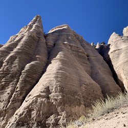
Visiting is a little more complicated than some other parks/monuments, but if you just read the…read morewebsite you'll get it figured out! The key is that reservations are required, both from the NPS and from the Cochiti Pueblo. Get the NPS reservation first, and only then get the Cochiti Pueblo one (link to that is on the NPS site!). Don't drive to the trailhead, drive to the Cochiti Pueblo visitor center first, check in there, then follow the guide car (runs pretty much continuously all day) to the NPS entrance. The trailhead has multiple pit toilets, all of which were well maintained. The hike through the slot canyon and up onto the ridge is absolutely stunning. There really aren't words to do justice, nor do the pictures really convey things either. The hike into and through the slot canyon isn't steep, although there are some pretty big steps required to clamber over some rocks here and there, and it can be narrow and is often sandy. There's not a lot of elevation change though until you get through the slot canyon, then you just switchback straight up a couple hundred feet onto the ridge. That section isn't terribly long though, and the views from the top are well worth it. The first third of the hike and the last third are pretty exposed to the sun, so make sure you apply that sunscreen and bring plenty of water!

Incredible. Reservation was easy. Gov Rec Ticket and Cochiti Tribal Pass, so two tickets. Worth…read moreevery penny. We got our tickets about 5 days out from visit. Check in at Visitor Center on arrival to check off your name on the list. Visitor centre has good restrooms, snacks and a few gifts and some very pleasant staff. Next Line up behind the white pilot vehicle and he will guide you in for a few miles where they will check your pass. After that its another few miles to a small carpark with restrooms and then off your go. We did slot canyon. Half a mile walk through amazing scenery/narrow passages through the stone and some climbing over rocks. I found it quite easy but do go before the sun comes out. We started at 9.30 am. After this section, which took us about 40 minutes due to lots of photo ops you will see another sign saying 1 mile to overlook. We almost gave up as the first climb looked hard - its not, just go on. We are in our 60's with dicky knees and it was not issue, just use your bottom when you have to. A light pair of garden gloves would be handy for when your hands scrape the boulders. All practical stuff here, the views speak for themselves. it's stunning and because of the limited access you meet few people along the way. As always with State Parks, check the website for any passes required or closures.

Photos
Kasha-Katuwe Tent Rocks National Monument - Kind of a tight squeeze at times along the trail

Kind of a tight squeeze at times along the trail

Kasha-Katuwe Tent Rocks National Monument - The first .5 mile

The first .5 mile

Kasha-Katuwe Tent Rocks National Monument

See all

Pecos Historical Park - parks - Updated October 2026
Loading...
Loading...
Loading...