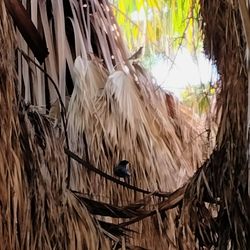
Painted Canyon Photos


You might also consider
More like Painted Canyon
Recommended Reviews - Painted Canyon
Start your review...

Reviews With Photos
")
"Faith is taking the first step even when you don't see the whole staircase," Martin Luther King, Jr. ~I have faith you'll love this hike! :) I hiked here in the beginning March and weather was perfect and sunny. I loved it. The dirt road to the trailhead is quite bumpy and sandy. Cars without 4X4, can make it to the trailhead, although be very aware of some thick, soft sections of deep sand on the road (you'll get stuck). Cellular reception is spotty and it'll be tough to call for a tow. AllTrails estimates this trail as a 4.9 mile loop, with an elevation gain of about 900ft. My friends and I always clock in more miles due to walking around pictures :D There is another trail that starts off to the right, which has the ropes -I hear. I followed the map on AllTrails and hiked the ladders only. Climbed up & down about 6 different ladders. Man-made rock shaped arrows and cairns long the trail intended to lead you in the correct direction. Trail was super crowded on the weekend I ventured out here. Bring your "ten essentials" (REI has a good list, if you're clueless to what I'm referring to). Prepare to get a lot of sun on this hike, even between slots, sun still seem to shine above my friends and I. Made for a perfect sunshiny day. Stay safe and healthy (mind, body and soul) Yelping out there :)

Such an awesome hike that is fun and challenging! Make sure to go early to avoid the heat and the crowds. We arrived by 9am and started our walk to the base of the mountain. You'll walk through some large columns of rocks until you see an arrow of rocks in the gravel pointing to your left. From there, you can start the hike. We made sure to follow these arrows throughout. You can also go in reverse but read that it can make the loop more difficult since you're going down the ladders which isn't as fun. Once you start hiking up, you'll immediately come upon your first ladder pretty quickly. All of the ladders felt safe to me and were supported by rocks to keep them from falling. I would say you should be in moderate shape and there was one ladder that had a bit of a distance you needed to pull yourself up & over once you reached the top (see my pictures). I'm pretty short (5 feet) so I would be careful if you bring small children to do this. The hike was very gorgeous! Tons of cool hallways of rocks that broke out to open spaces of more rocks. Once you get to the top of the mountain there were also amazing views! Our hike took us about 3 hours, but we stopped for photos along the way. TIPS: - The drive in to the canyon from the main road is about 15 mins and is all gravel/sand. The sign says that you should have 4 wheel drive and we saw a few cars get stuck in sand so be careful! We didn't have 4 wheel drive, but did have a small crossover and drove with care - There aren't any restrooms at the entrance so be prepared to do what you need to do - The hike can be long and is very hot depending on the time of year. Bring more water than you think you'll need All in all it was a lot of fun and I'm looking forward to doing it again some time!

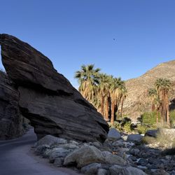
Walk up the wide sandy wash surrounded by sheer crusted sandstone and rocky walls as colorful as a bowl of ice cream with scoops of chocolate, mocha, berries and cinnamon. So beautiful! Slight sandy grade for 2.5 miles. Climbed 2-10 foot ladders over steep sections with a seasonal steam. Out of the wash and on top the ridge trail dips, drops and curves on a mountainous back bone with a few trails over hard decomposed granite. Nice hiking! The panoramic view is non-stop by breath-taking step by step. See Salton Sea in the distance. Mountains around! San Jacinto peak snow frosted. Green ocotillos! Views of the deep canyon wash below. Blue skies under full sun. 4.5 miles into the Ridge hike I came upon 2 girls. They asked "how do we get back to parking lot from here?" I looked at my AllTrails app and said follow the vein on the ridge where I am heading. The girl said that takes you into "Rope Canyon." She said "I am not doing that, but you can do it." I asked "why can I do it but you can't?" She said "I am scared!!!" The girls turned back. I proceeded to Rope Canyon. With 1 mile to go, I reached the slot canyon with a sheer drop into a hole about 25 feet. Shaking in my shoes while peering down, I thought "can I do this?" What if I can not repel - slip, fall and break my leg??? If I turn back, it is another 4.5 miles back. The rope is bolted into a rock. Calming my self, I grabbed the rope and started to lower myself, bracing my legs and feet on the sandstone - ready to learn how to repel on the fly. Fortunately, there were good foot holds carved in the sandstone to place my feet on the way down. Not as hard as I thought. Still shaking, wondering what lies ahead in this super narrow slot. There were 3 more rope drops, all pretty challenging and testing my fortitude, strength - and my grip. The slot was sheer straight walls which seemed like Portland Skyscrapers 20 to 30 stories high squeezing in on me. In places I had to remove my back pack and turn sideways to sccooooooch through! Supersize physiques will have a hard time in this made for "a skinny" slot! A large boulder blocked my passage. What would Indiana Jones do now. Too big to climb over. I had to crawl on my hands and knees under the boulder. When I made it out, I was relieved. I'm alive! I dusted my self off. Had a bigger hole in the elbow of my Patagonia shirt, which also had a blood stain on the elbow to overcome the narrow slot with deep drops - using all my adrenaline to overcome. Would I do it again??? No thanks! I will take the scenic route on top next time!


Jesus, directions here are rough. Let me try to help with what I'd need, because trying to follow the ones here did NOT help me personally, and data went kaput here. First things first, GPS to the ladder canyon trail. Screenshot it. Make sure your car has all wheel drive and enough suspension. When you enter the canyon area (you turn left onto painted canyon) KEEP DRIVING THROUGH IT TO THE END. THERE IS A TRAIL START MARKER AND A MARKED LOT. No, it's not paid. Enter at the sign. Walk forward. The first very obvious left leads to the rope stuff. Yes, there is a ladder you encounter, but it is not the ladder trail. Be prepared to climb over boulders, turn sideways, and crawl under boulders, as well as face gym class with the ropes. If you don't want to do the rope trail, literally just keep walking past the sign (it's at your back). The canyon opens up into cars land. You'll eventually see the little insignificant cave on your left. Just past it is a pile of rocks (no surprise), and this is where there is also a large arrow made of rocks on the ground pointing up into the mountains. Go there, greet the ladder trail. This hiking spot requires patience, and perseverance. If you give up easily, this is not for you. Expect to spend hours here challenging your body and mind. It's incredible, and probably best to go in at least a small group. Empower each other, and buddy system this ish. Wear closed toe shoes with traction, bring sunscreen, bring water, bring sugar for a pep in your step. It's absolutely beautiful. There is wildlife - bees, bats, beetles, flies, snakes, so be mindful of their home.

Well worth the trouble to get here and highly recommend you do the same! You will be treated to a unique hike. It took us nearly 2.5 hrs with no traffic since we left at 4:30 am. The last 4 miles or so is on a bumpy dirt road and definitely more comfortable in a truck/SUV but there was someone in our group who was driving a Sentra and was fine. We hiked this on 1/5/19. The weather was perfect...in the 40s and 50s. We got here around 7 am and had most of the trail to ourselves for the first 2 hrs but started getting busier after 9 am. At about .5 miles look for an arrow made of rocks on the ground pointing to the left to start your narrow trek up the canyon. The ladders you will find all seen sturdy and if everyone takes their time it will be fine and it is spectacular to experience this unique geology. At about 1 mile you will come to a fork and I suggest you stay to the right and the path will take you up to the ridge and views for miles in all directions. To complete the loop was approximately 5 miles with 1,000 ft of elevation gain. I would rank this hike on the easy side of moderate and suitable for young children but not dogs due to the ladders. It took us over 3 miles at a very slow pace with many pictures taken. Do yourself a favor and make the pilgrimage out to this beautiful hike in Mecca!


I called this is a magical canyon. There is sand road around ten mins drive to the parking area. 4x4 or SUV vehicle is recommended. They said to look a big arrow rock sign on the ground, you need to walk to the entrance. You will see a sign "robes" on left side, if you don't see it, you maybe on the wrong site. You can climb the robe to climbing up but I choose ladder the easy one. It's beautiful and worth it hike in three digits degree. You can enjoy gorgeous view once reach to the top. The canyon self is amazing. It's like a mini of antelope canyon. Enjoy it and please pick up your trash cuz we want to keep this place clean and natural as is. Thank you

We hiked this on the last days of summer at around 11 am and though temperatures were in the 90's, there was a good amount of shade all throughout. The hike is about an hour from Palm Springs and very close to the Salton Sea. I suggest a visit to the Salton Sea, especially to Bombay Beach, while you're there for the hike. This also isn't very dog-friendly due to the ropes and ladders. A very important thing to pay attention to is path of the trail because there are no more markers after you start the hike. I took a picture of the map at the trail head, but did not complete the loop (ropes) trail because we went off course a bit to the right (ladder trail). I would like to come back to complete the ropes trail, but what we saw was well worth it with the visually stunning views and picturesque terrain formations. If you have ever been to Zion National Park, this in many ways feels like a mini version of it! We climbed about 5 ladders before turning back and all of them were very stable and well-secured. However, you should always proceed with caution and practice patience. The ladders trail took us about 3 hours and was around 5 miles from start to finish. I highly recommend you come in a truck or SUV, because the drive up the 4 mile unpaved road was a very slow one. When we were leaving (and after thinking we beat the need for a more capable vehicle), my trusty car got stuck in the gravel of the parking lot. Amazingly, even though we didn't see a single soul on the hike, 2 hikers were finishing up the hike and came to help us push our car out of the gravel. Since this is a moderate hike you really just need a good amount of water, good hiking shoes, and some sunscreen. Totally worth checking out if you are tired of basic LA County hikes!

About an hour away from Palm Springs, this is truly a unique hike. There's a long dirt road about at least 6 miles which can be pretty bumpy so I'd recommend using a car with four-wheel-drive but our crappy rental car did make it. So there's a big arrow of rocks pointing to the right and we went left to the hidden ropes course and wow was it amazing! More difficult than the ladders but it goes up to an amazing opening. We didn't realize that you had to backtrack all the way back and ended up doing so in the dark with our phones as flashlights so please be prepared if you go later in the day. Some of the ladders really lead to no where specifically but there's plenty to explore. Apparently a lot of people get stuck so there is always the option of a helicopter rescue. Be aware that there is no cell phone reception and that you should familiarize yourself with the map beforehand.

After making the 45 minute to an hour drive in the last 5 miles being over at gravel rocky road we are excited to do this hike the entrance is very cool you're in a canyon with two walls of 100 feet each on both sides the train is Rocky Sandy not that secure so be careful we went about a 1.2 miles and we came to the first ladder the both bottom runs were bent. A couple of us ascended to the next ladder and went up it was quite wet and not very safe so be careful we ended up turning around . not a very exhilarating hike but very beautiful

Breath taking views. Fun hike, felt like I was in a different state at some moments during the hike because it didn't look like something that would be in California! I went with a few friends and we hiked and took some cool pictures, there wasn't a lot of people either which was dope because having people in the background of your pictures SUCK! This is a must go to if you're in the area or looking for an activity to do for the day

If you have time for only one hike then this is the trail we recommend you take. It will feel like your on a natural nature course. You will be driving on a pretty rough road on the way in but we made it through without having to turn on our 4 by 4. This is a 5 mile loop hike with five different size ladders. There were no ropes to climb, just ladders. The ladders felt safe and we felt it was a moderate hike. The canyons are so grand here. They tower over you with different tints of green, purple, pink, and red. At the parking area you'll see a map. You'll walk into a large canyon for about five to ten minutes until you'll see a trail marker on the right side. This will be the only trail marker. You'll turn left and you'll climb up your first ladder here. Others before you have used rocks to create arrows so that you'll know where to go. In the canyon it is pretty shady and cool but the entire hike is not in the canyon. The middle of the hike you'll be walking above the canyon and there will be no trees protecting you from the sun. The views here are stunning. You'll descend back down and you will have to go down two more ladders before the hike is over.

This review is for Ladder Canyon & Painted Canyon Trail which was a ~4.4 miles round trip that took ~2.5 hours to complete. Ladder Canyon & Painted Canyon Trail was a popular and crowded hike near Mecca, California. Trail was flat and sandy while you're at the bottom of the canyons. Started the loop clockwise; look for the ladder on your left. Requires a little bit of rock scrambling at this part and some ladders to get to the slot canyons. Trail becomes a bit more rocky with a slight incline towards the top of the canyons. Furthermore, there was a rope and ladder near the end of the loop. Overall, this was unique trail with stunning views throughout the hike! Required to drive on a well maintained dirt road for ~4.6 miles. Low clearance cars could make it; go slow and dodge the bigger bumps as you get closer to the parking. No restroom at the trailhead! Short video of the hike for those interested! https://youtu.be/7HECQHARzvs read more


1 year ago
I went there on April 6, 2025. There's 7 cars at parking area. I ran into 6 hikers while I was on the trail. It's quiet and really enjoyed the nature. Gloves and hiking boots are game changers. Last 2 miles are very rocky and sandy, so it's hard to walk. I forgot my sunscreen and sunglasses. read more


Definitely the best hike we've done in a while. Kudos to the local hiking organizations that maintain the ladders and anchor them to the rocks. A ton of different views in the canyon, through openings in the rocks, and panoramic views of the exposed desert. Pro tips: Get out there EARLY!! And when I say early I mean like 7am at the trailhead. It was sunrise when we got out there and definitely heating up when we left a couple hours later. Look for the giant rock cairn arrow on the ground (on your left walking in). It'll point you the correct way to walk so you're not taking all the ladders down (which is a lot worse than climbing them). Caution: Some areas in the more exposed parts are not the clearest on where the trail is but there are rock piles to help guide you on where humans should be. Sadly, some trash along the way. Let's keep it clean for everyone to enjoy! read more


2 years ago
"Faith is taking the first step even when you don't see the whole staircase," Martin Luther King, Jr. ~I have faith you'll love this hike! :) I hiked here in the beginning March and weather was perfect and sunny. I loved it. The dirt road to the trailhead is quite bumpy and sandy. Cars without 4X4, can make it to the trailhead, although be very aware of some thick, soft sections of deep sand on the road (you'll get stuck). Cellular reception is spotty and it'll be tough to call for a tow. AllTrails estimates this trail as a 4.9 mile loop, with an elevation gain of about 900ft. My friends and I always clock in more miles due to walking around pictures :D There is another trail that starts off to the right, which has the ropes -I hear. I followed the map on AllTrails and hiked the ladders only. Climbed up & down about 6 different ladders. Man-made rock shaped arrows and cairns long the trail intended to lead you in the correct direction. Trail was super crowded on the weekend I ventured out here. Bring your "ten essentials" (REI has a good list, if you're clueless to what I'm referring to). Prepare to get a lot of sun on this hike, even between slots, sun still seem to shine above my friends and I. Made for a perfect sunshiny day. Stay safe and healthy (mind, body and soul) Yelping out there :) read more
 - Hiking Near Me - Mecca, California")

Such an awesome hike that is fun and challenging! Make sure to go early to avoid the heat and the crowds. We arrived by 9am and started our walk to the base of the mountain. You'll walk through some large columns of rocks until you see an arrow of rocks in the gravel pointing to your left. From there, you can start the hike. We made sure to follow these arrows throughout. You can also go in reverse but read that it can make the loop more difficult since you're going down the ladders which isn't as fun. Once you start hiking up, you'll immediately come upon your first ladder pretty quickly. All of the ladders felt safe to me and were supported by rocks to keep them from falling. I would say you should be in moderate shape and there was one ladder that had a bit of a distance you needed to pull yourself up & over once you reached the top (see my pictures). I'm pretty short (5 feet) so I would be careful if you bring small children to do this. The hike was very gorgeous! Tons of cool hallways of rocks that broke out to open spaces of more rocks. Once you get to the top of the mountain there were also amazing views! Our hike took us about 3 hours, but we stopped for photos along the way. TIPS: - The drive in to the canyon from the main road is about 15 mins and is all gravel/sand. The sign says that you should have 4 wheel drive and we saw a few cars get stuck in sand so be careful! We didn't have 4 wheel drive, but did have a small crossover and drove with care - There aren't any restrooms at the entrance so be prepared to do what you need to do - The hike can be long and is very hot depending on the time of year. Bring more water than you think you'll need All in all it was a lot of fun and I'm looking forward to doing it again some time! read more


Walk up the wide sandy wash surrounded by sheer crusted sandstone and rocky walls as colorful as a bowl of ice cream with scoops of chocolate, mocha, berries and cinnamon. So beautiful! Slight sandy grade for 2.5 miles. Climbed 2-10 foot ladders over steep sections with a seasonal steam. Out of the wash and on top the ridge trail dips, drops and curves on a mountainous back bone with a few trails over hard decomposed granite. Nice hiking! The panoramic view is non-stop by breath-taking step by step. See Salton Sea in the distance. Mountains around! San Jacinto peak snow frosted. Green ocotillos! Views of the deep canyon wash below. Blue skies under full sun. 4.5 miles into the Ridge hike I came upon 2 girls. They asked "how do we get back to parking lot from here?" I looked at my AllTrails app and said follow the vein on the ridge where I am heading. The girl said that takes you into "Rope Canyon." She said "I am not doing that, but you can do it." I asked "why can I do it but you can't?" She said "I am scared!!!" The girls turned back. I proceeded to Rope Canyon. With 1 mile to go, I reached the slot canyon with a sheer drop into a hole about 25 feet. Shaking in my shoes while peering down, I thought "can I do this?" What if I can not repel - slip, fall and break my leg??? If I turn back, it is another 4.5 miles back. The rope is bolted into a rock. Calming my self, I grabbed the rope and started to lower myself, bracing my legs and feet on the sandstone - ready to learn how to repel on the fly. Fortunately, there were good foot holds carved in the sandstone to place my feet on the way down. Not as hard as I thought. Still shaking, wondering what lies ahead in this super narrow slot. There were 3 more rope drops, all pretty challenging and testing my fortitude, strength - and my grip. The slot was sheer straight walls which seemed like Portland Skyscrapers 20 to 30 stories high squeezing in on me. In places I had to remove my back pack and turn sideways to sccooooooch through! Supersize physiques will have a hard time in this made for "a skinny" slot! A large boulder blocked my passage. What would Indiana Jones do now. Too big to climb over. I had to crawl on my hands and knees under the boulder. When I made it out, I was relieved. I'm alive! I dusted my self off. Had a bigger hole in the elbow of my Patagonia shirt, which also had a blood stain on the elbow to overcome the narrow slot with deep drops - using all my adrenaline to overcome. Would I do it again??? No thanks! I will take the scenic route on top next time! read more


4 years ago
Go early. The road in is horrible Don't leave anything in your car Take water Not easy Super scenic Enjoy read more


Jesus, directions here are rough. Let me try to help with what I'd need, because trying to follow the ones here did NOT help me personally, and data went kaput here. First things first, GPS to the ladder canyon trail. Screenshot it. Make sure your car has all wheel drive and enough suspension. When you enter the canyon area (you turn left onto painted canyon) KEEP DRIVING THROUGH IT TO THE END. THERE IS A TRAIL START MARKER AND A MARKED LOT. No, it's not paid. Enter at the sign. Walk forward. The first very obvious left leads to the rope stuff. Yes, there is a ladder you encounter, but it is not the ladder trail. Be prepared to climb over boulders, turn sideways, and crawl under boulders, as well as face gym class with the ropes. If you don't want to do the rope trail, literally just keep walking past the sign (it's at your back). The canyon opens up into cars land. You'll eventually see the little insignificant cave on your left. Just past it is a pile of rocks (no surprise), and this is where there is also a large arrow made of rocks on the ground pointing up into the mountains. Go there, greet the ladder trail. This hiking spot requires patience, and perseverance. If you give up easily, this is not for you. Expect to spend hours here challenging your body and mind. It's incredible, and probably best to go in at least a small group. Empower each other, and buddy system this ish. Wear closed toe shoes with traction, bring sunscreen, bring water, bring sugar for a pep in your step. It's absolutely beautiful. There is wildlife - bees, bats, beetles, flies, snakes, so be mindful of their home. read more


Well worth the trouble to get here and highly recommend you do the same! You will be treated to a unique hike. It took us nearly 2.5 hrs with no traffic since we left at 4:30 am. The last 4 miles or so is on a bumpy dirt road and definitely more comfortable in a truck/SUV but there was someone in our group who was driving a Sentra and was fine. We hiked this on 1/5/19. The weather was perfect...in the 40s and 50s. We got here around 7 am and had most of the trail to ourselves for the first 2 hrs but started getting busier after 9 am. At about .5 miles look for an arrow made of rocks on the ground pointing to the left to start your narrow trek up the canyon. The ladders you will find all seen sturdy and if everyone takes their time it will be fine and it is spectacular to experience this unique geology. At about 1 mile you will come to a fork and I suggest you stay to the right and the path will take you up to the ridge and views for miles in all directions. To complete the loop was approximately 5 miles with 1,000 ft of elevation gain. I would rank this hike on the easy side of moderate and suitable for young children but not dogs due to the ladders. It took us over 3 miles at a very slow pace with many pictures taken. Do yourself a favor and make the pilgrimage out to this beautiful hike in Mecca! read more


4 years ago
As I mentioned through the pictures make sure you follow the rock formations arrows that are planted on your path follow them and you should not get lost they two entrances to this park one where you park and the other one will be to the left and where you park read more


4 years ago
I called this is a magical canyon. There is sand road around ten mins drive to the parking area. 4x4 or SUV vehicle is recommended. They said to look a big arrow rock sign on the ground, you need to walk to the entrance. You will see a sign "robes" on left side, if you don't see it, you maybe on the wrong site. You can climb the robe to climbing up but I choose ladder the easy one. It's beautiful and worth it hike in three digits degree. You can enjoy gorgeous view once reach to the top. The canyon self is amazing. It's like a mini of antelope canyon. Enjoy it and please pick up your trash cuz we want to keep this place clean and natural as is. Thank you read more


We hiked this on the last days of summer at around 11 am and though temperatures were in the 90's, there was a good amount of shade all throughout. The hike is about an hour from Palm Springs and very close to the Salton Sea. I suggest a visit to the Salton Sea, especially to Bombay Beach, while you're there for the hike. This also isn't very dog-friendly due to the ropes and ladders. A very important thing to pay attention to is path of the trail because there are no more markers after you start the hike. I took a picture of the map at the trail head, but did not complete the loop (ropes) trail because we went off course a bit to the right (ladder trail). I would like to come back to complete the ropes trail, but what we saw was well worth it with the visually stunning views and picturesque terrain formations. If you have ever been to Zion National Park, this in many ways feels like a mini version of it! We climbed about 5 ladders before turning back and all of them were very stable and well-secured. However, you should always proceed with caution and practice patience. The ladders trail took us about 3 hours and was around 5 miles from start to finish. I highly recommend you come in a truck or SUV, because the drive up the 4 mile unpaved road was a very slow one. When we were leaving (and after thinking we beat the need for a more capable vehicle), my trusty car got stuck in the gravel of the parking lot. Amazingly, even though we didn't see a single soul on the hike, 2 hikers were finishing up the hike and came to help us push our car out of the gravel. Since this is a moderate hike you really just need a good amount of water, good hiking shoes, and some sunscreen. Totally worth checking out if you are tired of basic LA County hikes! read more


About an hour away from Palm Springs, this is truly a unique hike. There's a long dirt road about at least 6 miles which can be pretty bumpy so I'd recommend using a car with four-wheel-drive but our crappy rental car did make it. So there's a big arrow of rocks pointing to the right and we went left to the hidden ropes course and wow was it amazing! More difficult than the ladders but it goes up to an amazing opening. We didn't realize that you had to backtrack all the way back and ended up doing so in the dark with our phones as flashlights so please be prepared if you go later in the day. Some of the ladders really lead to no where specifically but there's plenty to explore. Apparently a lot of people get stuck so there is always the option of a helicopter rescue. Be aware that there is no cell phone reception and that you should familiarize yourself with the map beforehand. read more


6 years ago
After making the 45 minute to an hour drive in the last 5 miles being over at gravel rocky road we are excited to do this hike the entrance is very cool you're in a canyon with two walls of 100 feet each on both sides the train is Rocky Sandy not that secure so be careful we went about a 1.2 miles and we came to the first ladder the both bottom runs were bent. A couple of us ascended to the next ladder and went up it was quite wet and not very safe so be careful we ended up turning around . not a very exhilarating hike but very beautiful read more


6 years ago
Breath taking views. Fun hike, felt like I was in a different state at some moments during the hike because it didn't look like something that would be in California! I went with a few friends and we hiked and took some cool pictures, there wasn't a lot of people either which was dope because having people in the background of your pictures SUCK! This is a must go to if you're in the area or looking for an activity to do for the day read more

5 years ago
If you have time for only one hike then this is the trail we recommend you take. It will feel like your on a natural nature course. You will be driving on a pretty rough road on the way in but we made it through without having to turn on our 4 by 4. This is a 5 mile loop hike with five different size ladders. There were no ropes to climb, just ladders. The ladders felt safe and we felt it was a moderate hike. The canyons are so grand here. They tower over you with different tints of green, purple, pink, and red. At the parking area you'll see a map. You'll walk into a large canyon for about five to ten minutes until you'll see a trail marker on the right side. This will be the only trail marker. You'll turn left and you'll climb up your first ladder here. Others before you have used rocks to create arrows so that you'll know where to go. In the canyon it is pretty shady and cool but the entire hike is not in the canyon. The middle of the hike you'll be walking above the canyon and there will be no trees protecting you from the sun. The views here are stunning. You'll descend back down and you will have to go down two more ladders before the hike is over. read more


6 years ago
Painted Canyon and Ladder Canyon are a GREAT way to spend half a day near Palm Springs, CA. Its about an hour drive from Palm Springs, and its family popular around 10am so I would suggest getting out there earlier. The trails are marked with rocks moved into the shape of an arrow on the ground and if youre not looking for it, its pretty easy to miss those. But, once you get into the ladder canyon portion of the trail it is a pretty magical place! You also get to walk along a ridge overlooking the Sultan Sea. read more


This place is seriously a hidden gem. I can't believe the vast differences of terrain, etc. we have in Southern California. I made the drive down from Los Angeles early Monday morning (MLK Jr. Day) and arrived around 8am to beat traffic. I do have a 4WD vehicle (Subaru Forester) but I really didn't need the 4WD on the sandy/dirt road, even with the recent rains we've had. I took it slow at first and then realized I was fine to speed it up a little bit. Be careful but know most cars can make it on this road... at least as of Monday 1/16/2017. Once at the "trailhead," I got my stuff together and began embarking on the fabulous-ness of the area. One thing I wouldn't recommend: don't come here by yourself. Bring a hiking buddy. We ended up going left on the trail when we probably should've went right. The crevices were pretty narrow in spots but honestly it was so awesome. The ropes were challenging but I was able to pull myself up and felt pretty accomplished in doing so! Eventually we found our way to the ladders (aka what I was looking for all along)! This is something special and a spot hikers should definitely check out. It is probably more on the moderate side than a beginners trail. Bring a map if you can - it can get confusing once you're on top of the canyon. By the time we got back to our cars around 10:30 or so, there were at least a dozen cars in the "parking lot." Come early if you want to have a more secluded experience. Either way, this is such a neat spot, I know I'll be back! read more


6 years ago
Made a visit to painted ladder canyon and it's an exhilarating hike. The canyons are easy to locate, but the last 4 miles of the unpaved road, must be driven slowly and with care, if you're driving a sedan into the canyon. Also, please remove all valuables from your vehicles. There has been reports of break-in, but I didn't experience or witness any during my visit. The canyons are majestic and some spots challenge you with ladders, ropes and tight spots. Therefore, please keep this in mind, before you drive out to hike this canyon. If you remain on the trail, you will not get lost or have any issues. Also, use common scense and respect nature. Enjoy your visit and be safe. read more


12 years ago
One of the most popular, beautiful, enjoyable and picturesque hikes of the desert. This place is called the painted canyon due to the different colored rocks and mountains that you will come across hiking here. This hike was a five mile loop which was a moderate, intermediate hike. It will take approximately 3 hours. There is some elevation gain but not a significant amount. The hike took us on some rock scrambling where we eventually climbed a series of ladders, each time getting to the next level. As you hike and climb you will travel through some beautiful canyon walls. At times the canyon trails and ladders are in narrow, tight places but the ladders are well maintained and very secure. If you are afraid of heights, tight or narrow spaces this hike might not be for you. The trail eventually leads up to the top of the mesa which looks out over the valley and gives us beautiful views all the way to the Salton Sea. We took a rest at the top of the mesa so bring plenty of snacks and water. It is important to drink plenty of water while hiking so you stay hydrated. The trip back will take us hiking back through the sandy wash where you will be able to view beautiful rock formations along the way. The hike does require sturdy hiking shoes with traction to keep you from slipping on the rocks and the ladders. Hiking shoes also help when walking through the washes. Tip: If you are sensitive about getting your car dirty, you may want to carpool. Painted Canyon road is a dirt road you'll drive on for 4 miles. It will get hot here since it's in the desert so bring plenty of water, sunblock, snacks, comfy hiking shoes, hat & a smile =) read more


4 years ago
4 years ago
Awesome hike and challenging had a great time with my son. People where friendly and helped us find our way. We both loved it read more


8 years ago
Beautiful spot just off of the Salton Sea. Gorgeous peaceful desert. My grandmother used to take my dad and siblings here to camp quite a bit when they were children. We came here as our own memorial after my grandmother's memorial today. It was beautiful and just what we needed. read more


what a trip! We had a blast exploring numerous paths to nowhere as well as the trails. You can't really get lost as there are stone arrows placed occasionally on the paths directing you to a way out. The drive to the trail head is tooth rattling, 4x4 is not totally needed, but you will know if you are in a compact car. Ladder climbs, rope climbs, narrow paths and ridge lines to walk along make this a great day trip and fun for all ages. If you stay on the main river bed you will see amazing sights with minimal effort. If you want to up the challenge take a detour adn explore nooks and crannies as some of them open up to new pathways, and some to quiet cul de sacs. Pay attention to man made rock formations as some will guide you eyes to natural formations or secret paths. BRING PLENTY OF WATER, we spent about 5 hours exploring the area and ran out of water. CONS: the D Bag taggers that have spray painted and carved their initials into the formations and the jerks that have left garbage behind. read more


6 years ago
This is one of my favorite hike. Is a little challenge, fun and full surprise view. Don't bother to get your car clean until after the hike. Painted Canyon road is all dirt road w/ small rocks. The trail is all rock and sand. Is nice view while driving in to parking a lot. Its kind of cool and block the sun since is between 2 big rocks. Watch out for big arrow sign to lead to you right away.. Each ladders lead to nice view.. Some part is narrow.. Big backpack is not recommend.. You might get struck. Nice breeze when reach the top and overview of the canyon. A lot of different colors of rock along the trail. read more


8 years ago
Long and bumpy road in. Thought our fiat was going to blow a tire we didn't know what to expect and just went for it. Could've been bad! Take plenty of water, snacks and have battery life on your phone. Look for arrows on the ground made of rock( which we missed all on the way in) Make sure you keep in mind when the sun will set to have a safe hike. I would've given this hike 5 stars but it lacks signs to show you the way. We hike regularly but anyone in decent shape should be able to do it. I would defiantly do this hike again now that we are somewhat familiar with it read more


 - Hiking Near Me - Mecca, California")


This is a belated review for 3-10-2018 Sat. It is my 2nd time here. The day was a cloudy day with some sprinkling. We stopped at a Starbucks before arriving. The parking lot was extremely crowded perhaps the Coachella Festival was this weekend also. The info board has a map and a sign-in clipboard. We took a picture before going into the canyon. The entrance is actually at the bottom of a narrow canyon. The trail is made up of mostly sand and river rocks. When you look up the canyon walls, you will realize how high it is. My top complaints are dog poop and horse poop on the trail. Plastic water bottle in some bushes. Please leave you dog at home unless you pick up your dog poops or teach your dog to hold. Your dog can't climb the ladder anyway. From the trail start, count about 1250 steps, then you will see the arrow on the ground pointing left. If you miss the arrow, too bad. The sign post is hidden on the far right. It may take about 3 hours of walking but it is worth it. While I am here, I tried not to think about earthquake. The rocks on the canyon wall are loose. In some places, you may crawl under large boulders. It is a risk that is worth taking. I brought several plastic bags for trash. I had dirt and sand in my shoes. I forgot to bring an extra pair of clean socks this time. If you plan to go up on the rope, bring a pair of gloves. Since there is no bathroom or potty potty, if you must do it, go to the tall bushes. Bring a trash bag for your toilet paper and poop. Read my previous review. read more


First off, if you don't know where you're going you could easily get confused and lost and end up where we ended up which was rappelling off some ropes into middle earth. I recommend leaving your dog at home unless you just plan to do some light hiking through the flat part where there's majestic rock formations where you can see the effects of the San Andreas Fault line and just turn right around and head back for the parking lot. As for kids, that's up to you, but again, if you don't know where you're going you could end up in the difficult zone with the ropes and crazy rocks/boulders that look like a scene from Aladdin or Indiana Jones. So as far as I know Painted Canyon isn't a state or national park which means no fees and you're free to set-up camp wherever you want. We entered down Painted Canyon road and did what one of the Yelper's suggested which was speed through the gravel to make it for a "smoother" ride. We went down quite a ways and winded through a few spots and saw campers, RV's and tents set up in random spots. When we finally reached the parking lot at the end, the tire pressure alarm went off in the car (Mazda CX-5). Luckily we hiked for 3 hours and came back and the tires were fine and got us home to Whittier. HERE'S WHAT TO BRING/WEAR: - A map helps a lot. We relied on word of mouth of others on the trail and never got to the ladder canyon everyone talked about. - Hiking shoes or boots or super grippy athletic shoes. Don't wear your worn out tennis shoes, the grippier the better. - Sunblock - Upper body strength - I can't imagine climbing up the canyon with just a rope. Also, some of the rope spots were narrow and hard to get down. - Gloves - mechanical kind for grip and so your hands don't get scratched up - Comfortable and durable leggings or jeans. Not shorts! - Friends and preferably a few strong ones to help at certain spots. - Water (I didn't need that much) HERE'S WHO/WHAT NOT TO BRING for the difficult rope section: - Unnecessary crap - Claustrophobic people - Nope! There are some spots where you have to crawl under a boulder to get through or the rocks are practically touching and you have to turn sideways and scoot through these crevasses for a while and if you look up and think about you're on the San Andreas fault like and all of this could come crashing down on you, then you're mentally done. - Your kids - Your dog We started from the parking lot and stayed to the right and went through the canyons and it was pretty much flat for the first mile. We got to a point where we went up a hill onto a proper trail and started seeing cute rock towers, blah, and then we noticed on the ground there were arrows made out of a variety of rocks telling us where to go. We followed these arrows and ended up where the ropes where. It's a bit scary at first, but the first rope down had knot s in it and it was a 12 ft. drop down. We were legit freaking out because none of us had rope climbing experience. Well one of us took a rappelling class at an indoor climbing spot, but this rope doesn't come with a harness so you have to lean back into the rope and just place your feet wherever you can. I tried getting down that rope as fast as possible so I concentrated on lowering my hands as fast as I could and if I dangled down it was fine. The second and third descents were scarier to me, but a lot shorter than the first. We climbed under boulders, over them, side stepped and winded through certain crevasses and finally saw the parking lot! Overall we felt pretty accomplished and bonded over our rope descent adventures. I'd recommend this to anyone that wants to see what happens when plates collide or camp in an untouched, unmanned area of California, but definitely make sure you're brave and physically able to carry your weight. read more

9 years ago
My best friend and I went on a weekday--partly cloudy. We rented a small Chevy Cruiz and drove no more then 10 MPH and made it just fine. Just don't drive off the roadway or you could get stuck. (Aka use common sense) When we got to the parking area we were the only people there --around 9 am and never saw another person on the trail the whole hike. Doing your homework on this trail before the hike pays off. Make sure you have the hiking 10 Essentials and most importantly water, sunscreen, and a hat. The trail was mostly clean with a few food wrappers. It should be noted that the entrance does have a bit of a size limit to it as you enter up a ladder and through a hole. Not an issue for us but it is something to consider. Kids could easily do this hike if their not afraid of heights. Someone mentioned getting gloves but I don't think they are necessary. The trail is very well marked (once you find it). Absolutely love the slot portion and ladders. If I am ever in Palm Springs again I will absolutely be back on this trail. We finished in 2 hours which included a snack break and lots of stops for photos. By the time we got to our car there were about 7 more cars. As far as break-ins go I suggest making sure your car is completely empty of any items and if possible leave your glove compartment and center console open. We had a light in our glove compartment so we did close that. We didn't have broken windows or anything like others mention. I do suggest starting early morning before 9, we lucked out with partial clouds. Also, check the weather first to make sure there isn't a risk for flash flooding or rains before that could have washed out the ladders. read more


6 years ago
Absolutely love this trail. We took our SUV, that's not 4WD, teen and baby today. It took us about 3 to 3.5 hours to do the ladder loop, taking 2 breaks. We go every February. read more


12 years ago
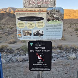
LADDERS?!?!? IN THE DESERT?!?!?! AS A HIKE?!?!? WTHECK? BACKGROUND: Painted Canyon, in the heart of the Mecca Hills, exhibits many mineral deposits in hues of rose, pink, red, purple and green. The canyon runs in a general north-south direction, and is distinguished by sandy washes sprinkled with Ironwood, Smoke Trees, and Palo Verde. Keen eyed wildflower enthusiasts will also find the rare Mecca aster, a lilac tinted bloom resembling a daisy. Along the rim of the canyon and the tops of the mesas, squat colorful Ocotillo, which add to the serenity with their presence. Occasionally Bighorn sheep cross over from the Orocopia Mountains on the east looking for water. Like any desert area, the visitor is also treated to a multitude of lizards, snakes, and prairie falcons. STATS: Distance: 5 miles Elevation gain: minimal Heights: lots (climbing secure ladders) ESSENTIALS: At least 3 liters of water Know your limits Comfy hiking shoes with good lugs Layered Clothing Gloves with gripage High protein food/snacks Electrolytes Camera Hat (optional) Sunscreen Trek poles (optional) OUR ROUTE: As a climber, this was the ultimate hike with rock scrambling, boulder scaling and ladders, what more could I ask for? Our route started out meandering on a sandy canyon floor through slots, where it is deadly during flash floods. Fortunately there wasn't any rain in the forecast. We climbed up several levels of the canyon. Where climbing was virtually impossible, ladders were available for the climbing. While some ladders were relatively short, about half dozen feet high, others scaled 20-30 feet high. Although we tried to keep track of how many ladders we climbed, we gave up after a dozen or so. We did eventually climb our way out the canyon and views were breathtaking. We could see the Salton Sea and beyond. So amazing and beautiful. After a quick break we continued our trek up a trail that eventually wound down a bit till we reached an area of the canyon that we were able to drop into that led us back to our cars. While most ladders were for climbing up, we did find a couple where we had to climb down. So much easier to climb up than down. BroTha, sister and I broke away from the group to do some boulder climbing and in the process found some more ladders that took us way up the canyon. Hiking in Painted Canyon was a lot of fun. The three of us really got in touch with the kids inside us, while the adults in us appreciated the beauty of the rock formations and vistas. I'm most certain we will be going back again. DISCLAIMER: Hiking is not something that can be taken lightly. It can be life-threatening as you see and hear on the news, people die or get lost all time. Please, if you are going to hike, never go alone and prepare for the worst, hope for the best. Remember when going for a hike, no matter how short you think it may be, always be prepared. Carry at least two liters of water for every five miles (more if the weather is warm), protein bar, nuts, and electrolytes. Wear sturdy lug sole shoes and protective clothing. Some areas the weather can change quicker than a fireman can put on his gear. It is also very important, always always always let a family member or friend know where you are going and when you expect to be back. Lastly, have fun when you hike it up. read more


9 years ago
Located approximately 40 miles or a 1-hour drive from downtown Palm Springs, The Painted Canyon Trail Ladder hike is an EPIC adventure! The 6-mile round trip trail features slot canyons, ladders, and countless photo opportunities. You'll feel as though you've stepped into a movie adventure as you traverse up ladders and canyon slots along the trail route. The slot canyons were formed by the San Andreas Fault pushing the North American Plate into the Pacific Plate. The plate's shift caused narrow passages & canyons to form. The area's geographic formations are breathtaking and unusual compared to other canyons in the Palm Springs area. TIPS - It's highly recommended to bring plenty of extra water, snacks, and a first aid kit as the trail area is very remote and away from immediate or close help. Although remote and isolated, Painted Canyon Ladder hike is an incredible adventure and one of the best in Southern California! read more


11 years ago
DO NOT do this hike in the middle of the summer. I decided to go when it was conveniently 115 degrees and literally almost had a heat stroke even though I had plenty of water. However, heat aside, this was a pretty cool hike. I was little nervous about all the car break in posts listed on Yelp, but we had no issues. We were the only car in the lot...probably because everyone else was smart enough to stay indoors. Its about 2.5 hour drive from LA. Once in Mecca, it's a 2-3 mile drive down a dirt road to get the parking lot. A sign says 4-Wheel Drive Only but we had no trouble with a Prius. Go slow and steady and you'll be fine. At the trailhead, the hike proceeds into a canyon with a very sandy floor. There is a large arrow made of rocks pointing to the left about 1/4 mile into the hike. Follow this and you'll get into the slot canyon. Some bouldering is necessary, but shouldn't be a problem for anyone physically active. The ladders I saw were metal, but didn't get too hot because the canyon is shaded. We didn't end up making the full loop because once we reached the top of the canyon the area was completely unshaded and VERY HOT. We sadly turned back and went the same we came. read more


13 years ago
Even though finding this place was a task (we had no real directions), it was so worth it. When entering the Painted Canyon Road, the dirt road is clearly marked "4x4 Access Only." Not true. It is a well grated road where many sedans were driving on. We took a Honda Civic easily. However, after rains and wash outs, I would be really cautious. The road is a few miles and when the road stops, that is where the hiking is. The hike is amazing and long. After 1.5 miles (though to the left there is a canyon you can hike with some rock climbing- look for it) you will see ladders that climb to another canyon with more hiking. Keep your eyes out for other ladders (there's a set to the right along the way) for even more adventure. Most of the trail is marked with rock arrows on the ground, so keep an eye out. Also, I would not recommend hiking this during the rain. In parts you can see how high the water gets during a flash flood and this place would be a death trap since it IS a wash. But, it is a very fun, beautiful trail! read more


Page 1 of 2
More info about Painted Canyon
Painted Canyon Rd
Mecca, CA 92254
Directions
Hours
Outdoor Amenities
Ask the Community - Painted Canyon
Where can I find a trail map? I've looked online but can only seem to find photos, not any maps..
Check the images here on yelp. Someone posted one.
Review Highlights - Painted Canyon


Why does Yelp recommend reviews?
1 review that is not currently recommended
The reviews below are not factored into the business's overall star rating.
11 years ago
Painted Canyon - hiking - Updated July 2026
Best of Mecca
People found Painted Canyon by searching for…
Things to Do in Mecca, California
Campgrounds in Mecca, California
Scenic Drives in Mecca, California
Rock Climbing in Mecca, California
Hiking Trails in Mecca, California
Natural Hot Springs in Mecca, California
Wildflowers in Mecca, California
Secret Spots in Mecca, California
Camping Sites in Mecca, California
Dog Friendly Hiking Trails in Mecca, California
Easy Hikes in Mecca, California
Hiking With Kids in Mecca, California
Running Trails in Mecca, California
Secluded Spots in Mecca, California
Star Gazing in Mecca, California
Free Parking in Mecca, California
Walking Trails in Mecca, California
Tent Camping in Mecca, California
Hiking Club in Mecca, California
Trending Searches in Mecca, CA
4th Of July Fireworks near Painted Canyon
Boat Rental near Painted Canyon
Cliff Jumping near Painted Canyon
Dog Friendly Trails near Painted Canyon
Fishing Spots near Painted Canyon
Jet Ski Rental near Painted Canyon
Kayak Rental near Painted Canyon
Lakes & Ponds near Painted Canyon
Outdoor Activities near Painted Canyon
Places To Walk Around near Painted Canyon
Public Pools near Painted Canyon
Public Shower near Painted Canyon
River Swimming near Painted Canyon
Rock Quarry near Painted Canyon
Scenic Night View near Painted Canyon
Scenic Overlook near Painted Canyon
Secluded Spots near Painted Canyon
Soccer Store near Painted Canyon
Splash Pad near Painted Canyon
Strawberry Picking near Painted Canyon
Sunrise View near Painted Canyon
Swimming Holes near Painted Canyon
Swimming Lakes near Painted Canyon
Browse Articles
Browse Brands
Related Searches in Mecca, CA
Affordable Kayak Rental Services in Mecca, California
Best Fishing Locations and Guides in Mecca, California
Best Fun Things to Do in Mecca, California
Best Off Leash Dog Parks in Mecca, California
Best Places for Horseback Riding in Mecca, California
Best Waterfalls and Swimming Holes in Mecca, California
Check Out Off Road Trails in Mecca, California
Discover Lakes & Ponds to Explore in Mecca, California
Discover Popular Photo Spots in Mecca, California
Discover Scenic Mountain Bike Trails Near Mecca, California
Discover Top Boat Tours in Mecca, California for All Ages
Discover Top State Parks to Visit in Mecca, California
Discover the Best Running Track in Mecca, California
Dog-Friendly Hikes With Dogs in Mecca, California
Effective Stairs Workout Spots in Mecca, California
Enjoy Scenic Night View Experiences in Mecca, California
Enjoy Tent Camping Spots Around Mecca, California
Enjoy a Beautiful Waterfall Hike in Mecca, California
Enjoy the Best Tubing Experiences in Mecca, California
Enjoy the Best Walking Trails in Mecca, California
Exciting Cliff Jumping Spots in Mecca, California
Explore Beautiful Botanical Gardens in Mecca, California
Explore Beautiful Parks and Green Spaces in Mecca, California
Explore Bike Rentals Throughout Mecca, California
Explore Family-Friendly Zoos and Wildlife in Mecca, California
Explore Popular Campgrounds Near Mecca, California
Explore Scenic Lakes to Visit in Mecca, California
Explore Top Water Parks in Mecca, California Today
Explore the Best Trail Options in Mecca, California
Find Beautiful Views in Mecca, California
Find Fun Things to Do With Kids in Mecca, California
Find Popular Ziplining Spots Around Mecca, California
Find Top Dog Swimming Spots in Mecca, California
Find Top-Rated Disc Golf in Mecca, California
Find the Best Playgrounds to Visit in Mecca, California
Find the Best Scenic View Locations in Mecca, California
Locate Tennis Courts Around Mecca, California
Perfect Spots to Watch Sunset in Mecca, California
Plan a Scenic Drive Route Near Mecca, California
Popular Kids Activities in Mecca, California
Popular Outdoor Activities to Try in Mecca, California
Popular Places to Take Pictures in Mecca, California
Popular Things to Do in Mecca, California
Relax at Natural Hot Springs Near Mecca, California
Safe River Swimming Areas in Mecca, California
Top Climbing Spots and Gyms in Mecca, California
Top Places to Visit in Mecca, California for Sightseeing
Top Running Trails to Explore in Mecca, California