Cancel

    Open app

    Search

    Ozark County Clerk

    5.0 (1 review)

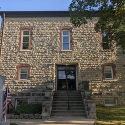
    Ozark County Clerk Photos

    Recommended Reviews - Ozark County Clerk

    Your trust is our priority, so businesses can't pay to alter or remove their reviews. Learn more about reviews.
    Yelp app icon
    Browse more easily on the app
    Review Feed Illustration

    15 years ago

    Awesome! Got the old marriage records I needed with fast and courteous clerks. : )

    Helpful 0
    Thanks 0
    Love this 0
    Oh no 0

    Verify this business for free

    Get access to customer & competitor insights.

    Verify this business

    Webster County - Webster County Historical Marker, Marshfield

    Webster County

    3.0(1 review)
    57.3 mi

    This historical marker stands on the grounds of the Webster County Courthouse and points out the…read morehistory of the area. There is plenty of street parking around and it is interesting to learn a bit. Stop by. The marker has quite a lot of information. On the front, it reads "Webster County, organized March 3, 1855, encompasses 590 sq. miles of the highest extensive upland area of Missouri's Ozarks. The judicial seat, Marshfield, lies 1490 feet above sea level, highest county seat in Mo. Pioneer legislator John F. McMahan named the county and county seat for Daniel Webster and his Marshfield, Mass. home. "Marshfield was laid out in 1856 by R.H. Pitts on land given by C.F. Dryden and W.T. and B.F.T. Burford. Until a courthouse was built, county business was conducted at Hazelwood where Joseph W. McClurg, later Gov. of Mo., operated a general store. Today's Carthage marble courthouse, built 1939-41, is the county's third. "During the Civil War, a small force of pro-Southern State troops was driven out of Marshfield, Feb. 1862, and ten months later a body of Confederates was routed east of town. On Jan. 9, 1863, Gen. Joseph O. Shelby's troops burned the stoutly built Union fortifications at Marshfield and at Sand Springs, evacuated earlier. By 1862, the telegraph passed near Marshfield on a route later called the "Old Wire Road."" And on the reverse, it continues with "In Webster County, straddling the divide between the Missouri and Arkansas rivers, rise the headwaters of the James, Niangua, Gasconade, and Pomme de Terre rivers. A part of the 1808 Osage Indian land cession, the county was settled in the early 1830's by pioneers from Ky. and Tenn. An Indian trail crossed southern Webster County and many prehistoric mounds are in the area. "The railroad building boom of the post Civil War period stimulated county growth as a dairy, poultry, and livestock producer. The Atlantic & Pacific (Frisco) was built through Marshfield, 1872, and by 1883 the Kansas City, Springfield, & Memphis (Frisco) crossed the county. Seymour, Rogersville, Fordland, and Niangua grew up along the rail routes. Early schools were Marshfield Academy, chartered, 1860; Mt. Dale Academy, opened, 1873; and Henderson Academy, 1879. "Astronomer Edwin P. Hubble (1889-1953) was born in Marshfield. The composition "Marshfield Tornado" by the Negro musician John W. (Blind) Boone gave wide publicity to the April 18, 1880 tornado which struck town killing 65 and doing $1,000,000 damage." The marker was erected in 1958 by the State Historical Society of Missouri and State Highway Commission. [Review 1085 of 2024 - 348 in Missouri - 22112 overall]

    Photos
    Webster County - Webster County Historical Marker, Marshfield

    See all

    Webster County Historical Marker, Marshfield

    Ozark County Clerk - courthouses - Updated May 2026

    Loading...
    Loading...
    Loading...