Cancel

    Open app

    Search

    Oregon Gold Adventures

    5.0 (1 review)
    Closed Closed

    Oregon Gold Adventures Photos

    More like Oregon Gold Adventures

    Recommended Reviews - Oregon Gold Adventures

    Your trust is our priority, so businesses can't pay to alter or remove their reviews. Learn more about reviews.
    Yelp app icon
    Browse more easily on the app
    Review Feed Illustration

    17 years ago

    Helpful 0
    Thanks 0
    Love this 0
    Oh no 0

    Ask the Community - Oregon Gold Adventures

    Verify this business for free

    Get access to customer & competitor insights.

    Verify this business

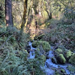
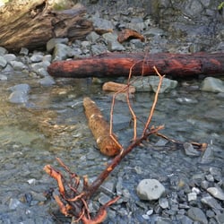
    Damnation Creek Trail - The stream

    Damnation Creek Trail

    4.8(5 reviews)
    53.5 km

    To get to Damnation Creek Trail, you'll have to follow a short bit of the Coastal Trail (which…read morefollows the old Highway 101). It's a fun descent to the ocean, over some little bridges and through some high brush at times. Time your hike with the tides. If you reach the trail's end at low tide, you can scramble down the rocks to the rocky beach. There are succulents clinging to the rocky bluffs, wildflowers growing above the beach, and waves crashing on the seastacks. You can find tidepools with all kinds of sea life. Wear waterproof shoes. The hard part is the walk back. The hike is a dead end, and the first half is downhill. That means you'll be walking up hill (the hike begins/ends with a 1000-foot elevation) for the second leg of your hike, so pace yourself. But the views are well worth the effort. You can even cool off by walking a bit of the coastal trail when you're done. It covers part of the old highway, so it's flat and paved. In the spring there are some pretty wildflowers, too. One of my favorite hiking trails in the area.

    Beautiful ending to a hike. By the time you get to the bottom (1000 ft) on the ocean, you just…read morewant to stay. However, the climb back will hit you. If you jump into the stream it refreshes you and gets you ready for the hike back up. Takes about 2 -3 hours on a decent pace. Make sure you head down. Don't make a left or right. You will see a sign that says 1.7 miles and dead end. Follow that one. Wear hiking shoes, it gets slippery. I wouldn't do it if it was raining. It can be dangerous.

    Photos
    Damnation Creek Trail - At the bottom

    At the bottom

    Damnation Creek Trail
    Damnation Creek Trail - Set up our own crossing bridge. Or you can use the giant logs

    See all

    Set up our own crossing bridge. Or you can use the giant logs

    Oregon Caves - Oregon Caves National Park, Cave Junction, OR - September 27, 2024

    Oregon Caves

    4.4(101 reviews)
    24.9 km

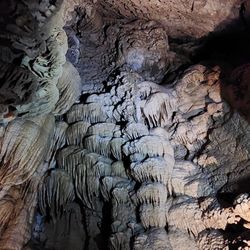
    9/19/26: The Oregon…read moreCaves National Monument was so cool today! (In both the literal and figurative senses....it was 44 degrees in there...) I bought tickets online (recreation.gov) about a month ago for the discovery tour. It was a straightforward drive to get to the Illinois Valley Visitor Center in Cave Junction (good place to stop for info, bathrooms, and to buy tickets if you haven't already). If you didn't buy tickets beforehand, you can buy tickets at the Cave Junction visitor center BEFORE making the long drive to the actual cave - very helpful. From there, it took a full hour to get on the sometimes narrow, often twisty (but very well-maintained and paved) road that led to the parking lot. We got there early and had time to walk to the main visitor center (about 1/8 mile from the parking lot) and see their well-designed interactive cave display. I checked in well before our tour time and they moved us up into an earlier tour spot - nice! We had time to eat lunch (brought with us) and change into long pants and warm jackets before meeting our tour guide. Ranger Ellie was awesome! Not only did she know about the cave's history and geology, she mixed in a ton of good humor with the information and gave us all time to look at the cave features we were passing while keeping us moving along. She was also great about telling us about how to navigate the cave's paths, stairs, and low-clearance areas safely. Though I'm 6'1" and had to duck a lot, Ranger Ellie prepared us so well throughout the tour that my head remained unscathed! The cave itself is truly awe-inspiring. Incredible formations throughout, pretty well-lit, and the pathways were all paved and well-marked. Every staircase felt sturdy, too, so even climbing stairs up into high places felt safe, even if the going was slow going up and down. (I'm glad I wore hiking boots.) It really was something to see amazing formations and an underground river traveling right through the mountain up close. It was cold in there (44 degrees, like a fridge!) so I'm glad I took my winter coat. The whole tour was about a mile, but seemed longer and had lots of steps. Even as a tall person, there were places for me to stand at my full height at all the tour stops. Once we were out, my friend and I walked the mile-ish loop around the top of the mountain at the cave's exit to take in the views - HIGHLY recommend doing this after. Tips: - Stop at the visitor center in Cave Junction for road info / bathroom break ahead of time - they'll tell you if walk-up tickets are sold out, too - plan on needing a full hour to get from Cave Junction to the parking lot - and drive SLOWLY - There's a 1/8 mile walk from the parking lot to where you check in for tours - get there at least an hour before your tour - It's COOL / COLD in the cave so dress accordingly! I've wanted to go here for years and it was SO much better than I was expecting. I look forward to coming back and trying the candlelight tours and some of their other hikes! Great job to the staff there who keep everything so clean, well-maintained, safe, and fun.

    Great place super cool tour unique. If you are traveling in this area these caves are a must!!…read moreBeautiful

    Photos
    Oregon Caves
    Oregon Caves
    Oregon Caves

    See all

    Simpson Reed Grove Trail - how did this happen?

    Simpson Reed Grove Trail

    5.0(2 reviews)
    43.9 km

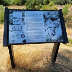
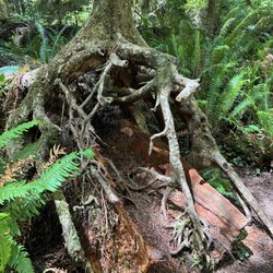
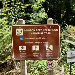
    Located on Highway 199, the Simpson Reed Grove Trail was the seventh (11:48) stop (not counting our…read moreretail stops in nearby Crescent City) during our fourth day of our trip to the northern most point of California. This trail was the primary reason why we came this way, as it was clearly called out as being the best combination of redwood seeing/admiring with more accessible trails for the mobility impaired. My wife, her 85 year old mom, and I knew this to be one of our last forest stops, so decided to take the trail slowly. Not sure if mom would have agreed to take it if she knew exactly how long the loop was (0.8 miles), but with a lot of rest stops (plenty of places to sit on the trail), it ended up being a very worthwhile experience. The Simpson-Reed Grove trail is located in Jediah Smith Redwoods State Park, and is named for the first president of the Simpson Timber Company, whose family made significant philanthropic contributions to preserve the old growth redwoods in the area. There isn't much change in elevation on the main loop of the trail, but a subsequent outshoot loop (Peterson Memorial Trail that adds .13 miles and takes you over foot bridge crossing over small creeks) has more incline. We ended up skipping that portion. There are a lot of fallen trees, left to provide to nutrients for subsequent generations. It gives multiple opportunities to get up close (tactile) and clearly experience some of the largest living things on Earth.

    Right off the Redwood Highway, on the north side of the road (just a little ways from Highway 101,…read moresits an astounding grove of redwoods. If you're just driving through the area, or even if you came to camp for a while, this place will provide you with some great photo opportunities. The trail is a wide, flat, and very short loop that even the weakest members of your group can probably tolerate. (Don't expect a real hike on this one. It's more of an easy stroll.) If you don't have the time or the desire to go deep into the forest or get dirty at all, this is the best way to see how truly magnificent the redwoods can be.

    Photos
    Simpson Reed Grove Trail - Info about the trail

    Info about the trail

    Simpson Reed Grove Trail
    Simpson Reed Grove Trail - Dead but still standing

    See all

    Dead but still standing

    Oregon Gold Adventures - hiking - Updated September 2026
    Loading...
    Loading...
    Loading...