
Noah Bud Ogle Cabin Photos


More like Noah Bud Ogle Cabin
Recommended Reviews - Noah Bud Ogle Cabin
Start your review...



6 months ago
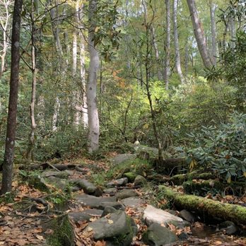
I love to see historic structures and this one is within Great Smokey Mountain National Park, not too far from Gatlinburg. The farmstead of Noah "Bud" Ogle is preserved and visitors are allowed to walk through the log house and wander the former property. There is no charge. Ogle was an early settler in the area. He owned 400 acres (well before the land was Park) and raised corn and apples. He built the cabin in the 1880's. A mill on the property was used to grind the corn. Parking is limited, maybe twelve spaces. A parking pass is required that can be purchased at any visitors center. There is a 3/4 mile nature trail leading into the forest with spring flowers in bloom. read more

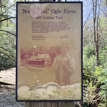


Great short hike [less than a mile] but AMAZING views along the path of the nature. There are a couple of historic buildings [Bud Ogles Cabin and the Mill] along the walk. Even with the forest fire almost 10 years ago, these buildings are still standing today!! read more
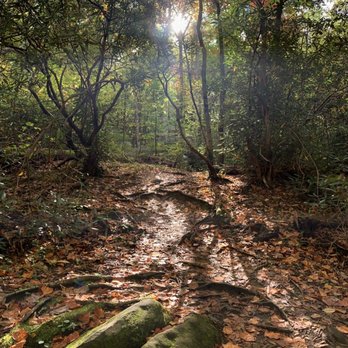

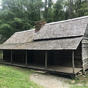
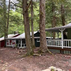
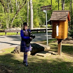
One of my favorite discoveries during a recent trip to Tennessee was all of the historic structures I found still standing in Great Smokey Mountains National Park. Some require a hike to reach but one that is right next to the road is the Noah Bud Ogle Cabin. To get there you take Historic Nature Trail/ Airport Road into the National Park. There is a parking lot close to the cabin so it only requires a short walk to reach it. The homestead is located on the Roaring Forks Nature Trail. The log home was built by Noah "Bud" Ogle. Ogle's grandparents William and Martha were the first homesteaders of European descent to arrive in White Oak Flats, now Gatlinburg in the 1800's. Bud was born in 1863 and he established this 40 acre homestead in 1879. Although the rocky land was not good for crops, Ogle grew corn and apples. The homestead is typical of a 19th century Appalachian mountain farm. The saddle-bag house was built in the early 1880's. The style refers to the fact that there are two separate house joined in the middle by a chimney. The two cabins were built five years apart to accommodate the growing Ogle family. This is one of the rarer floor plans found in the Smokey Mountains. Both cabins measure eighteen by twenty feet and are one story with a loft. Besides the cabin you can visit the homesteads tub mill located about a third of a mile away. Built in 1885 the mill ground corn for the family and other settlers in the area. It is the last surviving tub mill in the area. Also still standing is the Ogle family barn where chicken and pigs were raised. It is the last existing four pen barn in the park.The style of the barn is called a drive through because you could drive your wagon into the middle of the barn. The cabin, tub mill, and barn were added to the National Register of Historic Places in 1977. The farms proximity to the road makes it very easy to visit and it doesn't take much time to walk around. The park service offers brochures about the history of the homestead in a stand next to the parking lot. I love how the park service where able to preserve some of these historic homesteads. read more


More info about Noah Bud Ogle Cabin















Noah Bud Ogle Cabin - landmarks - Updated October 2026
Best of Gatlinburg
People found Noah Bud Ogle Cabin by searching for…
Scenic Overlook in Gatlinburg, TN
Places to Take Pictures in Gatlinburg, TN
Free Things to Do in Gatlinburg, TN
Scenic Drive in Gatlinburg, TN
Walking Trails in Gatlinburg, TN
Tourist Attractions in Gatlinburg, TN
Historical Sites in Gatlinburg, TN
Public Parking in Gatlinburg, TN
Hiking Trails in Gatlinburg, TN
Public Services & Government in Gatlinburg, TN
Natural Hot Springs in Gatlinburg, TN
Trending Searches in Gatlinburg, TN
Apple Orchards near Noah Bud Ogle Cabin
Apple Picking near Noah Bud Ogle Cabin
Castles near Noah Bud Ogle Cabin
Corn Maze near Noah Bud Ogle Cabin
Costume Store near Noah Bud Ogle Cabin
Craft Fairs near Noah Bud Ogle Cabin
Dog Parks near Noah Bud Ogle Cabin
Gold Panning near Noah Bud Ogle Cabin
Hair Stylists near Noah Bud Ogle Cabin
Halloween Events near Noah Bud Ogle Cabin
Haunted Houses near Noah Bud Ogle Cabin
Hidden Gems near Noah Bud Ogle Cabin
Historic Restaurants near Noah Bud Ogle Cabin
Lookout Points near Noah Bud Ogle Cabin
Men's Clothing near Noah Bud Ogle Cabin
Photo Spots near Noah Bud Ogle Cabin
Pick Your Own Farms near Noah Bud Ogle Cabin
Places To Take Pictures near Noah Bud Ogle Cabin
Places To Visit near Noah Bud Ogle Cabin
Places To Walk At Night near Noah Bud Ogle Cabin
Public Art near Noah Bud Ogle Cabin
Pumpkin Patches near Noah Bud Ogle Cabin
Scenic Night View near Noah Bud Ogle Cabin
Scenic Overlook near Noah Bud Ogle Cabin
Shoe Stores near Noah Bud Ogle Cabin
Browse Articles
Browse Nearby
BEST of Gatlinburg, Tennessee Coffee near Noah Bud Ogle Cabin
BEST of Gatlinburg, Tennessee Things to Do near Noah Bud Ogle Cabin
BEST of Gatlinburg, Tennessee Restaurants near Noah Bud Ogle Cabin
BEST of Gatlinburg, Tennessee Shopping near Noah Bud Ogle Cabin
BEST of Gatlinburg, Tennessee Breakfast near Noah Bud Ogle Cabin
Browse Brands
Related Searches in Gatlinburg, TN
Best Fun Things to Do in Gatlinburg, Tennessee
Best Lookout Points to Visit in Gatlinburg, Tennessee
Best Waterfalls and Swimming Holes in Gatlinburg, Tennessee
Book Engaging Historical Tours in Gatlinburg, Tennessee
Discover Charming Historic Homes in Gatlinburg, Tennessee
Discover Famous Monuments in Gatlinburg, Tennessee
Discover Historic Sites and Places in Gatlinburg, Tennessee
Discover Popular Landmarks in Gatlinburg, Tennessee
Discover Popular Photo Spots in Gatlinburg, Tennessee
Discover the Best Caves to Explore in Gatlinburg, Tennessee
Enjoy the Best Family Activities in Gatlinburg, Tennessee
Enjoy the Best Walking Trails in Gatlinburg, Tennessee
Explore Beautiful Botanical Gardens in Gatlinburg, Tennessee
Explore Beautiful Castles and Landmarks in Gatlinburg, Tennessee
Explore Beautiful Parks and Green Spaces in Gatlinburg, Tennessee
Explore Free Things to Do Around Gatlinburg, Tennessee
Explore Fun Activities to Do in Gatlinburg, Tennessee
Explore Fun Field Trips in Gatlinburg, Tennessee
Explore Popular Scenic Overlook Points in Gatlinburg, Tennessee
Explore Popular Scenic Views Near Gatlinburg, Tennessee
Explore Secret Spots Worth Visiting in Gatlinburg, Tennessee
Explore Venues & Event Spaces in Gatlinburg, Tennessee
Explore the Crime Museum Exhibits in Gatlinburg, Tennessee
Explore the Top Car Museum in Gatlinburg, Tennessee
Explore the Wax Museum Attractions in Gatlinburg, Tennessee
Find Beautiful Views in Gatlinburg, Tennessee
Find Top Art Museums in Gatlinburg, Tennessee
Find Top-Rated Waterfalls in Gatlinburg, Tennessee Now
Find the Best Bridge Spots in Gatlinburg, Tennessee
Find the Best Playgrounds to Visit in Gatlinburg, Tennessee
Great Things to See and Do in Gatlinburg, Tennessee
Hiking Trails With Waterfalls in Gatlinburg, Tennessee
Must-See Tourist Attractions Around Gatlinburg, Tennessee
Plan a Scenic Drive Route Near Gatlinburg, Tennessee
Popular Outdoor Activities to Try in Gatlinburg, Tennessee
Popular Picnic Spots to Visit in Gatlinburg, Tennessee
Popular Places to Take Pictures in Gatlinburg, Tennessee
Popular Things to Do in Gatlinburg, Tennessee
Popular Things to See in Gatlinburg, Tennessee
Top Hiking Trails to Explore in Gatlinburg, Tennessee
Top Places to Visit in Gatlinburg, Tennessee for Sightseeing
Top-Rated Plantation Tours Near Gatlinburg, Tennessee
Tour Famous Lighthouses Located in Gatlinburg, Tennessee
Tour Popular Historical Sites in Gatlinburg, Tennessee
Visit Beautiful Gardens in Gatlinburg, Tennessee
Visit Popular Museums in Gatlinburg, Tennessee Now
Visit a Free Museum Near You in Gatlinburg, Tennessee


