Nelson County Photos

Recommended Reviews - Nelson County
Start your review...



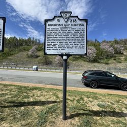
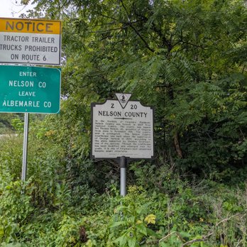
This marker is along US-250 that parallels I-64 in this mountainous region. It points out the border between Nelson County and Albemarle County, providing some history of each on the appropriate side. On the one side, "In the foothills of Virginia's Piedmont, Nelson County was formed in 1807 from Amherst County. The county was named for Thomas Nelson, Jr., governor of Virginia from June to November 1781. The county seat is Lovingston. The Nelson County courthouse was built under the supervision of George Varnum in 1809, according to the plans submitted by Sheldon Crostwait, one of the justices. Though the courthouse has been modified and enlarged over the years, it is one of Virginia's best-preserved historic court structures." And on the other, "Albemarle County was formed in 1744 from Goochland County and named for William Anne Keppel, the second Earl of Albemarle, titular governor of Virginia from 1737 to 1754. A portion of Louisa County was later added to Albemarle County. In 1761, part of Albemarle County was divided to form Buckingham and Amherst Counties. President Thomas Jefferson (1743-1826) was born in this county at Shadwell and here he built his home Monticello. The city of Charlottesville is the county seat and the home of the University of Virginia, chartered in 1819 and opened for instruction in 1825. Jefferson designed the university and supervised its construction." There is some room to pull over here. Marker number Z-20 was erected in 2002 by the Virginia Department of Historic Resources. [Review 1207 of 2026 - 1572 in Virginia - 26386 overall] read more