Mount Woodside Photos


More like Mount Woodside
Recommended Reviews - Mount Woodside
Start your review...

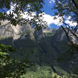
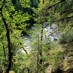
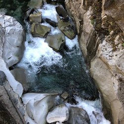
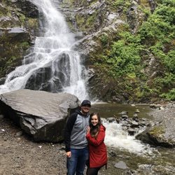
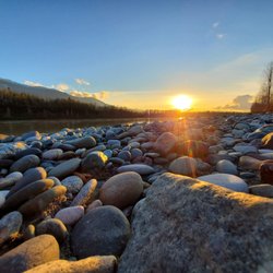
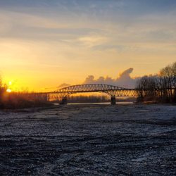
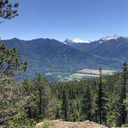
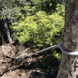
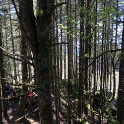
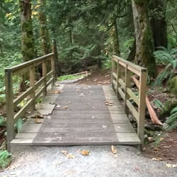
Random mountain about 120km E of Vancouver. Parking is available in various sections along the logging roads. The roads are pretty rough here. A raised vehicle would help. 4x4 is pretty much mandatory. Some of the dips in the road are large enough to fit a filing cabinet. There is a paragliding launch pad about halfway up the mountain. Looks like some school uses it regularly. Pretty cool watching them set up and glide away. There is an abandoned (Telus?) communication tower at the top. Looks like it was a pretty decent building until some partiers decided to trash the place. They even smashed the poor payphone inside. The actual geographic peak is a short walk away from the communications tower, but there's no actual path there. In fact, there are a pile of trees in the way. I had a chance to visit nearby Stacey Lake as well. Pretty nice view. There's even a fire pit and a place to set up some chairs. Lastly, as of the time of writing, there is no bubble tea anywhere on the mountain. My friends and I looked. We really tried. read more


More info about Mount Woodside
116 kilometres east of Vancouver
Kent, BC V0M 1A1
Canada
Directions
Hours
Outdoor Amenities


Mount Woodside - hiking - Updated May 2026
People found Mount Woodside by searching for…
Lakes in Kent, British Columbia
Things to Do in Kent, British Columbia
Views in Kent, British Columbia
Off Road Trails in Kent, British Columbia
Hiking Trails in Kent, British Columbia
Lakes & Ponds in Kent, British Columbia
Things to Do on a Rainy Day in Kent, British Columbia
Scenic Views in Kent, British Columbia
Walking Trails in Kent, British Columbia
Lookout Points in Kent, British Columbia
Easy Hikes in Kent, British Columbia
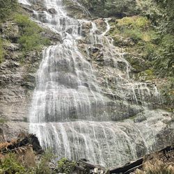
Waterfalls in Kent, British Columbia
Off Leash Dog Hikes in Kent, British Columbia
Running Trails in Kent, British Columbia
Browse Articles
Browse Brands
Related Searches in Kent, BC
Best Fishing Locations and Guides in Kent, British Columbia
Best Off Leash Dog Parks in Kent, British Columbia
Best Places for Horseback Riding in Kent, British Columbia
Discover Scenic Mountain Bike Trails Near Kent, British Columbia
Discover Top Boat Tours in Kent, British Columbia for All Ages
Enjoy Tent Camping Spots Around Kent, British Columbia
Explore Beautiful Botanical Gardens in Kent, British Columbia
Explore Beautiful Parks and Green Spaces in Kent, British Columbia
Explore Bike Rentals Throughout Kent, British Columbia
Explore Popular Boat Charters Near Kent, British Columbia
Explore Popular Campgrounds Near Kent, British Columbia
Explore Popular RV Parks Around Kent, British Columbia
Explore Scenic Lakes to Visit in Kent, British Columbia
Explore Top Dog Parks in Kent, British Columbia Near You
Explore the Best Beach Spots in Kent, British Columbia
Explore the Best Boating Spots in Kent, British Columbia
Find the Best Playgrounds to Visit in Kent, British Columbia
Find the Best Swimming Pools in Kent, British Columbia Today
Hiking Trails With Waterfalls in Kent, British Columbia
Locate Tennis Courts Around Kent, British Columbia
Locate a Public Shower Facility in Kent, British Columbia
Plan a Scenic Drive Route Near Kent, British Columbia
Popular Kids Activities in Kent, British Columbia
Popular Things to Do in Kent, British Columbia
Safe and Fun Parks for Kids in Kent, British Columbia
See Top Fireworks Events in Kent, British Columbia
Top Fishing Charter Experiences in Kent, British Columbia
Top Paddleboarding Activities in Kent, British Columbia
Top Playgrounds for Kids to Enjoy in Kent, British Columbia
Top RV Campgrounds to Visit in Kent, British Columbia
People who viewed Mount Woodside also viewed
Mount Hope Lookout
1 review
Mount Lincoln
1 review
Slesse Memorial Trail
1 review
Rendall Park
1 review
Mill Lake
2 reviews
Purple Hayes School of Kayaking
4 reviews
Great River Fishing Adventures
10 reviews
Cheam Fishing Village and Campground
5 reviews
Spirit Trail Walk
1 review
Coquihalla Canyon Provincial Park
9 reviews