Moses Falls Photos


More like Moses Falls
Recommended Reviews - Moses Falls
Start your review...

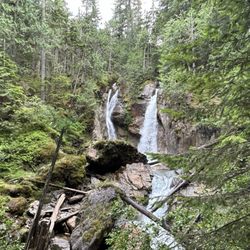
I was sitting in my favorite place in Revelstoke, British Columbia...yes, Tim Hortons!! And, I noticed a sign posted on the wall inside highlighting 10 worthwhile sights to check out around town. The #1 listed activity was to visit 3 waterfalls, and this Moses Falls was part of the list. I thought to myself...."waterfalls? I love waterfalls! I'm a waterfalls' enthusiast!"...and so here I am getting to talk about the efficient roadside stop that is...Moses Falls! It's located about 7.5 kilometers or 5 miles outside downtown Revelstoke. Pretty easy. I parked in the small dirt road lot and then trekked down a fairly steep but manageable pathway within the forest for maybe 1/3rd of a kilometer. And then the waterfall was right in front of my eyes. I especially liked the view here as Moses Falls trickled down the side of a rock wall. No frills to it, and it was a quick picture to capture. Best of all, the sun pierced through the trees for the afternoon visit and really accentuated the backdrop. I noticed some visitors were in their bathing suits for getting wet. The falls splash down into a pool which blends among a gentle flowing stream. Moses Falls is simply a nice getaway into nature and a pleasant surprise considering most tourists coming to Revelstoke drive the Meadows in the Sky Road within the national park boundaries. Finally, who knew? Not only does Tim Hortons sell the best pastries, bagels and coffee in Canada, but so cool of them to mention rewarding places around Revelstoke to discover at your own leisure. read more
More info about Moses Falls
Westside Road
Revelstoke, BC V0E 2S0
Canada
Directions
Hours
Outdoor Amenities


Moses Falls - hiking - Updated July 2026
Browse Brands
Related Searches in Revelstoke, BC
Best Places for Horseback Riding in Revelstoke, British Columbia
Enjoy Tent Camping Spots Around Revelstoke, British Columbia
Explore Beautiful Parks and Green Spaces in Revelstoke, British Columbia
Explore Fun Activities to Do in Revelstoke, British Columbia
Explore Popular Campgrounds Near Revelstoke, British Columbia
Explore Popular RV Parks Around Revelstoke, British Columbia
Explore Scenic Lakes to Visit in Revelstoke, British Columbia
Find the Best Playgrounds to Visit in Revelstoke, British Columbia
Popular Things to Do in Revelstoke, British Columbia
Top-Rated Boat Rental Services in Revelstoke, British Columbia
Browse Articles
People who viewed Moses Falls also viewed
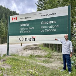
Glacier National Park
5 reviews
Begbie Falls
2 reviews
Mount Revelstoke National Park
5 reviews
Blanket Creek Provincial Park
2 reviews
Meadows In the Sky Parkway
3 reviews
Martha Creek Provincial Park
1 review
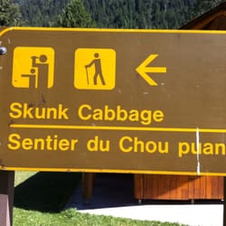
Skunk Cabbage Boardwalk
1 review
Rutherford Beach
1 review
Revelstoke Aquatic Centre
4 reviews
The Cabin
4 reviews