Cancel

    Open app

    Search

    Marty Bender Nature Area

    5.0 (1 review)

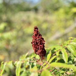
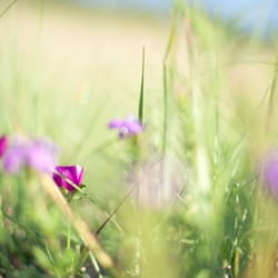
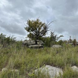
    Marty Bender Nature Area Photos

    More like Marty Bender Nature Area

    Recommended Reviews - Marty Bender Nature Area

    Your trust is our priority, so businesses can't pay to alter or remove their reviews. Learn more about reviews.
    Yelp app icon
    Browse more easily on the app
    Review Feed Illustration

    3 years ago

    Helpful 3
    Thanks 0
    Love this 2
    Oh no 0

    Verify this business for free

    Get access to customer & competitor insights.

    Verify this business

    Kanopolis Lake State Park - Pretty area

    Kanopolis Lake State Park

    4.4(10 reviews)
    25.0 mi

    Beautiful park! We started our hike at Buffalo Track Canton Nature Trailhead, which is located a…read moreshort drive into Kanopolis Lake State Park. This trailhead has two entrance points, and one is usually more manicured than the other. We didn't know there was a difference at the time and took the path less traveled and less tended to. Which was unfortunate for us because we were walking through tall grasses and brush, which was uncomfortable because some of the people I was hiking with were wearing shorts. So, if you want a more pleasant hike, make sure you're taking the hiking trail that has been mowed. Other than slapping away plants and hoping we weren't transporting ticks, the hike was great and the scenery here is beautiful. Our trail was a little less than a mile one way, and led us to a really cool cave with rocks that looked like the profile of a person! We checked out the cave for a while, then headed back. Once you're at the cave, you do have an option to travel down another trail to go farther into the park, but we chose to just head back. There's a lake here and other things, but we only visited the park to hike. We had a great time hiking, though! This part of Kansas is beautiful, and walking through Kanopolis is a great way to experience some of it.

    Great camping spot and lake. Shower facilities could use some cleaning and updated paint but…read moreoverall a really nice spot.

    Photos
    Kanopolis Lake State Park - A body of water

    A body of water

    Kanopolis Lake State Park
    Kanopolis Lake State Park - Steep climb

    See all

    Steep climb

    Coronado Heights - S'more at the fire pit

    Coronado Heights

    4.6(15 reviews)
    13.9 mi

    Wow! Visiting Coronado Heights was one of the highlights of my trip to south central Kansas. Kansas…read moreisn't known for its elevation, but this is one place in the area where you can feel like you're up high. In reality, it's just a hill, sitting in front of a plain, asking you to love it. But it's a pretty neat hill, Coronado Heights is. And on the top of the hill is a castle! Yes, there's a real castle here, which you can explore. It's believed that Spanish explorer Francisco Vasquez de Coronado and his soldiers used this area as a lookout point because it sits about 300 feet above the prairie. All kinds of historical items have been found in this area that back up this idea, including bits of chain mail and Spanish coins. I visited around sunset, which is a beautiful time to visit. There are a few picnic areas that you can use, with fire pits, grills and tables. The people I was with had the foresight to bring some marshmallows, chocolate and graham crackers, so we made some s'mores and enjoyed them in the twilight near the castle. It was a beautiful time. One thing to note: The restrooms are primitive (aka port-a-potties).

    This place is advertised as the "best view in kansas", i wouldn't say that, but It's a good view!…read moreWe really wanted to see the history behind this place but there were limited signs. You gotta look it up yourself. With that being said, this is a great place to visit. There are cool structures, lots of tables for picnics, and a bathroom. The castle has stairs you can walk up which allows you to look over the edge. In the fall this would be beautiful!!

    Photos
    Coronado Heights - Making s'mores at the fire pit

    Making s'mores at the fire pit

    Coronado Heights
    Coronado Heights

    See all

    Acorns Resort

    Acorns Resort

    3.5(15 reviews)
    43.8 mi

    Everything was awesome from friendly staff to absolutely immaculate camping area…read more The Cove Restaurant/Bar was top notch. Waiting staff was amazing, beer was cold and views from inside were cool.

    Kind of a long review, but for simplicity sake the top take aways:…read moreCabin 10- 10/ 10 Awesome! Staff- 12/10 Leslie and her team were so accommodating and awesome Experience 10/10 What an absolute awesome hidden gem!!! My buddies and I booked cabin 10 for a guys weekend, and took off from KC on a Friday. We spent the afternoon playing a round of golf over at Rolling Meadows (highly recommend a nice little country golf course). Then popped back over to the resort for a dinner down at the restaurant. We lucked out, as they had a live band playing that were surprisingly amazing, and accompanied our dinner perfectly. The gang was split across burgers, chicken sandwiches and whatnot. Nobody complained and I don't recall any left overs remaining! Friday night saw us sitting by a big fire outside the cabin, and watching some of the planes flying around from Fort Riley for the evening. Saturday was a bit of an early morning, as we went over to Acorn's Wild for an awesome pheasant hunt! We had four dogs, an amazing guide in Paul, and were off for hiking the fields for a half day. It was simply the best hunt any of us have ever gone on, and literally all of us have been talking about how fast we can get back out there again. They followed it up with a heck of a lunch spread (seriously, I gotta find those homemade cinnamon rolls), then we sadly packed it up and went back to KC for family obligations. Already day dreaming about our next escapee over. All of this and it's only 2.5 hours away from KC!

    Photos
    Acorns Resort
    Acorns Resort
    Acorns Resort

    See all

    Konza Prarie Biological Station - a bee on a wild flower

    Konza Prarie Biological Station

    4.7(9 reviews)
    55.6 mi

    Hiking this good in Kansas? Who knew? I'm sorry it took me so long to get here but now that I've…read morevisited I shall return. I spent a marvelous couple of hours hiking the 6 mile trail here yesterday (the Godwin trail) that changes from meadow and dry/wet creek crossings to steep hills and finally the tops of the magnificent bluffs and hills that dominate the reserve. And what fine hiking it is. The trails are a bit wide for my tastes but they're covered with gravel and also serve as access for the research going on here. It's obvious there's a lot of it (research). I can adapt. This isn't Colorado and we're not at 6,000 feet. Take along one of the flyers from the parking lot as it describes a lot of things you'd otherwise miss along the trail and these items are clearly noted with small signs along the way. Be warned: if you're doing the long trail like I did and it's mid 80s you might want to take a bottle of water and some sun screen and a hat for sure (I did). The lack of shade and high winds that sometimes come (as did on my hike) will suck the moisture right out of you and you'll be glad you did. I'm really impressed with what's been built here. The Kanza tall grass prairie is one of nature's true wonders and the fact that Kansas State University has built this great trail (three at least) with a lot of information to soak up as you hike is a home run for this experienced hiker. One of the more unique hikes I've taken and worth the effort to get here. Access: entrance is clearly marked from the McDowell Creek highway guessing about 5-7 miles south south of the I-70 exit of the same name.

    Very cool! Amazingly beautiful and well marked signs! It only takes about 10 mins to get here from…read moreManhattan and well worth it! The drive to get here is very pretty along the Kansas river. The hike is more of a nature walk and is about a 2 of 10 on difficulty. There are 2 very neat bridges near the beginning and the signs are well placed and give you the option of making this walk a distance of 2.5/4.4/6.0 depending on what path you decide to take! We opted for the 4.4 miles and loved it!

    Photos
    Konza Prarie Biological Station - Oolite (egg stone), a sedimentary rock formed from ooids, spherical grains composed of concentric layers.

    Oolite (egg stone), a sedimentary rock formed from ooids, spherical grains composed of concentric layers.

    Konza Prarie Biological Station - Beginning of the trail - early morning sunrise

    Beginning of the trail - early morning sunrise

    Konza Prarie Biological Station - Wild flowers

    See all

    Wild flowers

    Konza Prairie - Trail

    Konza Prairie

    4.7(13 reviews)
    55.7 mi

    This tallgrass prairie remnant is a very special treasure. How lucky we are that there are public…read moretrails we can use sunup to sundown! There is a porta-potty at the trailhead. The shortest loop is 2.6 miles and has very steep inclines. I brought a group of 10 older, very active gardening women. They went slow and steady and did great. We stopped and took breaks. It took a little over 2 hours. One brought a walking stick and it really helped her. We took a hike in the fall. I really want to come back in the spring!

    We literally stumbled across this attraction. We exited I-70 one exit earlier than we planned -…read morelooking for a place to have lunch. My wife spotted a sign indicating 10 miles to Manhattan, KS and said let's detour into Manhattan. NOTE - There is no public access directly from Interstate 70. To access, take Exit Number 307 (McDowell Creek) and go north. Travel about 4 miles, the entrance will be on your right. There are extensive hiking trails through lowland gallery forest, cross Kings Creek, and climb over ancient limestone ledges into the native tallgrass prairie. At the highest points, enjoy spectacular views of the Flint Hills and the Kansas River Valley. The grasslands of the Konza Prairie Biological Station have been home to people for many thousands of years, including indigenous peoples who lived and hunted here prior to European colonization. The Konza Prairie was named after the Kaw, or Kanza ("Kaáze") people, who inhabited and stewarded this area until their forced removal between 1846 and 1872. Konza Prairie Biological Station (KPBS) is a 3,487 hectare native tallgrass prairie preserve jointly owned by The Nature Conservancy and Kansas State University. It is located in the Flint Hills of northeastern Kansas, a grassland region of rolling hills overlain by shallow limestone soils unsuitable for cultivation. The Flint Hills region encompasses over 1.6 million hectares in eastern Kansas extending from near the Kansas-Nebraska border south into northeastern Oklahoma. This region includes the largest remaining areas of unplowed tallgrass prairie in North America. The vast majority of KPBS, and the surrounding landscape, has never been plowed and retains much of its native characteristics.

    Photos
    Konza Prairie - Blue salvia

    Blue salvia

    Konza Prairie
    Konza Prairie

    See all

    Marty Bender Nature Area - hiking - Updated May 2026

    Loading...
    Loading...
    Loading...