Maine Huts & Trails Photos


More like Maine Huts & Trails
Recommended Reviews - Maine Huts & Trails
Start your review...

3 years ago


4 years ago
11 years ago
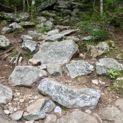
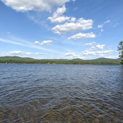
In the European tradition this is a well organized series of hut to hit hikes or skiing adventures that await you if you dare. Full service and self, pending on the season and membership make a big difference. I've done a Winter snowshoe jaunt at New Years and it was s blast and just now I returned from peak Fall foliage hiking and canoeing. Both equally amazing experiences! read more


10 years ago
8 years ago
More info about Maine Huts & Trails
496 Main St
Kingfield, ME 04947
Directions
(207) 265-2400
Call Now
Visit Website
http://mainehuts.org
Hours
Outdoor Amenities
Other Amenities
From the Business
Ask the Community - Maine Huts & Trails


Maine Huts & Trails - hiking - Updated May 2026
Best of Kingfield
People found Maine Huts & Trails by searching for…
Hiking Trails With Waterfalls in Kingfield, ME
Live Bait Shop in Kingfield, ME
Waterfalls and Swimming Holes in Kingfield, ME
Cross Country Skiing in Kingfield, ME
Fishing Spots in Kingfield, ME
Off Road Trails in Kingfield, ME
Fishing Guides in Kingfield, ME
Swimming Lakes in Kingfield, ME
Fly Fishing Shop in Kingfield, ME
Walking Trails in Kingfield, ME
Trout Fishing in Kingfield, ME
Hiking With Kids in Kingfield, ME
Browse Nearby
BEST of Kingfield, Maine Coffee near Maine Huts & Trails
BEST of Kingfield, Maine Things to Do near Maine Huts & Trails
BEST of Kingfield, Maine Restaurants near Maine Huts & Trails
BEST of Kingfield, Maine Parks near Maine Huts & Trails
BEST of Kingfield, Maine Lakes near Maine Huts & Trails
BEST of Kingfield, Maine Breakfast near Maine Huts & Trails
BEST of Kingfield, Maine Hotels near Maine Huts & Trails
BEST of Kingfield, Maine Campgrounds near Maine Huts & Trails