Illinois Prairie Path Photos


You might also consider


More like Illinois Prairie Path
Recommended Reviews - Illinois Prairie Path
Start your review...


Reviews With Photos


If you live in the Western Suburbs of Chicago, and enjoy walking, running, biking, or equestrian activities, the Illinois Prairie Path is a resource not to be missed. It is the heart of an overall system of trails that covers a good portion of northeast Illinois. First, some history: Today's Prairie Path was once the right-of-way for an electric train (Chicago, Aurora & Elgin Railway), established in 1902. Towns like Berkeley and Villa Park grew up on the railway line, which explains why the town centers are where they are. By the late 40's, the line was in grave financial trouble, and in the early 50's, the right-of-way in Chicago was taken over by the 'new' Congress (Eisenhower) Expressway (and CTA), which effectively crippled operations - passenger service ceased in 1957, and freight ceased in 1959. The resulting holding company wanted to liquidate the remaining right-of-way assets as one parcel. A local activist and naturalist, May Theilgaard Watts, led the fight to establish the Prairie Path, and after many years of accumulating support the path was established in 1966, the first rail-to-trail conversion in the US. Today's path effectively starts in the east at 1st Ave., 4 blocks north of the Eisenhower in Maywood (there is access from the CTA Blue Line, Forest Park, from a recent bridge built over the DesPlaines River) , runs west to Wheaton (the main line (stem)), then branches north to Elgin, and south to Aurora, with spurs to Geneva (from the Elgin branch) and Batavia (from the Aurora branch). For those without a map handy, Elgin, Aurora, Geneva, and Batavia are all located on the Fox River. A former associated freight line, also part of the overall path system, The Fox River Trail, basically follows the Fox River from Aurora, north to Elgin (and well beyond these two points). The use of this trail allows triangular travel (on the 2 branches and spurs), so you never have to return the way you came, and allows greater distance to be covered; ideal for bicyclists. The basic path has a crushed limestone surface, which is as easy to walk or ride on as asphalt (and fine for road bikes). It also sheds water quickly, so rain does not greatly affect its use. There are water fountains along the path, and limited facilities in a few spots. The mile markers on the system all start in Wheaton, where the rail yard was located (now the Wheaton Center complex). Here are the approximate mile breakdowns: Wheaton to 1st Ave: 15 mi Wheaton to Elgin: 15 mi Wheaton to Aurora: 13 mi Wheaton to Geneva: 11 mi Wheaton to Batavia: 13 mi It is also worth noting that it is possible to triangulate on the main line, accomplished by using the Great Western Trail (also a crushed limestone surface, which parallels North Ave.), which intersects the Prairie Path (a block to the north on Villa) in Villa Park, and intersects the Prairie Path again on the Elgin branch, at Prince Crossing Rd, in West Chicago. For bicyclists, this gives you a quick 24 miles of controlled path riding, almost in your own back yard! For those looking at less distance, any north-south thru street in the area will connect these two paths. For bicyclists, the main line of the Prairie Path is intersected by many streets, especially Elmhurst to Lombard. Exercise care in this stretch! The path from 1st Ave. Maywood to Berkeley appears to be the least used stretch, but another area to exercise caution. Wheaton Update: Reconstruction of the Illinois Prairie Path structures over Wesley Street, Front Street, and the railroad tracks: This is mile marker 0 of The Prairie Path, and the nexus of the system. Elgin branch construction is behind, this was to be open 5/20/2010. Now the schedule calls for the end of August. We'll see, but I am not encouraged. Note: Bridge now done (late Oct 2010, in time for the crush of winter traffic). The old bridge has been retained, and the new structure is built within. From the right angle, it looks like a prop for the "ET Flyover."


1 year ago

12 years ago
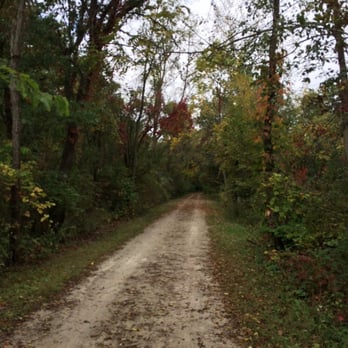
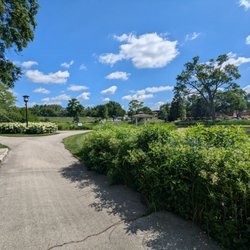
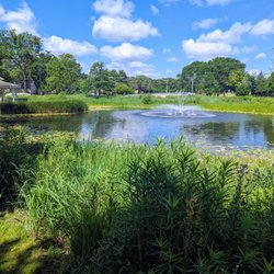
The prairie path is *huge* so I chose to review a particular part of it. I am a runner so I will preface this with the fact that this review is catered towards the active group. I am reviewing the Elgin branch from Geneva Rd. And County Farm to Smith Rd. The pluses for runners/cyclists: + long stretches-- I hate waiting to cross roads, drivers don't have the courtesy they used to. The first crossing is 1.9 miles in, the next is a residential road (not busy) and the one that follows is the same. I did a 5 mile out run and didn't have to stop. + the scenery-- the scenery is beautiful. The first 2 miles is mostly wooded ( it backs to Klien Creek Farm and a forest preserve ). The next stretch is almost all woods as well with some breaks when you cross under North Ave. The minuses: - no port-o-potties, water fountains or other amenities. Pack t/p and wear a water belt if you are going to be out long. - pretty secluded- even though there are a lot of homes around, I was nervous running by myself (even though I carry pepper spray). I would suggest it for running clubs and group runs, and only Day time running. This is my go-to route for long runs. Beautiful and no distractions. read more


8 years ago

9 years ago

15 years ago

16 years ago
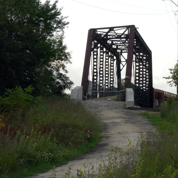
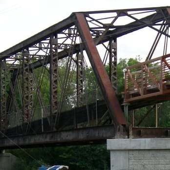
If you live in the Western Suburbs of Chicago, and enjoy walking, running, biking, or equestrian activities, the Illinois Prairie Path is a resource not to be missed. It is the heart of an overall system of trails that covers a good portion of northeast Illinois. First, some history: Today's Prairie Path was once the right-of-way for an electric train (Chicago, Aurora & Elgin Railway), established in 1902. Towns like Berkeley and Villa Park grew up on the railway line, which explains why the town centers are where they are. By the late 40's, the line was in grave financial trouble, and in the early 50's, the right-of-way in Chicago was taken over by the 'new' Congress (Eisenhower) Expressway (and CTA), which effectively crippled operations - passenger service ceased in 1957, and freight ceased in 1959. The resulting holding company wanted to liquidate the remaining right-of-way assets as one parcel. A local activist and naturalist, May Theilgaard Watts, led the fight to establish the Prairie Path, and after many years of accumulating support the path was established in 1966, the first rail-to-trail conversion in the US. Today's path effectively starts in the east at 1st Ave., 4 blocks north of the Eisenhower in Maywood (there is access from the CTA Blue Line, Forest Park, from a recent bridge built over the DesPlaines River) , runs west to Wheaton (the main line (stem)), then branches north to Elgin, and south to Aurora, with spurs to Geneva (from the Elgin branch) and Batavia (from the Aurora branch). For those without a map handy, Elgin, Aurora, Geneva, and Batavia are all located on the Fox River. A former associated freight line, also part of the overall path system, The Fox River Trail, basically follows the Fox River from Aurora, north to Elgin (and well beyond these two points). The use of this trail allows triangular travel (on the 2 branches and spurs), so you never have to return the way you came, and allows greater distance to be covered; ideal for bicyclists. The basic path has a crushed limestone surface, which is as easy to walk or ride on as asphalt (and fine for road bikes). It also sheds water quickly, so rain does not greatly affect its use. There are water fountains along the path, and limited facilities in a few spots. The mile markers on the system all start in Wheaton, where the rail yard was located (now the Wheaton Center complex). Here are the approximate mile breakdowns: Wheaton to 1st Ave: 15 mi Wheaton to Elgin: 15 mi Wheaton to Aurora: 13 mi Wheaton to Geneva: 11 mi Wheaton to Batavia: 13 mi It is also worth noting that it is possible to triangulate on the main line, accomplished by using the Great Western Trail (also a crushed limestone surface, which parallels North Ave.), which intersects the Prairie Path (a block to the north on Villa) in Villa Park, and intersects the Prairie Path again on the Elgin branch, at Prince Crossing Rd, in West Chicago. For bicyclists, this gives you a quick 24 miles of controlled path riding, almost in your own back yard! For those looking at less distance, any north-south thru street in the area will connect these two paths. For bicyclists, the main line of the Prairie Path is intersected by many streets, especially Elmhurst to Lombard. Exercise care in this stretch! The path from 1st Ave. Maywood to Berkeley appears to be the least used stretch, but another area to exercise caution. Wheaton Update: Reconstruction of the Illinois Prairie Path structures over Wesley Street, Front Street, and the railroad tracks: This is mile marker 0 of The Prairie Path, and the nexus of the system. Elgin branch construction is behind, this was to be open 5/20/2010. Now the schedule calls for the end of August. We'll see, but I am not encouraged. Note: Bridge now done (late Oct 2010, in time for the crush of winter traffic). The old bridge has been retained, and the new structure is built within. From the right angle, it looks like a prop for the "ET Flyover." read more



15 years ago

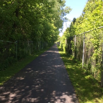
This is a very nice trail, close to my house and takes you through some good forest preserve. Some parts of the trail are gravel roads but its definitely good for walking. The trail is very close to my house and i often go biking or walking down the trail. My only complaint is that there are bugs when the weather gets a little damp. One the whole a great place to get a nice bike ride. read more



13 years ago

13 years ago

13 years ago


18 years ago

15 years ago


16 years ago

13 years ago
7 years ago


11 years ago


16 years ago

13 years ago

11 years ago
10 years ago

12 years ago


14 years ago
12 years ago
14 years ago
More info about Illinois Prairie Path
Ask the Community - Illinois Prairie Path
Review Highlights - Illinois Prairie Path
You might also consider



















Why does Yelp recommend reviews?
1 review that is not currently recommended
The reviews below are not factored into the business's overall star rating.

14 years ago


