Cancel

    Open app

    Search

    Ice Age Trail - Montrose Segment

    5.0 (1 review)

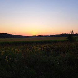
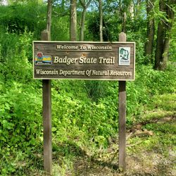
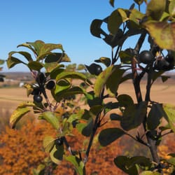
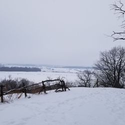
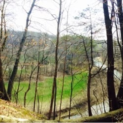
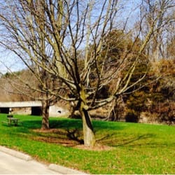
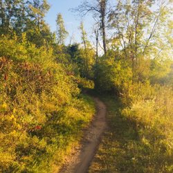
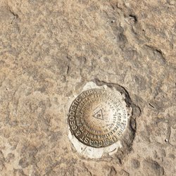
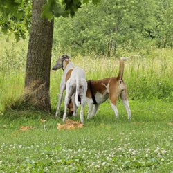
    Ice Age Trail - Montrose Segment Photos

    You might also consider

    Recommended Reviews - Ice Age Trail - Montrose Segment

    Your trust is our priority, so businesses can't pay to alter or remove their reviews. Learn more about reviews.
    Yelp app icon
    Browse more easily on the app
    Review Feed Illustration
    Photo of Jess N.
    1040
    380
    2752

    6 years ago

    Helpful 6
    Thanks 1
    Love this 6
    Oh no 0

    Verify this business for free

    People searched for Hiking 363 times last month within 15 miles of this business.

    Verify this business

    Donald County Park

    Donald County Park

    5.0(11 reviews)
    9.8 mi

    Our friends live about 10 minutes from this park and recommended we check it out, so we stopped by…read moreafter visiting them. There's a huge rock formation that definitely catches your eye, but the path leading up to it isn't well paved. You'll need to navigate through some tall brush if you plan to climb up. I wouldn't suggest attempting it unless you have proper shoes and decent balance (or a good core!). We saw a few adventurous teenagers make the climb, though. Aside from that, there are several nearby trails that are much better maintained and perfect for a casual walk or light hike. Overall, it's a nice county park with plenty of parking spaces to explore, especially if you're in the area and want a bit of fresh air and nature.

    Discovered this park while looking for a hiking spot after visiting Mt. Horeb. Only 6 minutes drive…read morefrom Mt. Horeb and what a great hidden gem. We parked at Pop's Knoll which has a gravel parking lot for about 20 vehicles. About 100 meters from the parking lot is an area with a covered shelter with picnic tables and a toilet room. What really surprised me about this park was how well the trails were maintained and marked with numbers so you have reference points to know where you are on the park map. Consists of multi-use trails for hikers and horseback riders, as well as hiking trails for pedestrians only. A good mix of trails through corn fields, wooded areas, and grassy paths along streams. Dogs are allowed but must be leashed at all times. I highly recommend.

    Photos
    Donald County Park
    Donald County Park
    Donald County Park

    See all

    Badger State Trail - Badger State Trail between Monticello and Belleville WI

    Badger State Trail

    4.5(2 reviews)
    8.3 mi

    Great walking, jogging, biking trail. Beautiful peaceful place once out of the town of Monroe…read more Deer, turkeys, chipmunks about. However, watch out for the bikes that don't bother to slow down or even notify walkers they zooming by. Almost been run over a few times.

    Note that the address listed above is for correspondence only, and does not indicate the actual…read morelocation of this trail. A trail map can be obtained from the website listed above. The Badger State Trail runs from Madison WI to Illinois, where is meets up with the Jane Addams trail that proceeds south to Freeport, IL. The Badger is a beautiful trail but one word of caution, there's a $5 daily fee or yearly fee required to ride it. I didn't have a fiver on me so I rode without paying, but I did see a trail worked that likely checked bikers for payment slips. So..be careful. I rode the path from south of Monticello, north past Belleville WI and back. This stretch of path includes the Stewart Tunnel, which was easily one of the most interesting things I've seen on any bike path I've ever ridden. Built in the 1880's, this tunnel is about four tenths of a mile long and contains no lighting inside. Once you lose the grace of the light coming from one end of the tunnel, you'll be in complete darkness until you catch light from the other side. Depending on how fast you ride, that might take a couple minutes. I used the flashlight app on my phone to illuminate the ground as I didn't want to hit something and take a spill in the dark. That and I went slowly, just to be on the safe side. If you go through the tunnel I highly advise you go slow and use a flashlight or light shedding device. That I experienced, the trail was flat and smooth in here, and nothing except the brick walls surrounded me. The rest of the trail is kept up okay. I like a trail that goes from town to town with country in between, so the Badger kept me happy. I'm looking forward to doing more stretches of this trail in the future and hope to see reviews from other riders who've done different sections. Cheers.

    Photos
    Badger State Trail

    See all

    Magnolia Bluff Park

    Magnolia Bluff Park

    4.0(4 reviews)
    13.6 mi

    Went hiking here in the snow on a weekend and got a very good workout. The path was paved pretty…read morewell, but it is still climbing a bluff and we had a dog pulling us all the way up. When you get to the top, there is a great view of the countryside. Only comment is that the way down was a little treacherous with the snow-covered steps and ground. Also with the snow, only the lower lot was open, but well plowed, unlike some of the other parks we've been at recently.

    I really love this park. In high school, we would come out here often when the weather was nice to…read moreclimb around on the bluffs and explore. I've continued to come out here, not as frequently, but when I get the chance. The park itself has some large bluffs. There is parking down below them, or you can drive up a steep winding narrow roadway to a large parking area up top. Once you're up there, there is a large green space with lots of tall mature trees that provide nice shade cover on hot summer days. There are picnic tables and an outhouse style restroom available. As you walk out towards the edge of the bluff, the trees clear and there is a nice view of the surrounding farmland. The bluffs are really cool to check out. Years ago, we would climb all over them. Now, due to safety concerns, they have the area marked off. Makes sense. There are also a lot of trails to walk along back in the wooded area that sits behind the clearing. A lot of these trails are also equestrian trails, so you must be on the lookout for horse poo! I really enjoy bringing my dog out here and cutting him loose in the woods. He never gets too far, and it's a great place for him to explore! The park is open year round, however the drive to the top does get gated off during the winter. You have to make the trek up on your own!

    Photos
    Magnolia Bluff Park - Great place to walk and hike. Nice views.

    Great place to walk and hike. Nice views.

    Magnolia Bluff Park
    Magnolia Bluff Park - A woodchuck don't chuck wood

    See all

    A woodchuck don't chuck wood

    Head Gates Park - the trip home, sunset

    Head Gates Park

    5.0(1 review)
    17.8 mi

    This is a really neat park on the Sugar River. It starts at the "head gates" for the once brodhead…read moremill and hydro project. The park is a trail along the raceway, or mill race. This is essentially a man made canal that provides water to the mill pond in Brodhead. It is a lovely walk, very scenic with numerous wetlands, woodland, farmland, ending with a lovely stroll along the canal into the village of Brodhead. Here, along one side of the canal are numerous fun homes reminiscent of the canals in Amsterdam. If you choose to walk or kayak, once in Brodhead, stroll downtown to a local cafe or restaurant. Hint: This is a GREAT trip for a fun outdoor date! Even if the date doesn't go well, the scenery is lovely and you can enjoy the walk back alone. It's a 4+ mile roundtrip. Easy hike with gravel two lane path. Hint: Hint: oooh...you discovered the super double secret hint! This is a great place to bring your dog. Lots of room to run big! Fetch, swimming, ducks, and the water is clean so, your dog can enjoy itself! Hint: Hint: Hint: A super triple secret hint? Say it isn't so! Kayakers - pay attention! Here is an INCREDIBLE opportunity for kayaking that requires no shuttling! Put your boat in here, paddle up river a short distance (no current here) to the decatur tap, portage the dam, paddle down the Sugar River to where the race rejoins the Sugar River. Then paddle up the race to Brodhead dam. Portage the dam and bing bang boom, you're back on the race! Now it's an easy paddle up the race back to the head gates where your car is parked, waiting for you, with a cooler of beer in trunk! Cheers, you earned it! Hint 4X: A quadruple hint-o-rama....be still my palpating heart....If you want to get into kayaking and kayak this in a group, check out the Mad City Paddlers website for group kayaking and canoe trips! Or, send me an email, I kayak this at least once a year :)

    Photos
    Head Gates Park - In town, the old dam and powerhouse

    In town, the old dam and powerhouse

    Head Gates Park - Looking west, dusk

    Looking west, dusk

    Head Gates Park - Real colors!  no photoshop here

    See all

    Real colors! no photoshop here

    Ice Age Trail - Montrose Segment - hiking - Updated May 2026

    Loading...
    Loading...
    Loading...