1. High Five Zipline Adventure

    0

    Glorieta, NM

    Cancel

    Open app

    Search

    High Five Zipline Adventure

    4.9 (8 reviews)
    Closed • Closed

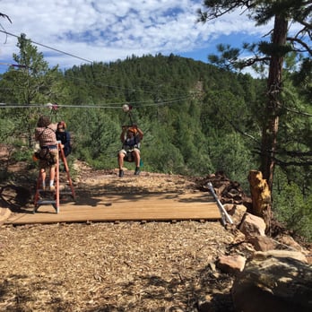
    High Five Zipline Adventure Photos

    You might also consider

    Recommended Reviews - High Five Zipline Adventure

    Your trust is our priority, so businesses can't pay to alter or remove their reviews. Learn more about reviews.
    Yelp app icon
    Browse more easily on the app
    Review Feed Illustration
    Photo of Joyce A.
    1
    109
    440

    1 year ago

    Helpful 1
    Thanks 2
    Love this 1
    Oh no 0

    2 years ago

    Helpful 0
    Thanks 0
    Love this 0
    Oh no 0
    Photo of Ben T.
    0
    13
    4

    10 years ago

    Helpful 2
    Thanks 0
    Love this 0
    Oh no 0
    Photo of Steph C.
    40
    224
    14

    10 years ago

    Helpful 0
    Thanks 0
    Love this 1
    Oh no 0

    10 years ago

    Helpful 0
    Thanks 0
    Love this 0
    Oh no 0

    10 years ago

    Helpful 0
    Thanks 0
    Love this 0
    Oh no 0

    10 years ago

    Pretty awesome! Just wish they provided more shade in between each station. I recommend they install some large patio umbrellas.

    Helpful 0
    Thanks 0
    Love this 0
    Oh no 0
    Photo of E K.
    0
    83
    9

    10 years ago

    Helpful 0
    Thanks 0
    Love this 0
    Oh no 0

    Ask the Community - High Five Zipline Adventure

    You might also consider

    Verify this business for free

    People searched for Tours 222 times last month within 15 miles of this business.

    Verify this business

    Atalaya Trail

    Atalaya Trail

    4.7(15 reviews)
    5.5 mi

    Atalaya Trail is a very serviceable and enjoyable trail.  It's just the right length for an…read moreafternoon (or morning) hike, and it offers just enough elevation gain that you won't be bored by the level of endeavor required.  That said, apart from the views you'll be rewarded with when you're here, there's not a whole lot else of interest to see during your visit. Tip: This is a popular destination for both hikers and cyclists; both of the aforementioned need to keep their eyes peeled for their opposite numbers; hikers especially need to exercise caution to avoid being hit by oblivious cyclists. I've been here several times recently, and very much enjoy myself each time.  I've found that the views (especially from the top) are very rewarding.  Because it's very easily accessible from all over the area, the trail can sometimes get very crowded; it's best to visit either in the early morning or at off-peak hours to optimize avoid the crowds. The trail winds through the Cruz Blanca neighborhood before rapidly ascending up the side of Atalaya Mountain; it eventually reaches a height of just over nine thousand feet.  While the final stretch is quite gravelly and steep, the views from the top are totally worth it!

    Part of the Dale Ball trail system, that include the Dorothy Stewart and Wilderness Trailheads. The…read moreparking lot near after entry for St John's college is the largest and furthest away. Drive up Camino Cruz Blanca and save yourself the 1.5 walk along the road past $1MM homes to these other trailheads. As with everything Dale Ball creates, this is a superbly marked trail system that allows the hiker to plan and tailor their experience. I made a bee-line to the summit of Mt. Picacho. Beautiful vista, but I'll need to return for a sunset and very carefully make my way down the steeper parts of a darkening trail.

    Photos
    Atalaya Trail
    Atalaya Trail
    Atalaya Trail

    See all

    Bandelier National Monument - Bandelier National Monument

    Bandelier National Monument

    4.8(223 reviews)
    31.5 mi

    This is a very well taken care of trail that is very easy for people to see quite up close. You…read morecould possibly have a stroller or wheelchair here and still see a lot. There are seats all throughout the routes. The first third of the trail isn't as shaded but the entire last portion is quite shaded. There's also a bathroom available about 2/3rds of the way to alcove house. The history is amazing. Glad we are preserving this place and sharing it with the public.

    One of my favorite national parks that I have ever been to and hiked! STUNNING. I love that you can…read morehike up the ladders on one of the hikes here. That hike definitely is not for the faint of heart and pushed my limits at the top (you are high and it seems scary) but it is one of my most memorable hikes all around for the scenery and unique experience. A must visit! For those who don't to do the ladder hike, you can still walk to the bottom of it and look up and get a good view. So there is something for all levels here. The scenery is gorgeous. It does get windy here sometimes (we had a lot of wind blasting us as we were climbing the ladders) so be careful and be prepared for that. The nature all around is beautiful. Additionally, there are some tables so you could bring a picnic. Staff in the visitor center is very friendly and has lots of great recommendations of what to do here or nearby. A must do! This was the highlight of my trip to this area and I can't recommend it enough :)

    Photos
    Bandelier National Monument - Bandelier National Monument

    Bandelier National Monument

    Bandelier National Monument - Bandelier National Monument

    Bandelier National Monument

    Bandelier National Monument - Bandelier National Monument

    See all

    Bandelier National Monument

    Picacho Peak

    Picacho Peak

    4.8(6 reviews)
    9.5 mi

    A challenging hike, but absolutely worth it!…read more When we went, the parking area had some construction going on, but it was still usable. There are several trails that start from the lot, so it will be used. The construction seems to be to connect this trailhead area to the nearby nature preserve society buildings and educational area. Which, by the way, is the closest restroom facilities. For those that need it... The trail is pretty easy to follow, though at the beginning, I was checking the photo I took of the trails and the AllTrails map. There were a couple confusing and unmarked on maps forks, or small dry creek beds or other areas that look like possible trails. And since part of the Picacho Peak trail is along or in a dry creek bed...it can be a little confusing. But once past that, the trails are pretty clear and well marked. It is challenging. It is in a higher elevation than I am generally used to, and even higher again from Albuquerque. And then you are climbing up a dang mountain. Take your time if you need to, bring more water than you think you'll need, bring snacks for energy at the top of the mountain. And enjoy!! The trail was neat and pretty well-maintained. The views are wonderful! And the other folks who will also make this trek are friendly and kind. Very glad we did it!

    The views are so worth the sweat! Trails aren't well marked at trailhead, but gets better as you go…read morealong. Moderate to hard effort and you need to pack ample water. Highly recommend this beautiful hike.

    Photos
    Picacho Peak
    Picacho Peak
    Picacho Peak

    See all

    High Five Zipline Adventure - tours - Updated October 2026

    Loading...
    Loading...
    Loading...