Genesee Riverway Photos


More like Genesee Riverway
Recommended Reviews - Genesee Riverway
Start your review...



6 years ago
We took a short walk on this trail and couldn't believe how far this trail goes! This is quite a great spot for a walk. Many people and traders on ships cane through here years ago. So much history here we didn't know about! Don't forget to stop for a bite to eat at Hose 22 for a nice lunch it has out door seating as well as inside. read more


3 years ago
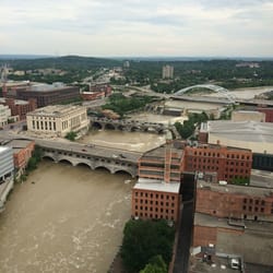
We started the morning of a one-day visit to Rochester by biking 8 miles out from the downtown area on the Genesee Riverway Bike Trail. As a bike trail, we were rather disappointed.There are some interesting points along the way (nice view of the city, a short span through a waterfront residential area, a great view of their main bridge, the University of Rochester, and some nice park areas), but overall we found that path's difficulty (mainly due to uneven paving, cracks, ill-repair and nearness to highway at one point) to outweigh the touristic value. We got some fascinating views of the Canal, which I wouldn't have wanted to miss. But it is one of those trails we will probably never go on again. Perhaps it is better if you start it out of the city instead? read more


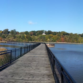
This is one of Rochester's hidden gems that I didn't discover until I moved to Irondequoit in 2006. My favorite way to experience the trail is an early morning run or a family bike ride. I like to start from the zoo and head north. If you enter from the zoo, follow the zoo entrance drive along for less than half a mile, and an entrance to a concrete ramp with metal railings will appear on your left, marked at the entrance with posts to prevent motorized vehicles. Turn left down the ramp and follow it down to a bridge over the Genesee. The bridge is wide. It is a great place to linger and take photographs. It is especially spectacular in mid October when there is a rainbow of colors blanketing the trees along the shore. Continue on the end of the bridge and up the ramp to the other side. Caution, if biking with little ones, they will probably struggle a bit coming up the ramp, but it is doable. When you get to the top, turn right and head north along the path to Lake Ave. There is a lookout about midway with a historical marker where an old fort once stood. Continue up Lake past Kodak for another mile and a half. You will pass Hanford's Landing cemetery and Saint Bernard's, a beautiful old stone building on your right. You will continue on and pass the larger Holy Sepulchre and Riverside cemeteries. Shortly after, there will be a sign on your right and a path leading back down to the Riverway trail. Follow it about half mile or so as it winds around to the left and meanders through tree covered woods. You may see deer in here. The path then splits. Follow the path to the right and descend down the hill until it flattens out again. This is particularly fun on a bike. Eventually the path dumps out at the base of the footbridge. You can turn left up a steep hill to Turning Point Park, but stay on the path and follow the footbridge as it winds around to the left. This area is particularly gorgeous in Spring and Fall, and peaceful anytime of year, especially at sunrise or sunset, and still relatively sparsely traveled in early morning hours, though it can get busier on nice days. There are often swans and ducks and occasionally, if you're lucky, herons hanging out in the reeds looking for breakfast. You may also see fish jumping or turtles coming to the surface. The water here is usually calm and peaceful, and I have a mind to bring a kayak South from the Lake and just explore some day. When the bridge ends (it is 2/3 mile long!), follow the path back up through a lightly wooded area and you will see boats docked on your right. Keep following the path along and under the O'Roarke bridge to the boat dock at Charlotte Beach. While not open early in the morning, there is a snack bar and restrooms here. There are also two water fountains which are accessible 24 hours and, though not chilled, they are crucial finds in the middle of a long run. Once you exit the dock area, you can just follow River Street north to the beach. If you are taking the trail later in the day, there is a Cheeburger Cheeburger in the Ferry Port building, which is a great casual spot for dinner, or hit up California Rollin in the same building, or any of the Charlotte icons like the LDR char pit or Mr. Domenics on Lake Ave. Grab an Abbots cone from the port building and walk out to the end of the pier, or just head over to Lake Ave and go South to Pattonwood. Turn left to cross the bridge and follow Pattonwood about a mile to St. Paul. Turn right on St. Paul and head back down to the zoo, about 4 miles to complete the loop. Warning, it is a bit of an uphill climb the first mile along St. Paul from Pattonwood but it is fairly gentle, and eventually levels out. Roughly 11 to 12 miles round trip from the zoo if you skip the side trips. Optional extenstions are to head left on St. Paul off Pattonwood to head down to Oly's for a beer (about a mile), or up Rock Beach (turn right off of St. Paul) to view some beautiful houses and beach bungalows. Rock beach is about a mile long and dumps you out on to Lake Shore. The truly adventurous could then turn left and explore the lake trail which will take you another two miles from Camp Eastman along the Lake Ontario shore between the beach and Durand Eastman Park and through the woods up to Culver and the Seabreeze area. But most will probably have had enough by the time Rock Beach comes out on Lake Shore. Turning right instead of left on Lake Shore will take you back to St. Paul and then just follow St. Paul left back to the zoo. My favorite part of the trail by far is the wooden footbridge, and I will just never get enough of that panoramic view. read more






14 years ago