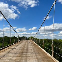
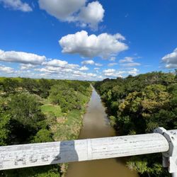
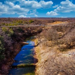
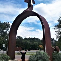
Cancel

    Open app

    Search

    Fort Mason Photos

    Recommended Reviews - Fort Mason

    Your trust is our priority, so businesses can't pay to alter or remove their reviews. Learn more about reviews.
    Yelp app icon
    Browse more easily on the app
    Review Feed Illustration

    9 months ago

    Helpful 0
    Thanks 0
    Love this 0
    Oh no 0
    Photo of Rain W.
    163
    1316
    1372

    2 years ago

    Helpful 1
    Thanks 0
    Love this 0
    Oh no 0

    9 years ago

    Helpful 16
    Thanks 0
    Love this 17
    Oh no 0

    Verify this business for free

    Get access to customer & competitor insights.

    Verify this business

    Atchafalaya Basin Bridge - The view from below

    Atchafalaya Basin Bridge

    4.3(4 reviews)
    38.8 mi

    The Atchafalaya Basin Bridge is one of the many reasons I love Louisiana. Crossing it takes a while…read morebecause it is quite long. 18.2 miles long, to be exact and the fourteenth longest bridge in the world. It takes you from Baton Rouge to my second favorite city in Louisiana...Lafayette. The speed limit is 55-60 mph and that's just fine with me (and I have a lead foot) because the view is just breathtaking. Going that speed allows me to really take in the scenery of the beautiful Atchafalaya Basin. The cypress trees growing in the swamp are decades old and oh so pretty. I like to think about how many alligators are right under my car when I'm crossing the bridge. Eek!! See you in Cajun country!

    I have traveled the Atchafalaya Basin Bridge an untold number of times. Some trips were uneventful,…read moreothers were amazing, and I've even occasionally cursed its existence. Since describing the uneventful times would be somewhat boring, I will focus on the two extremes that I've experienced here. The Good The view from this bridge is quite possible the best in America. It doesn't matter what direction you are headed; the view of the Atchafalaya Swamp is better than any postcard you can buy. Another cool view from the bridge is of the Whiskey Bay. I am not sure why it is called a bay as it looks like a river, but it's cool nonetheless. My favorite view of the bay is the pipeline that crosses the channel via some sort of bridge parallel to the basin bridge. I am sure it has a technical name, but the pipeline bridge is unique, and very cool. If you can somehow time your view to coincide with sunrise or sunset, you will have a difficult time keeping your eyes on the road. That leads me to my other experiences. The Bad When the basin bridge is bad, it is really bad. I have had the misfortune of getting stuck for hours due to a crash, being forced to detour due to a pipe explosion, and witnessing extremely reckless drivers. Because the wrecks can be so severe, the speed limit is lowered, and the bridge is heavily patrolled. It of course never seems to be heavily patrolled when I witness reckless driving, but if you speed, you are likely to get a citation. Fun Fact: The bridge is around 18 miles long and is considered the fourteenth longest bridge in the world.

    Photos
    Atchafalaya Basin Bridge - The view from below

    The view from below

    Atchafalaya Basin Bridge
    Atchafalaya Basin Bridge

    See all

    National Historic District Fredericksburg

    National Historic District Fredericksburg

    5.0(3 reviews)
    39.2 mi

    I love Fredericksburg. It looks like a German town. I love beer and food. I walked around Main…read morestreet. There were a lot of beautiful buildings. Nowadays, I saw many Hispanics. I heard a lot of Spanish. Germans might dissapear. But I still could see some legacies. Please visit Fredericksburg!

    Old limestone houses! This Historic District is in the…read morenational register of historical places. It's a few square blocks around Main Street in downtown Fredericksburg. The Historic District is a fun, pedestrian friendly area that's a cool walk to wander. The buildings in the district were mostly built in the 1840's-1880's and later. There's a lot of limestone in the area, so the German settlers built Texas versions of their houses back home in Germany. The structures vary from old log cabins to impressive stone churches. Be sure to check out the Sunday Houses, which are town homes for people who lived out in the boonies, so they could come to town and do church stuff, and trade. The district is safe, there's always cops patrolling the area, and this town runs a bit slower than the big city. You can legally walk around in this district with an open beer! Cheers! They have a map on the internet of an official route, which shows off a few old churches, a few cool old homes, and some public buildings. Overall, there's more than 700 old structures in this district. The map shows off some of the highlights. It's a great stroll through Texas history!

    Photos
    National Historic District Fredericksburg - Sunday houses!

    Sunday houses!

    National Historic District Fredericksburg
    National Historic District Fredericksburg

    See all

    Geographic Center of Texas - The drive was long and service was severely spotty but it was worth it.

    Geographic Center of Texas

    4.5(2 reviews)
    45.2 mi

    To quote the Texas Highways dot com website: "A stop at this…read morehistorical marker that's as close as the public can get to the exact geographic center will make anyone appreciate the majesty of the Lone Star State. It's important to note that the marker was not placed at the exact center of the state. That's 5 miles northwest on private property, the marker points out. So, if you visit the marker, you'll also want to drive about a quarter of a mile south and pull into the Heart of Texas Park, complete with a few picnic tables and a small observation tower you can climb to see the true center amid the rolling hills, oak and mesquite trees, round hay bales, and cattle." Make sure you also visit the picnic area known as the Heart of Texas Park. There is an observation tower so you can see 360 degrees above the tree tops. The stairs have 18 steps. The picnic tables are in shelters. Enjoy!

    Kind of out of the blue one day, my partner in crime said he wanted to go to the Geographic Center…read moreof Texas. I'll admit I was half listening and responded, "Oh yeah?" Of course this was a segway into telling me how he read about it on a couple of different websites, how it wasn't too far away from us, and how we could probably incorporate it into one of our weekend drives. We decided to go for it one particular weekend and missed the GCoT. The GCoT is about 135 miles N/NW of San Antonio and we found out later we were off by about 10-12 miles to the east on 190 vs staying on 377 but we didn't know that since cellular service doesn't exist in this area (at least it didn't for our service). And Waze was almost useless in this area especially since the address on there lists Rochelle which is on 190. My partner in crime even loaded his offline Google maps on his phone but we still couldn't get straight as to where we were at in reference to the marker. We finally 86'd our mission and decided to try again another time. After getting our butts kicked the first time, we went overboard and super prepared for the next trip. Btw, can you super prepare? Maybe I meant over prepare. At any rate, we finally found it the second time! It almost felt as though we were back in our geocaching days. At a certain point after we left the city limits of Brady, we saw cell service drop off but we kept pushing and after a moment we finally saw the marker! We did pass by it at first and noticed the Heart of Texas Park not too far from the marker. We decided we'd stop there once we got our pics of the marker. And yes, my partner in crime was satisfied. I, on the other hand, was half smiling through sweat as the temperature gauge read it was 114 degrees. After we left, my proud partner in crime said, "We did it. I'm glad we stuck with it this time." "Yep. Me too." "Now I want to go to the Geographic Center of the US." I think I slowly died inside after that.

    Fort Mckavett - Officers quarters - there are three left standing

    Fort Mckavett

    4.6(5 reviews)
    52.3 mi

    Love this place. Price is crazy low. 8$ for two of us. Drive for us was 2 hrs but the drive was…read morebeautiful. The gentleman that greeted us was very informative and friendly. We were able to have our dog with us on a leash as long as we picked up after him. He of course couldn't go in any buildings and they stressed not to tie him to anything. Easy. It was a great walk with lots of information posts. The buildings you get to go into a such a great look into the past. Easily would go back here. We took it easy and it took about 1 1/2 hrs and could have spent longer but we were right at closing time. That said they did not rush us out.

    Really enjoyed this park. Ok, not a park - "Historic Site". That's semantics in my book. Or…read moreactually another way to pay since my annual Park Pass doesn't work. No big deal. At $4 to visit, you will spend more on gas to get there. Most of the fort is still around in one form or another. Original, decayed buildings. Restored and refurnished. Rebuilt in situ. All lend to show what it used to look like. If this were closer, it would be MUCH more popular. It really was a gem and worth a visit if you haven't seen one of the frontier forts. It really was only a short time in use during the Texas history, but boy do we still revel in those times. Here's a way to get back in touch how it really looked.

    Photos
    Fort Mckavett - Interesting displays to help visualize it all.

    Interesting displays to help visualize it all.

    Fort Mckavett - Great fort. Even the Fort's school is there.

    Great fort. Even the Fort's school is there.

    Fort Mckavett - Sinks, Dead room found behind the hospital

    See all

    Sinks, Dead room found behind the hospital

    Heritage Oak Tree

    Heritage Oak Tree

    5.0(2 reviews)
    85.2 mi

    The Heritage Oak tree is massive live oak tree in the middle of Heritage Oak Park. This tree is a…read moregargantuan Southern live oak estimated to be around 400 years old. The tree is massive with a large circumference with branches that extend wide and deep. It has a large tree trunk, which immediately grabs attention. It is important to note that his particular tree was here long before the city of Cedar Park existed as a town. The Heritage Marker near the tree provides an explanation of the historical significance of the oak and its role in Cedar Park's development. The historical marker is thoughtfully done with visitor friendly, easy to read language. It highlights why this tree is important.

    I discovered this tree shortly after the F5 Tornado that blew through Jarrell and danced and…read moretwirled it's despicable self to Cedar Park to gut out the Albertson's that no longer exists. I felt the energy of Cedar Park and bought me a house out there. No regrets as it has turned out to be a great investment. This tree is over 400 years old standing at 57 + feet with a span of 80 feet. The trunk is 50+ inches with a circumference of 13 freaking feet! It is majestic people! I have had a love affair with this tree since the first time we met. She is magical and powerful. It is located in the median on Quest Blvd. I love to go and sit under her and just let my thoughts go. In a sense, meditate. Can you imagine how many secrets this tree could tell. I mean being 400 years old an all, ya' gotta know some good tales. Every year during the Christmas Holidays this tree is decorated with over 30,000 lights, and, it is a site to behold! One of the most beautiful things you will ever see. This beautiful Live Oak has free access. The Cedar Park Heritage Society has done a wonderful job at preserving this wonderful tree. Come visit and enjoy and please be respectful to the tree and Mother Nature.

    Photos
    Heritage Oak Tree
    Heritage Oak Tree
    Heritage Oak Tree

    See all

    Fort Mason - landmarks - Updated May 2026

    Loading...
    Loading...
    Loading...