Cancel

    Open app

    Search

    Ford MineTrail

    4.0 (1 review)

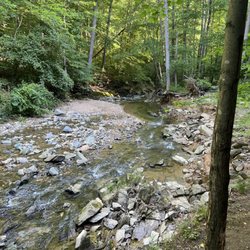
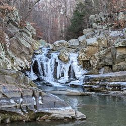
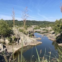
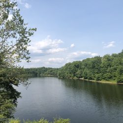
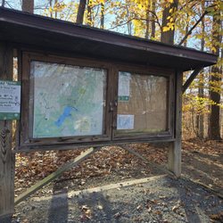
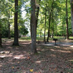
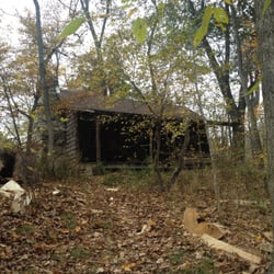
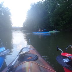
    Ford MineTrail Photos

    You might also consider

    Recommended Reviews - Ford MineTrail

    Your trust is our priority, so businesses can't pay to alter or remove their reviews. Learn more about reviews.
    Yelp app icon
    Browse more easily on the app
    Review Feed Illustration
    Photo of Sean L.
    123
    262
    7881

    5 years ago

    Helpful 1
    Thanks 0
    Love this 0
    Oh no 0

    You might also consider

    Verify this business for free

    People searched for Hiking 3,606 times last month within 15 miles of this business.

    Verify this business

    Billy Goat Trail - Section  A - A quieter Potomac River

    Billy Goat Trail - Section A

    4.8(252 reviews)
    1.7 mi

    Not a reflection of the trail as a whole, but when I stopped back on this occasion I was dismayed…read more It was one thing during the peak of the COVID era when there were signs up saying this trail was to be undertaken in one direction only. People were throwing around all sorts of silly rules out of desperation in those days. I doubt any lives were saved by this; maybe the theory was to reduce human contact but realistically, we're talking about hiking in open air. Public health aside, I return to find even now there are still signs saying to take the trail one way. And having done it both ways many times, it's the wrong way! Absurd. Supposedly there's some justification, but I think that grown adults can figure out how to hike in two directions without running into each other. As an overall natural resource, it remains a gem (though it must be noted that the Billy Goat B trail downstream is currently closed due to damage). But whoever is making these stupid rules shouldn't be in the business of making rules at all. Thankfully some rebels were taking the trail in the northernly direction, as well they should.

    I really enjoy this hike because it has great views and is an interesting hike. The first half…read moreinvolves hiking on the rocks overlooking the Potomac River. It has some rock scrambles which keep my kids interested in the hike. After you finish hiking "section A", you get spit out on the towpath and it's an easy walk on gravel next to the C and O canal. Total mileage is 3.9 miles. It took my 6 and 8 year old 3 hours to complete the hike including breaks.

    Photos
    Billy Goat Trail - Section  A
    Billy Goat Trail - Section  A - Views from Billy Goat Section A.

    Views from Billy Goat Section A.

    Billy Goat Trail - Section  A - Part A

    See all

    Part A

    Lake Frank

    Lake Frank

    4.3(15 reviews)
    9.5 mi

    Located in the Derwood/Rockville area of Moco!…read more My alumni association recently did a hike here but I missed it so I decided to explore this trail on my own. I visited on an early Sunday morning. I parked off Avery Road and there were a few cars already there. The change of scenery was nice. I enjoyed the scenic and peaceful views!

    This is a lovely park, with plenty of hiking options and the feel of being in deep woods while…read moreactually located in the middle of town (Rockville). The lake itself is gorgeous, and always so picturesque.... I have hiked the Lakeside Trail a few times, which is about three miles and mostly wooded, with two creek crossings (one easy, the other more difficult, requiring stepping on stones that could be slippery or even, at times, underwater). The first time we hiked the trail we did get lost as we skipped the difficult creek crossing and ended up going straight, and almost right back out of park...so bring water to drink and wear (or bring) a pair of shoes that can handle the creek water (it's not safe to swim--so I'm assuming, or wade around--in). UPDATE: Part of the Lakeside Trail has construction going on around it (near the easier stream crossing) and last time we encountered it we decided to turn around rather than trying to get around the mess...but there are other parts of the trail to explore, including hiking along the path that' intersects with Rock Creek Trail (or you can go around the other end of the Lakeside Trail, close to the Avery Park entrance...) Usually when we're here we don't do the entire trail, anyway, but turn around at various points, depending upon how long we want to walk. Although the park does get busy on weekends (and it can be difficult to get a parking spot at the Avery Park lot) the further along the trails you go the less people you'll encounter. Weekdays are also pretty peaceful. I look forward to visiting the Meadowside Nature Center when it reopens--this is located at the other park entrance at Muncaster Mill Road.

    Photos
    Lake Frank
    Lake Frank
    Lake Frank

    See all

    Carderock Recreational Area - Potomac River from Carderock Maryland side

    Carderock Recreational Area

    4.8(16 reviews)
    3.3 mi

    I love the Canal Tow Path. I have run along it a couple dozen times. I usually enter in Georgetown…read moreor at Fletcher's Cove. But I also start at Carderock for a change or if that is how the race is set up. I don't do much in the park itself. But I see it is a lovely, underused facility (which I don't want to ruin). There is, as people have mentioned, a military facility nearby. I wonder as I drive around, if they are conducting surveillance or if you'd get in trouble for doing something such as taking photographs. I've never had an issue though, if you were wondering. I have gotten lost, however, because it's not quite clear (and GPS is not precise) how you get to where you want to go once you take the exit. I recommend Carderock highly for a hike. I believe it also is a nice place to hang out, even if you don't get to the trail (but why would you go here and not at least take a gander at the water).

    On Sunday during Tony's Birthday Trip, We stopped at CarderRock Recreation Area which is part of…read moreThe Great Falls National Park. It can be seen on both sides of the Potomac River Gorges, Virginia and Maryland. The fee is $20 per car. Once you pay, your receipt is good for 7 days at any park entry points, including both sides, either states. At this location there is plenty of Parking but no Visitors Center. There is a nice bathroom facility though and plenty of picnic sites. Several trails along the gorge walls with slippery rocks so wear correct footwear.

    Photos
    Carderock Recreational Area
    Carderock Recreational Area
    Carderock Recreational Area - Signs in disrepair.

    See all

    Signs in disrepair.

    Great Falls Park - Dog friendly

    Great Falls Park

    4.7(461 reviews)
    0.9 mi

    Great Falls & National Parks, Oh my!! (US National Parks) worth an Annual Pass…read more Do you like easy walking trails? Beautiful views? A front seat to nature...ducks, frogs eagles and other animals await your visit to Great Falls Park. It's really 2 parks in 1, or is that 1 park cut into 2? Let me explain, Great Falls is a national park that sits in the border of Maryland and Virginia. The trails were relatively easy, in regular sneakers. Apparently, if you get up in the morning you can see an amazing array of wildlife and a huge amount of birds. There's even a man made waterfall, areas to enjoy water sports and fishing. It cost $20 per car, $15 per motorcycle and $10 on foot. It cost $35 for Annual Pass (only for Great Falls Park and C&O Canal National Historical Park). There's also an America the Beautiful--the National Parks and Federal Recreational Lands Pass, which cost $80 for US residents and citizens. For nonresident it cost $250. There are even a senior citizen resident annual pass for $20 and lifetime resident pass $80. For the cost of a one year annual pass, you can visit many times in a year. It's cheaper than paying each time you go...if you are into physical fitness, trails, nature and the great outdoors. Did you know the US National Parks include a rainforest and a Spanish Fort located in Puerto Rico, a US territory. Yes, for such a small area Washington, DC has 30 National Parks (including historic sites, memorials, and parkways). But wait there's more, The Greater Capital Region (DC, MD and DC) has 86 Parks in total with all parks and sites maintained by the US Parks Department. Are you going to Great Falls or will you hit all the US Parks this summer? Get a pass and get out in nature.

    Where else can you pull up, park and walk for two minutes to see spectacular, huge, majestic…read morewaterfalls!? Let me know because this place is worth a visit or two. Be careful walking to the overlooks, especially #1, because the rocky ground is definitely not flat. I can barely navigate it and I'm sure others will struggle as much or even more. Take your time and avoid a sprained ankle or worse! The is also a lot of history here if you look for it. The rangers at the visitor center are full of knowledge and are quite willing to explain. The flood marker shows the flood of 1972 when the water level was 85ft above the river! 85 feet!? I was a young kid visiting Washington DC in 1972 and the flood there was massive as well. There was a one mile long canal built on this side of the river, which was eventually overcome by a superior canal built on the other of the river, which was overcome by the invention of the railroad. Now it's trucks. Soon it will be self driving trucks. Goods have to flow and technology keeps advancing... what's next? Life is good with a nice visit to a unique national park. The first time, I walked here from a mile or more upstream. I met and walked with three Catholic priests who subsequently blessed me after our conversations and upon reaching our destination. The second time, I was with my nephew who is hiking the Appalachian Trail! I feel blessed, lucky and alive.

    Photos
    Great Falls Park - Dog friendly

    Dog friendly

    Great Falls Park - View of kayaker.

    View of kayaker.

    Great Falls Park - View of kayaker.

    See all

    View of kayaker.

    Ford MineTrail - hiking - Updated May 2026

    Loading...
    Loading...
    Loading...