Cancel

Open app

Search

Circle C Campground

4.0 (4 reviews)
Closed • 10:00 am - 5:00 pm

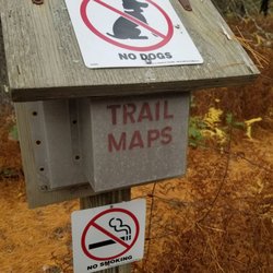
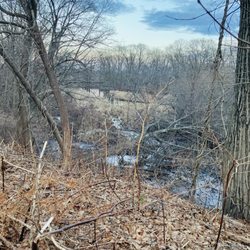
Circle C Campground Photos

You might also consider

Recommended Reviews - Circle C Campground

Your trust is our priority, so businesses can't pay to alter or remove their reviews. Learn more about reviews.
Yelp app icon
Browse more easily on the app
Review Feed Illustration

10 years ago

Helpful 0
Thanks 0
Love this 0
Oh no 0

9 years ago

Helpful 0
Thanks 0
Love this 0
Oh no 0

11 years ago

Helpful 2
Thanks 0
Love this 1
Oh no 0

10 years ago

Helpful 0
Thanks 0
Love this 0
Oh no 0

Ask the Community - Circle C Campground

You might also consider

Verify this business for free

People searched for Campgrounds 437 times last month within 15 miles of this business.

Verify this business

Maxwell Mays Wildlife Refuge - Trail map

Maxwell Mays Wildlife Refuge

4.3(13 reviews)
5.7 mi

We find this a very enjoyable place for a quiet walk. Although not all man made sounds are masked,…read morethe sounds of crickets and birds and the wind in the tree tops gently serenaded us on our most recent walk through the wood. Easy to find, the gravel car park is a very good size. There is a covered information kiosk off the car park and another three-sided sign board at the trail head, along with a small covered Trail Map box on a post. Signs everywhere tell you this is *not* a dog friendly location. The early part of this trail is one person wide, fairly even ground. It wends it's way along the edge of two meadows. After the second meadow, the path becomes much broader and remains fairly clear of roots and rocks until you reach the old stone fireplace at Carr Pond where the pathway turns into the wood and becomes more difficult to navigate. If you have a sturdy, off-road baby pram or wheelchair, you may be able to travers this early part of the trail with a little assistance. You will need to navigate around the 'no dog' sign in the middle of the path at the trail head and the narrow meadow portion. After that the trail widens and would be easier to traverse in dry conditions. We branched off on to the CP trail into the wood. The trail takes a short, steep climb at the beginning and then levels out. Single wide, the trail is clearly blazed, even under a carpet of autumn foliage. CP trail is the white trail mark and signs for other trails are very well signed. Carr Pond is about half way round on the CP trail, before looping back and returning to the meadow. We 'strolled' the trail, enjoying being in the wood, stopped at the pond a couple of times to enjoy the serenity. You can most definitely walk it faster, but we took about an hour to make the loop. There are no benches to rest on along this trail, or to sit and enjoy the pond views. In the wooded section you need to keep an eye on roots and rocks. There are a couple of short boardwalks over low area near the pond. It was cooler under the trees making me glad I remembered a hat and jacket along with my water. No facilities of any kind are available, so go, before you visit. Definitely an easy trail for those who are sturdy on their feet. Wear appropriate footwear, and enjoy the quiet peace of the wood and pond.

This is one of my favorite hikes to do with little kids. It has a great loop with a second longer…read moreloop if you want it. I love the pond that it surrounds and we always see signs of beaver activity by it. There's an old fireplace on the hike that is my kids go to spot to stop for a snack. The only downside to this hike is in the winter if it snows and you'd like to snow shoe. It's NOT well marked when there is snow on the ground. The trail markers for one trail are white which make it very difficult to follow after a fresh snow fall. A friend of mine and I did it years ago and ended up having to turn around. If there is snow on the tree trunks it made it impossible to follow the white trail markers. The yellow trail is the longer loop and we never made it that far to find those markers. That's my only complaint!

Photos
Maxwell Mays Wildlife Refuge - Meadow at the beginning of the trail

Meadow at the beginning of the trail

Maxwell Mays Wildlife Refuge - Trail skirts two meadows before plunging into the wood.

Trail skirts two meadows before plunging into the wood.

Maxwell Mays Wildlife Refuge - Trail maps are available at the trail head

See all

Trail maps are available at the trail head

John B. Hudson Trail - Woods

John B. Hudson Trail

3.5(2 reviews)
5.9 mi

A great place to…read more get lost The John Hudson Trail, named for one of the saints of Rhode island hiking, is technically only about a 3 to 4 miles long round trip. Hardly worth the effort of finding the place. However it's part of the huge Arcadia Wildlife Management Area so there are a vast number of side trials that go off in every possible direction. Some are practically roads, others are barely visible ancient paths. Some go somewhere, others go nowhere. The whole area can be extremely confusing and hard to follow, If you you stay on the Hudson Trial and follow the yellow marks you will end up at Breakheart Pond. A beautiful place for fishing or just viewing. A lot of different types of wildlife are attracted to the water and if you are quiet and observant you will see a multitude of birds, reptiles, amphibians and mammals. Mountain laural is everywhere and in places so thick that if actually forms a tunnel. If you are adventurous you can then catch the Breakheart Trail and continue your hike or backtrack the way you came. Or if you are very adventurous you can try one of the small unmarked side trails. If you take one of the larger ones you probably will eventually come out to a marked trial or road but on the smaller trails you take your chances. People get lost in here all the time. The whole area has lots of streams, ponds and waterfalls. Since this is ancient farmland stonewalls divagate back and forth and many old foundations are still visible. Remnants of a different time and reality. Of course the omnipresent ancient Rhode Island cemeteries are scattered about in unexpected spots. Unfortunately because of the soft sandstone and abundance of water in the area the inscriptions on most the ones I looked at could no longer be read. Ashes to ashes, dust to dust. The John B. Hudson Trail is one of the oldest and shortest hikes in the state system. But in those 3 or 4 short miles you will see a lot of history and nature. And if you decide to brave one of the side trials you will probably get lost and end up seeing more history and nature than you wanted. But then getting lost is half the fun. A great place to get lost

Yellow trail wasn't a whole lot of fun but if you loop your way back on the white trail it hugs the…read morebank of the stream and gets interesting. A lot of things to explore out there.

Photos
John B. Hudson Trail - Woods Dam

Woods Dam

John B. Hudson Trail

See all

Circle C Campground - campgrounds - Updated July 2026

Loading...
Loading...
Loading...