Cancel

    Open app

    Search

    Bow River Trail

    5.0 (2 reviews)
    Open Open 24 hours

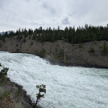
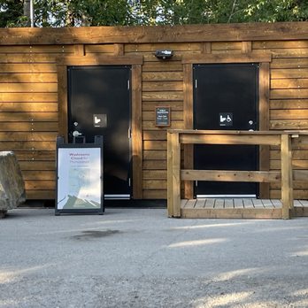
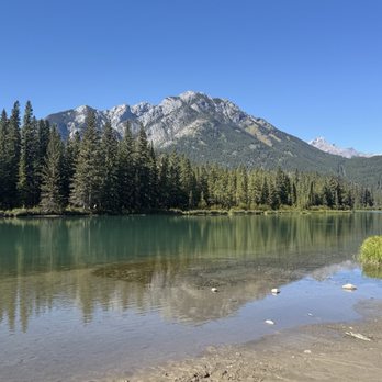
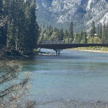
    Bow River Trail Photos

    Recommended Reviews - Bow River Trail

    Your trust is our priority, so businesses can't pay to alter or remove their reviews. Learn more about reviews.
    Yelp app icon
    Browse more easily on the app
    Review Feed Illustration

    23 days ago

    Helpful 1
    Thanks 0
    Love this 1
    Oh no 0

    2 years ago

    Helpful 11
    Thanks 3
    Love this 13
    Oh no 0

    Verify this business for free

    People searched for Hiking 129 times last month within 15 miles of this business.

    Verify this business

    Johnston Canyon & Ink Pots

    Johnston Canyon & Ink Pots

    4.6(90 reviews)
    20.6 km

    The hike to the waterfalls and the hike to the Inkpots are two different tales..but both…read morespectacular. The hike to the falls are on a paved or finely-crushed gravel path, or on a causeway that walks you above the water. Either way, it is a relatively easy walk for most able-bodied persons. The falls are spectacular, but be prepared...in August, it will be busy with people, and you will spend a lot of time brushing elbows as people head the other way. And, at lower falls, there will be a 45 minute wait to look at the falls through a natural window opening in the rock. Personally, I'm not in the "selfie" crowd, so I will make better use of my time. Upper falls is another few minutes up the trail, and is equally powerful. Obviously, since water flows downhill, you are hiking uphill from the parking lot to see the falls. Continue past the upper falls, and now you are on the way to the Inkpots. This is where you will really start working. It is wide, well marked, but with much less humanity...we were never completely alone, but usually we didn't have anyone within 50 yards of us. It is about 3.5 mi from parking to the Inkpots, and it is uphill 2/3 of the way from the falls to the Inkpots, before descending back downhill to the river and Inkpots. The Inkpots were not as colorful as I had hoped, but they were an interesting natural phenomenon that we wanted to see. There are some benches, no toilets, and the river runs nearby. the walk back was 1/3 uphill and 2/3 downhill to the falls before the final (and crowded) stretch to the parking lot. Speaking of parking, we arrived at 8:20AM and were lucky to grab the last parking spot. It fills up quickly. More parking is nearby, but it adds to your walk. A cafe/store at the start of the trail sells food, coffee, and souvenirs. Bathrooms are also near the cafe. This is a must-see destination at Banff, but in peak season, arrive early- with good hiking shoes, if going to the Inkpots- and bring your food, water, bear spray, and camera. Our round trip was 7.8 miles in 3.5 hours.

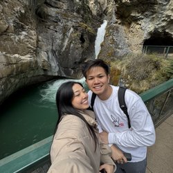
    We're excited to have an early morning start. Ample time to hike Johnston Canyon Lower Falls. Our…read morebiggest surprise included entering and exiting the cave. Amazing waterfalls! Would love to return and hike Upper Falls in the future.

    Photos
    Johnston Canyon & Ink Pots - Apple? no ty ITS GOOOD

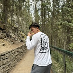
    Apple? no ty ITS GOOOD

    Johnston Canyon & Ink Pots - The line to enter the cave at the lower falls

    The line to enter the cave at the lower falls

    Johnston Canyon & Ink Pots - 0.5

    See all

    0.5

    Banff Gondola - sulphur mountain

    Banff Gondola

    4.5(268 reviews)
    3.0 km

    Ready for a birds-eye view of Banff and the majestic mountains surrounding the area? No need to…read morehike the switchback trails 3000ft up to the top, there's a fun little gondola ride you can take! We had a group of 8 people, which was perfect to fit into two gondolas. The rides up and down are about 5min long and you get a nice 360 view of the area. Once at the top, there's a few boarded walking paths with overviews to take your pictures. The walk all the way to the opposite point is another 5-10mins. It's a casual walk but it does include about 100 stairs for those who may have difficulty getting around. If you don't want to make the walk, there's a coffee shop and restaurant where you can dine with a view. There's wildlife around to see as well- goats, chipmunks, birds and more. We didn't see any bears but they do advise bear spray. We spent about 45min up top, making the round-trip experience about 1 hour. It was the perfect way to enjoy the crisp morning air on a sunny summer day!

    We made reservations in advance via Pursuit Pass for departure time and return time. Print out all…read moretickets in advance in case of SOS before arrival for faster check-in. If you're taking a free shuttle from Brewster Transportation, there are certain areas in Banff where shuttle will pick up and drop off passengers. Allow over an hour before departure time: 1) Park your vehicle in free or paid public parking. 2) Walk to designated shuttle area(s). 3) Shuttle(s) will make multiple stops prior to arriving at Sulphur Mountain. We enjoyed the magnificent scenery from various elevation levels indoors and outdoors. Highest peak at 7,846 ft. There's a plethora of information to read, washrooms, hydration station to refill water flask(s), casual and fine dining, observatory deck, fireplace, gelato cart, gift shop, Starbucks. We spent about a little less than two hours exploring everywhere on upper level before descending and catching the shuttle. Worth the exhilarating and fascinating experience!

    Photos
    Banff Gondola - Here we are having reached the top of the ride!! The view was absolutely incredible!!

    Here we are having reached the top of the ride!! The view was absolutely incredible!!

    Banff Gondola - Nothing but views.

    Nothing but views.

    Banff Gondola - We ate at the buffet, very average food, pricey. Fantastic view!

    See all

    We ate at the buffet, very average food, pricey. Fantastic view!

    Emerald Lake

    Emerald Lake

    4.8(44 reviews)
    73.8 km

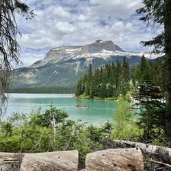
    Emerald Lake in Yoho National Park is a wonderful alternative for canoeing if the boathouses at…read moreLake Louise and Moraine Lake get too busy. What really stands out is the value; the canoe rental rates are significantly more affordable here than at the other major lakes. The staff that operates the boat house and the attached gift shop were wonderful, incredibly friendly, and helpful. While the lake is certainly less crowded than its more famous neighbors, parking can still a challenge. Expect to spend around an extra 20 minutes to park, and be prepared to walk a short distance from your spot to the water's edge. Once you're there, it's well worth the effort. There are also several beautiful, easy-to-moderate trails circling the lake to explore the scenery on foot after your paddle. Cilantro on the Lake restaurant can get busy, but The Window walk up food counter is quick, and perfect for grabbing some food for a picnic in the canoe. Highly recommended for a more relaxed and less crowded scenic mountain experience!

    I go to see three beautiful lakes on my first day in Banff National Park. Our last stop was at…read moreEmerald Lake in Yoho National Park. Yoho National Park is one of the four contiguous national parks in Canada's Rocky Mountains. Emerald Lake is a freshwater lake near the town of Golden. The lake has a emerald green color to it and is enclosed by mountains of the President Range. I had a nice time here. I did some of the hiking trials and saw a little bit of wildlife along the way. This lake is less crowed than Louise and Moraine lakes which I enjoyed. I enjoyed the views while hiking and came across a plaque about the fossil-bearing deposits of the Burgess Shale in the area. I grabbed lunch at the Cilantro on the Lake restaurant before heading out. There are canoe rentals at Emerald Lake if you want to get out on the water.

    Photos
    Emerald Lake - So blue!

    So blue!

    Emerald Lake - Emerald Lake

    Emerald Lake

    Emerald Lake - The trailhead for hiking paths among Emerald Lake.

    See all

    The trailhead for hiking paths among Emerald Lake.

    Kootenay National Park - Stanley Glacier Hike

    Kootenay National Park

    4.7(15 reviews)
    38.1 km

    We had an amazing time visiting sites in Kootenay National Park while staying in Radium Hot Springs…read morefor a week. The is such a picturesque part of British Colombia, Canada. Our first stop was Olive Lake. A gorgeous green-blue body of water. A short trail from the parking lot. Our next stop was Paint Pots. Such a cool experience. We've never seen anything like it before. The colorful, iron-rich pools were so cool to see up close. The boardwalk to the paint pots was picturesque too. There are many stops and viewpoints along highway 93. Be sure to stop at the ranger station to get your park pass ($14/day) and map of all stops along the route. Most stops have restrooms available as well. Overall a must while visiting British Colombia, Canada. We thoroughly enjoyed exploring this area and would highly recommend.

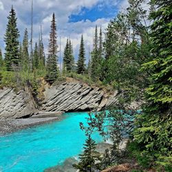
    Rumor had it that Kootenay National Park was, perhaps, the most underrated of the National Parks in…read morethe area. I'm all for supporting the underdogs (& avoiding the crowds). Compared to Banff, Kootenay was empty & there are plenty of bodies of Gatorade-like waters. We enjoyed the wide open spaces and the non-touristy vibe of the park. On our Stanley Glacier Hike, we only saw 3 other sets of people... no shoulder bumping or shuttles needed here. We opted for the annual family/group pass, a great value if you're spending a week or so in any combination of the parks &/or may come back. (& we will come back... already planning it)

    Photos
    Kootenay National Park - Stanley Glacier Hike

    Stanley Glacier Hike

    Kootenay National Park - Stanley Glacier Hike

    Stanley Glacier Hike

    Kootenay National Park

    See all

    Bow River Trail - hiking - Updated August 2026

    Loading...
    Loading...
    Loading...