Cancel

Open app

Search

Adur River Walk

5.0 (1 review)

Adur River Walk Photos

Recommended Reviews - Adur River Walk

Your trust is our priority, so businesses can't pay to alter or remove their reviews. Learn more about reviews.
Yelp app icon
Browse more easily on the app
Review Feed Illustration

4 years ago

Helpful 0
Thanks 0
Love this 0
Oh no 0

Devils Dyke - Footpath and friends after the rain.

Devils Dyke

4.8(9 reviews)
7.4 mi

We took the 77 bus to it's last stop at Devil's Dyke and took footpaths through fields of cows and…read moremagnificent views of the farm lands below, the sea in the distance and frolicking lambs. We got caught in a rain storm and made our way to the pub by the bus stop. Locally made Gin, delicious leek and potato soup with duck paté and bread, made the rain a blessing. It's wonderful, that in 20 minutes you can travel from the gaudy honky-tonk of the pier to such a peaceful and natural setting.

The curiously named Devil's Dyke is one of the most scenic spots on the South Downs Way. Just five…read moremiles north of Brighton it's easily accessible even when you're not walking the path. It now belongs to the National Trust so car parking fees apply but you can also get the bus up to the Dyke from Brighton in the summer months. The views are fantastic, and on a clear day you can even see as far away as the Isle of White. Its a great location for walking, mountain biking, zorbing of paragliding; or just a picnic if you are feeling a little more sedate. There is a pub if you fancy a pint and an ice cream van most of the year round. Legend has it that the dyke was formed by the Devil to drown the parishioners of the Weald, but scientists tell us that is was formed naturally during the last ice age. However it was formed, the end result is the longest, widest and dryest dry valley in the UK and it's absolutely stunning.

Photos
Devils Dyke - The back of Devil's Dyke and near the pub.

The back of Devil's Dyke and near the pub.

Devils Dyke - Devil's Dyke

Devil's Dyke

Devils Dyke - Cows grazing in the dyke

See all

Cows grazing in the dyke

A walk from Barnham to Hunston along the old Portsmouth to - Crossing the Barnham-Bognor line, looking north towards Barnham. Trains are quite frequent, but visibility is good. Just out of

A walk from Barnham to Hunston along the old Portsmouth to

5.0(1 review)
15.0 mi

This walk runs from Barnham to Hunston and largely follows the route of part of the Portsmouth to…read moreArundel Canal. It takes in very gentle landscapes, much of it flat farming land, but also small sections of woodland and hedgerow. In summer, there is an abundance of wild hedgerow flowers, insect and bird life. The walk is almost entirely level, and there are steps to climb some short slopes. It is usually reasonably dry (depending on the weather, of course!). Wear walking boots, long trousers and a shirt, as in summer heavily overgrown paths can mean 2m high nettles and brambles! (A walking stick comes in handy to beat back the undergrowth). Where the canal has disappeared, you walk across fields, which can also make for uneven surfaces. The walk is about 9km long and takes 3 hours or so at a steady pace, and the footpath is well signed throughout. There are no opportunities to stop for refreshments, however, for the first 7km, so take water and some snacks with you. You also need to be fit enough to walk for this distance comfortably. It is entirely on OS Landranger Map 197, as are all map references. The impetus for the construction of the canal was the Napoleonic War in the opening years of the 19th century. Goods going from London to the naval dockyards at Portsmouth usually went by ship and followed the coastal sea route, and were vulnerable to French raids. The canal was part of a route built to provide an inland alternative. The first part of the canal crossed Portsea island to connect Portsmouth to Chichester Harbour. A second canal ran from Chichester Harbour into Chichester, and from a junction at Hunston another arm ran to Ford and the river Arun, which was used to navigate north to Pallingham. There, barges used the older Wey and Arun canal to strike north towards London. Construction began in 1818 and was completed in 1823, but the undertaking was never a commercial success: the Napoleonic wars had ended, coastal shipping had resumed and the advent of the railways from 1846 onwards provided unbeatable competition. With the exception of the section to Chichester, which survived until 1906 (and is currently partly navigable and being restored), the rest of the canal was abandoned as early as 1850. However, enough artefacts remain to make it enjoyable both to walk and to see some industrial archaeology many parts are still 'in water', although very heavily overgrown. From Barnham station, turn right, walk under the railway bridge and turn right again at the fabulous Murrell Arms pub. A plaque on the wall gives some history of this wonderful ale-house, built in 1750 and licensed since 1866. Walk a mile south west to St Mary's church, which dates from mediaeval times. To your left, just before the church, follow the new cycle-track for a few hundred metres until you come a sloping flint wall above two brick walls either side of a depression: closer inspection reveals this to be the site of the Hollinsworth swing bridge over the canal (at OS 957034). (The excavated depression is the site of the waterway). Turn right and follow the signed footpath this is the former tow-path of the canal. Just further along, by a farm, are the clear remains of the Stewart swing bridge, and part of the canal bed here may be in water. (Confusingly, the cast iron arms of the Hollinsworth bridge are laid out on the grass, here). Further along, it's clear the canal ran on an impressive embankment, although the far side has been removed. The path then goes over a small stream and through a short wood to cross the Barnham to Bognor Regis railway line at OS 950035. Take care crossing! Beyond the railway, another short section of woodland follows, with the canal clearly visible on the right. The path then becomes a small lane with high hedges either side, and traces of the canal disappear until after you have passed Lidsey sewage works. (Just past the works are the scant remains of an aqueduct over a small stream). The footpath then crosses the A29, at OS 938032, and now the canal is on the left (south) side. The path here and further along may be heavily overgrown in summer. After 300m the path passes a house on the left and becomes a 3m wide grassy path with a tall hedge on the right. Ignore the fork to the right, and continue straight ahead again, the canal (still on your left) may be in water here. This section carries on for nearly 1km, until we reach another canal embankment, again heavily wooded, where the path narrows for 150m. Here it crosses a small river - the Adingbourne Rife ('rife' is a Sussex dialect word for stream). In winter, with less plant growth, the remains of the aqueduct carrying the canal over can clearly be seen. After another 100m, we find that, sadly, the embankment has been removed and we now have to continue on the right of way across large fields for 1km until we climb slightly to walk through a further few hundred metres of woodland to reach the little lane at

Photos
A walk from Barnham to Hunston along the old Portsmouth to - The wooded section between the end of the embankment and the railway line.

The wooded section between the end of the embankment and the railway line.

A walk from Barnham to Hunston along the old Portsmouth to - The Walnut Tree Inn at Runcton

The Walnut Tree Inn at Runcton

A walk from Barnham to Hunston along the old Portsmouth to - Tufted Vetch (Vicia cracca) is a common sight along the walk.

See all

Tufted Vetch (Vicia cracca) is a common sight along the walk.

Ditchling Beacon - Poppies!!

Ditchling Beacon

3.0(2 reviews)
8.0 mi

For me Ditchling Beacon is little more than Sussex's most beautiful car park. Maintained by the…read morenational trust it serves as the final and most brutal challenge of the London to Brighton Bike ride. For the main part it's a great place to start a long walk across the downs on a route that (heading west) has a few interesting points to offer including some historic dewponds and an area of land known to the mountain biking community of Sussex as Tank Tracks. The reason for this being that it was used a training ground for tank drivers during the Second World War. As with most places on the downs the whole walk offers incredible views all year round and unlike Devil's Dyke for example you are free of the reminder that the pub offers of how close you are to civilisation you are.

Ditching beacon is the site of a Paleolithic hill fort, though sadly nothng remains of the original…read morestructure. What is left is one of the most breathtaking views you will get of the Sussex county. The site is a nature reserve maintained by the National Trust and if you want to get out of the city and have a walk along the downs, then this should be your first port of call. If you follow the route West along the chalk downs you will pass a couple of old dew ponds (used by herders in times past for watering their flocks) and end up coming to a quaint little windmill. The actual car park will usually have an ice cream van stationed for any refreshments, but aside from that don't expect a pub or venue to quench your thirst. Hence, bringing along some snack and drinks is a good idea. The car park is fairly adequate, but on summer weekends you may have to resort to parking on the side of the road. I came here a lot as a kid and would really recommend this as a nice Sunday afternoon walk to burn off the effects of the Sunday lunch.

Photos
Ditchling Beacon
Ditchling Beacon
Ditchling Beacon

See all

Stanmer Park

Stanmer Park

4.5(13 reviews)
8.8 mi

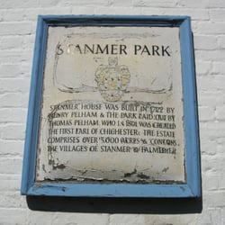
Visitors more familiar with the densely built up City Centre of Brighton and its Georgian…read morearchitecture will be surprised to learn just how many large parks the city has. One of the nicest, and most historic, is Stanmer Park, on the eastern outskirts of the city and adjacent to the lovely campus of the University of Sussex at Falmer. The park is set around Stanmer House, built in 1720 by the first Earl of Chichester, Thomas Pelham. Set in its own little valley, the estate includes Stanmer Village and church: the former a picturesque private village built for the estate's workers, and the latter rebuilt in 1838 when the earlier mediaeval church burned down. As with many such estates, it was planned on the principles of classic English landscape gardening, and consists of sweeping areas of lawn planted with specimen trees, all edged with woodland. Bought by Brighton Council in 1947, the grounds are now open to the public as parkland. The 'village' includes a cafe ('see separate entry under 'Stanmer Tea Rooms') and public toilets. Part of the old stable block now houses a mildly diverting small museum of rural life (free entry but rather limited opening hours) and a nursery which is open to the public, selling a wide range of plants, in what was the house's walled garden (which closes at 16h). The whole ensemble is maybe not quite as well kept as it could be, but it's nice enough. The House itself has been beautifully restored and is let as a conference and private function venue, and some of the main function rooms can be visited (again, for free) when not hired out. It contains a collection of old photographs, but most of the original contents have long since gone - however, the modern furnishings fit in well enough in a 'Country House Hotel' sort of way. However, the main reason for a visit to the Park is just to get some fresh air, in nice surroundings: it's a great place for a game of cricket or rounders, or picnic, or just a woodland walk, and is very popular with students from the nearby University and families in the summer. The park is a 15 minute walk from Falmer station, and 10 minutes from the University, but on summer Sundays and Bank Holidays there is an hourly bus service (route 78) from the centre of Brighton, via the railway station, during the day, right up to the Village and House. Car-parking is in the process of being reorganised, but is normally not a problem unless there is an event taking place.

Stanmer Park is located just off the A270 between Brighton and Lewes, right next to the University…read moreof Sussex Campus, in the village of Stanmer. It is a lovely place to walk the dog or take the kids for a run around if they need to expel some excess energy! There's a small car park, but be warned this can get packed out pretty quickly, as it seems to serve as an overflow car park for visitors to the village, church and pub! Easily accessible from Falmer village and Sussex campus, Stanmer park provides a really nice, scenic walk- it's not particularly challenging or varied, more of a light stroll around the estate's grounds. I often used to pop over to Stanmer to stretch my legs and get a change of scenery, during my first year at university, it's a really great place to have on your doorstep, which I suspect many students aren't even aware of. If you feel like exploring, you can also wander through the village, where there's a really sweet old church and a pub that do nice food. Stanmer House itself is also quite something to look at and Stanmer Nursery is nestled away at the side and is well worth a visit. This is where the council grow many of the flowers they use in displays all over the city! Oh and if you're interested in Eco living and building, be sure to check out the Earth ship, it's incredible and they do tours!

Photos
Stanmer Park - Items in the Rural Life Museum

Items in the Rural Life Museum

Stanmer Park
Stanmer Park - Items in the Rural Life Museum - The Wee House was actually someone's home!

See all

Items in the Rural Life Museum - The Wee House was actually someone's home!

Undercliff Walk - All the way from Berlin!!

Undercliff Walk

4.6(7 reviews)
11.7 mi

A beautifully serene environment, quiet, far spaced from the rest of town, but quite a trek out…read morefrom the main Pier. -Would recommend a quiet jog or a walk with the dogs or a friend -Picturesque and a great place to enjoy your own thoughts -Be prepared for a long walk - at least 30min from the Brighton Palace Pier

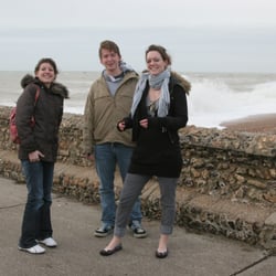
One of Brighton's less well known treasures is the undercliff walk that starts by the Marina and…read moregoes 5km past Ovingdean and Rottingdean to Saltdean. It's excellent for an afternoon stroll or a cycle ride, and you can access the main coast road from any of the above-mentioned places, if you want to catch one of the frequent buses back to town. The walk is actually a sea-wall, built originally in the 1930s to prevent to erosion of the chalk cliffs. It has been rebuilt and enhanced many time since then, most recently after a series of cliff falls a few years ago. Walking along it - especially on a bright, sunny day - is almost a surreal experience. After a few minutes, you leave behind the sprawl of the modern Brighton Marina with its shops and flats with their legoland architecture, and experience the contrast of the dazzling white chalk cliffs, 25m high, on the one side, with the changing shore on the other: now rockpools, now shingle, now great rocks. The white of the cliffs and the concrete on a sunny day really can be overpowering - sunglasses are essential. As well as the stunning geology - all manner of fossils have been found in the cliffs - it is the nesting site for several types of birds, and the rock pools have the usual array of shore life. There are regular access points (steps) to the sea every 100m or so. There are small beaches at each of Ovingdean, Rottingdean and Saltdean, with a small cafe (and toilets) at Ovingdean. The pubs and shops of Rottingdean are a few minutes' walk from the path. There are no life guard facilities at any of the beaches, so swimming or paddling is at your own risk (plenty of people do it). The attraction is that the beaches are much quieter than those in central Brighton. Access via ramps (for wheelchairs, prams etc) is available at the Marina (next to Asda car park), Rottingdean and Saltdean, but not Ovingdean, where there is a long flight of steps. The slopes at Rottingdean are quite steep. Users are also advised to take care during storms, when the sea crashes over the sea wall!
Photos
Undercliff Walk
Undercliff Walk
Undercliff Walk

See all

Ashdown Forest

Ashdown Forest

3.8(4 reviews)
20.0 mi

My friends live in Tunbridge Wells so they wanted to take us to the place that inspired AA Milne's…read moreWinnie the Pooh's hundred acre woods. I learned today in England that a forest is not necessarily defined as a place loaded with trees but rather a place of expensive land for hunting. Apparently several Royals have hinted this land over the years. Since this is one of the highest points in Sussex, the view at this time of year was quite lovely as the leaves were changing colors and the expansive hills shined brightly under the sun. This is a great place for a weekend hike. My only complaint was the trails had deep grooves in them which made it difficult to walk and certainly something to consider if you are traveling with young children or those who may have trouble maneuvering through.

Situated in Ashdown Forest, just south of Wych Cross is Ashdown Forest Llama Park. It's easy to…read morelocate, being on the main London to Eastbourne road (A22). There is a moderately sized free car park. The admission charge is £5.95 for adults and £4.95 for children/concessions (in 2008). It is open from 10am to 5pm every day. The park consists of some covered pens and several large fields. There are a large number of llamas and alpacas including some very young ones. There are also three female reindeer. There is also a barn which is used as museum/eductaion centre. The contents of this was mainly about the uses of llamas and alpacas and there was a short 8min video. There were a few hands-on activities for the younger visitor. Outside there is the required adventure play area for children. Inside the main building there are toilets which appear to be well maintained, a gift shop and a coffee shop. The gift shop contains a lot of products from South America and a large range of alpaca knitwear. Whilst not expensive, they products were certainly not cheap. The coffee shop offers home made cakes and light lunches, including Sussex Cream Tea. Where possible they use organic and/or fairtrade products. There is a large indoor seating area and more tables outside. The prices are quite reasonable. It is also possible to go for a walk with a llama. This is seperate from the admission charge and costs £30 per person. The walk is for about 2.5 miles and lasts approx 1.5hrs. You are taken in a group with a guide. However the minimum age for this is 14, and so we were not able to take advantage of it. Overall it is a nice place to visit but I cannot imagine it keeping any one occupied for more than a couple of hours. It is certainly not an all-day place.

Photos
Ashdown Forest - Dana and Aidan

Dana and Aidan

Ashdown Forest - Russ and Bete, our hosts

Russ and Bete, our hosts

Ashdown Forest

See all

Adur River Walk - hiking - Updated May 2026

Loading...
Loading...
Loading...