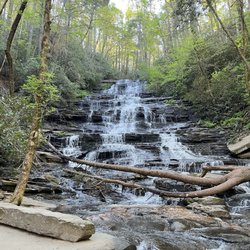
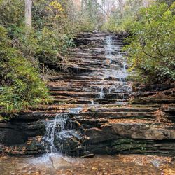
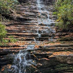
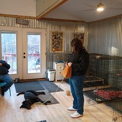
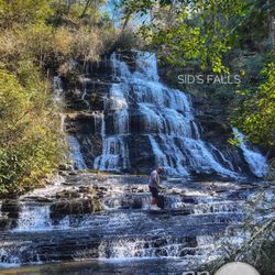
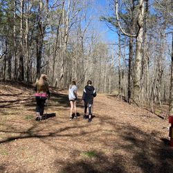
Cancel

    Open app

    Search

    Install the Yelp app
    Continue your search on the app. It’s easier!

    Tap Yard

    4.5 (52 reviews)
    ModerateBars, Cafes, Parks
    Open 11:30 am - 7:00 pm
    Updated a few days ago

    Tap Yard Photos

    Business Info

    TAP YARD ATMOSPHERE

    What's the vibe?
    Live music
    Outdoor seating
    Happy hour specials
    Good for kids

    You might also consider

    Recommended Reviews - Tap Yard

    Your trust is our priority, so businesses can't pay to alter or remove their reviews. Learn more about reviews.
    Yelp app icon
    Browse more easily on the app
    Review Feed Illustration

    Reviews With Photos

    Front entrance and lower parking.
    Shan B.

    Pretty awesome place. Great for families and large groups. Plenty of space for kid to roam in safety while the adults can have a brew and a good time too. Food was pretty dang awesome and the service was top notch. I have this one marked!

    Outside rock wall
    St C.

    Friend and I were going to Black Rock Mountain to go camping for the weekend and this place was recommended. I am now recommending it to everyone that drives up here. You order at the bar and started off with a local IPA and the Pulled Pork sandwich. She asked me which sauce and I asked for all three on the side. My recommendation is mixing the sweet and spicy together! The people behind the counter were super nice, the food was delicious, and the location opens up to head down to the beach area on the river. The place has a rock wall for the kids and they were having live music that night. Perfect place to go before or after your N.Ga adventures!

    The food is amazing the service is great so kind people everyone!! This is the orchard sandwich with street corn..
    Ray P.

    This is amazing place the service was amazing!!! The food is amazing!!! I'm so glad we stopped here it made a day trip perfect!!!! We will be back !!

    Brenda G.

    Excellent food, quick service. A great stop with kids or a pup. Servings are generous. We enjoyed the open air seating. Try the orchard chicken salad sandwich.

    Kale salad
    Alison M.

    Great fun atmosphere for warm or cool weather. Very close & convenient to the Gorge. The food was great. We had the club sandwich, wings, kale Caesar & budah bowl. All super. Only feedback is too many croutons in salad. The potato salad is a lot like dirty rice with some warm spices-not traditional.

    Bar and seating area
    Gene E.

    In a word Outstanding Food! We had the Pumpkin Soup along with Seasonal Salad and Grilled Chicken Sandwich with Potato Salad. You could tell a lot of effort with excellent ingredients went into everything they served. Great atmosphere and plenty of running room for the kids in the backyard! You have got to give this place a try!

    Jessica S.

    Delicious food, one of a kind atmosphere and excellent service. So glad I found this place!

    See all

    7 months ago

    Helpful 0
    Thanks 0
    Love this 0
    Oh no 0

    1 year ago

    Helpful 0
    Thanks 0
    Love this 0
    Oh no 0

    3 months ago

    Helpful 0
    Thanks 0
    Love this 0
    Oh no 0

    9 months ago

    Helpful 0
    Thanks 0
    Love this 0
    Oh no 0

    7 months ago

    Helpful 0
    Thanks 0
    Love this 0
    Oh no 0
    Photo of Gary H.
    1
    46
    32

    7 months ago

    Helpful 0
    Thanks 0
    Love this 0
    Oh no 0
    Photo of Jayne C.
    131
    15
    0

    7 months ago

    Helpful 0
    Thanks 0
    Love this 0
    Oh no 0

    2 years ago

    Helpful 0
    Thanks 0
    Love this 0
    Oh no 0
    Photo of J C.
    0
    17
    0

    5 months ago

    Helpful 0
    Thanks 0
    Love this 0
    Oh no 0

    6 months ago

    Laid back comfy place to enjoy a sandwich and a drink. Italian was good, club was good. Duck Cuban was dry, no flavor.

    Helpful 0
    Thanks 0
    Love this 0
    Oh no 0

    6 months ago

    Helpful 0
    Thanks 0
    Love this 0
    Oh no 0

    1 year ago

    Helpful 0
    Thanks 0
    Love this 0
    Oh no 0

    10 months ago

    Helpful 0
    Thanks 0
    Love this 0
    Oh no 0

    3 years ago

    Helpful 0
    Thanks 0
    Love this 0
    Oh no 0
    Photo of Ray P.
    31
    18
    13

    2 years ago

    Helpful 0
    Thanks 0
    Love this 0
    Oh no 0

    3 years ago

    Business owner information

    Photo of Leslie L.

    Leslie L.

    Helpful 1
    Thanks 0
    Love this 1
    Oh no 0

    2 years ago

    Helpful 0
    Thanks 0
    Love this 0
    Oh no 0

    2 years ago

    Helpful 0
    Thanks 0
    Love this 0
    Oh no 0
    Photo of Alison M.
    4
    192
    88

    3 years ago

    Business owner information

    Photo of Leslie L.

    Leslie L.

    Helpful 0
    Thanks 0
    Love this 0
    Oh no 0

    4 years ago

    Helpful 1
    Thanks 0
    Love this 0
    Oh no 0

    11 months ago

    Helpful 0
    Thanks 0
    Love this 0
    Oh no 0

    3 years ago

    Business owner information

    Photo of Leslie L.

    Leslie L.

    Helpful 0
    Thanks 0
    Love this 0
    Oh no 0
    Photo of Sean B.
    8
    143
    359

    3 years ago

    Helpful 0
    Thanks 0
    Love this 0
    Oh no 0

    3 years ago

    Helpful 1
    Thanks 0
    Love this 0
    Oh no 0
    Photo of Cara M.
    0
    81
    112

    3 years ago

    Helpful 0
    Thanks 0
    Love this 0
    Oh no 0
    Photo of John Z.
    412
    38
    3

    2 years ago

    Helpful 0
    Thanks 0
    Love this 0
    Oh no 0

    2 years ago

    Helpful 0
    Thanks 0
    Love this 0
    Oh no 0

    3 years ago

    Helpful 0
    Thanks 0
    Love this 0
    Oh no 0

    2 years ago

    The staff is super friendly and helpful. Food is delicious and it's a lovely place to relax after hiking or boating.

    Helpful 0
    Thanks 0
    Love this 0
    Oh no 0

    2 years ago

    Helpful 0
    Thanks 0
    Love this 0
    Oh no 0

    2 years ago

    Great spot!! Glad we found this place. Amazing food and large portions. I'm sure we'll be back.

    Helpful 0
    Thanks 0
    Love this 0
    Oh no 0

    4 years ago

    Helpful 1
    Thanks 0
    Love this 0
    Oh no 0

    3 years ago

    Business owner information

    Photo of Leslie L.

    Leslie L.

    Helpful 0
    Thanks 0
    Love this 0
    Oh no 0

    2 years ago

    Great restaurant /hang out spot with things to do with the kids. Highly recommend stopping in when you're near Tallulah Gorge.

    Helpful 0
    Thanks 0
    Love this 0
    Oh no 0

    4 years ago

    Helpful 0
    Thanks 0
    Love this 0
    Oh no 0

    3 years ago

    Helpful 1
    Thanks 1
    Love this 1
    Oh no 0

    3 years ago

    Helpful 0
    Thanks 0
    Love this 0
    Oh no 0

    2 years ago

    Helpful 0
    Thanks 0
    Love this 0
    Oh no 0
    Photo of Cory B.
    18
    16
    9

    3 years ago

    Helpful 0
    Thanks 0
    Love this 0
    Oh no 0

    4 years ago

    Helpful 0
    Thanks 0
    Love this 0
    Oh no 0

    Page 1 of 2

    Ask the Community - Tap Yard

    Review Highlights - Tap Yard

    Tallulah Adventures is the place for your weekday or weekend adventure!

    Mentioned in 3 reviews

    Read more highlights

    You might also consider

    Tallulah Gorge State Park

    Tallulah Gorge State Park

    4.5(209 reviews)
    0.2 mi

    Tallulah Gorge State Park is a 2,689-acre Georgia state park adjacent to Tallulah Falls, Georgia,…read morealong the county line between Rabun and Habersham Counties. The park surrounds Tallulah Gorge, a 1,000-foot deep gorge formed by the action of the Tallulah River, which runs along the floor of the gorge. Service options here are picnic tables available, has barbecue grill and it's dogs friendly. One of the most spectacular canyons in the eastern U.S., Tallulah Gorge is two miles long and nearly 1,000 feet deep. Visitors can hike rim trails to several overlooks, or they can obtain a permit to hike to the gorge floor (100 per day, not available during water releases). A suspension bridge sways 80 feet above the rocky bottom, providing spectacular views of the river and waterfalls. $5 parking fee or an Annual ParkPass is required for each vehicle. The park offers a range of trails, from easy rim walks to the more challenging trek down into the gorge floor. Permits are required for gorge floor access, but the effort is well worth it as you can get up close to the waterfalls, including the famous Hurricane Falls. Approximately 2 miles, round-trip Mulched with metal stairs, Rated difficult. This trail has a total of 1,099 stairs (including staircase to gorge floor). Please do not attempt this trail if you have any known health condition. The North and South Rim Trails consist of 3 miles round- trip which will take approximately 2 hours to hike. It is a mulched trail with exposed roots that is a leisurely walk. From the Interpretive Center there is a recycled rubber tire trail that accesses Overlooks 2 and 3. Overall had a great experience.

    The visitor center is phenomenal! Movie was down for some reason. The gift shop has loads to choose…read morefrom and the rest rooms were clean and there were many stalls available. There is almost a museum quality to the taxidermy animal scene they have in the middle of the room and along the walls. Truly a special visit! The hike to see the inspirational point and the swinging bridge wasn't too strenuous for my 4 or 5 year old for people's reference when considering it. We are an active family who hikes etc. There were a lot of warnings but we found it wasn't as bad as it seemed.

    Photos
    Tallulah Gorge State Park
    Tallulah Gorge State Park - 10.22 towards the S Rim 568 stairs up

    10.22 towards the S Rim 568 stairs up

    Tallulah Gorge State Park

    See all

    Panther Creek Recreation Area - Trail could use a little TLC

    Panther Creek Recreation Area

    4.6(37 reviews)
    3.0 mi

    Overall great hike. A few steep sections but nothing too crazy. Beautiful scenery the whole way…read more Would recommend for anyone looking for a solid outdoor experience.

    My partner and I recently visited Clarksville for a spontaneous hiking trip. Panther Creek Trail…read morewas at the very top of our list and we were not disappointed. At first we were worried that the trail would be closed due to the storm damage that occurred during the prior year but we drove by and there were multiple parties going in and out of the trail so we figured we would go for it! This trail is long and arduous, so be prepared! Us Floridians definitely overestimated our hiking abilities but we still got it done (thankfully). Bring around 2L per person or more if it's a hot day. We started on a Friday around 2pm and finished by 6:30pm and clocked in a total of 8 miles round trip. If you can go earlier, I highly recommend doing so to have plenty of light. There's two main parts of the trail where the bridges were damaged and removed. In one section, there's several logs that lay across the stream. Find a big stick, and scramble across. In the second section, the water is shallow enough to walk across without the possibility of getting your legs wet. But even if you get wet, both sections are not deeper than your ankle. I don't know if I'd recommend this for children as there are multiple sudden drop offs but more power to you if your family can do this! If you are a hiker, this does not disappoint!

    Photos
    Panther Creek Recreation Area - Good hike today. Simple, relaxing, and Fun.

    Good hike today. Simple, relaxing, and Fun.

    Panther Creek Recreation Area - OTG Hiker's Club Hike #3

    OTG Hiker's Club Hike #3

    Panther Creek Recreation Area - Christina & boyfriend

    See all

    Christina & boyfriend

    Brasstown Falls

    Brasstown Falls

    4.8(4 reviews)
    5.7 mi

    Beautiful waterfalls for just a short hike** from the parking lot. Has 3 sections,…read moreCascades/Veil/Sluice, the Cascades is the first one to get to and the easiest. The Veil section is probably my favorite part, it's a picture I see when someone mentions "waterfalls". I didn't hike down to the Sluice section as it didn't seem worth the effort after seeing the Cascades and Veil sections. ** excerpt from Richard R's amazingly detailed review and great tips "The hike is short to the first section of the falls known as "The Cascades." This is a highly appropriate name since this section really is more of a series of cascades than a waterfall. On the day of my visit, there had been several days of rain making the trail extremely muddy, but also making the falls extremely full! The flow was so strong that it was hard to see where the Cascades separated from the second section known as The Veil. You reach 'The Cascades' by following the trail on the right after the information board. You will go uphill slightly before making your descent down to the cascades. You will hear the falls long before you reach them. The downhill trail to the cascades is relatively easy, but it gets far more difficult when you continue downhill to see the two lower sections. NOTES: This is a class three hike, meaning you will need both hands to navigate the steepness of the trail. I HIGHLY RECOMMEND good hiking boots and a backpack for any camera, phone or other items you might carry in your hand. You will definitely need both hands to hold on to branches, tree roots or whatever you can find. * SCOUTING TIP - It is better to take the higher routes as you navigate your way to the lower falls. * SCOUTING TIP 2 - This trail IS NOT suitable for young children or anyone who doesn't have sure balance. Your legs, knees and upper body will be heavily used! * SCOUTING TIP 3 - DO NOT bring a walking stick. Again, you will need both hands to navigate this trail safely. I personally did not see the advantage to hiking down to the base of the second section known as 'The Veil'. However, if you are feeling adventurous, you can actually walk behind this section of the falls on low flow days. The trickiest part of the trail is finding your way to the base of 'The Sluice' section. At first I considered forgoing the hike since it was rather steep, but another hiker on his way up showed me pics on his camera that convinced me to continue. There is also a downed log you can use as a bridge to balance across to the other side for an even closer view of this third section of the falls, which looks a lot like a powerful water slide." https://www.yelp.com/biz/brasstown-falls-long-creek?hrid=Weq_6ZUYbqLd0Ao6QafbDg&utm_campaign=www_review_share_popup&utm_medium=copy_link&utm_source=(direct)

    This was well-worth the drive from Columbia, SC. The hike wasn't that long. There were some stairs…read morethat were pretty steep but hand rails were available. Absolutely Stunning views.

    Photos
    Brasstown Falls
    Brasstown Falls - Waterfalls

    Waterfalls

    Brasstown Falls

    See all

    Angel Falls & Panther Falls - Panther Falls | Instagram: @telephonesmoothie

    Angel Falls & Panther Falls

    4.6(11 reviews)
    4.4 mi

    This is a beautiful trail that leads to two stunning waterfalls. The trail can be challenging in…read moresome areas due to rocky terrain and roots on the path. However, overall it's a pleasant trail with several creek crossings and rhododendron tunnels. The first falls, Panther Falls, is a sight to behold and you can even walk in the pool at the base of the falls. As you proceed from Panther Falls, the trail becomes harder as you go up the side of the falls, and there are handrails due to steep drop-offs. The trail is an in and out and takes you through lush rhododendron forests, alongside a scenic Creek. The effort is well worth it, though, as the falls themselves are magnificent, with cascading waters that make for an incredible photo opportunity. Angel Falls at the end of the trail can be harder to see due to plants growing over it partially. The Angel Fall Trailhead is located in Loop 2, area 2 of the Rabun Beach Campground. This is mostly an easy trail with a couple of short, steep runs. The payoff is reaching the observation deck where you can enjoy Angel Falls. Here you will see dogs on leash, kid-friendly, forests, rivers, and hiking. Great, short, easy "Moderate" hike. Parking is enough for a few cars only, but nearby there is a campground with a lot of parking. The hike itself is pretty easy. The peaceful surroundings and the sound of rushing water create a serene atmosphere, making it a must-visit for nature enthusiasts.

    Angel Falls was tough to find with Google providing the wrong location, but the trailhead is off…read moreRabun Rd. about 4 miles down from where Google says it is! Happy we continued the beautiful drive around the lake to find it. The parking area is small, but we also were the only car there for our visit. It's a short, easy walk (just watch out for the roots!) to the falls, but it was a little more advanced after the bridge at the falls. We had lots of rain so the mud was slippery. Must-do hike if you're near!

    Photos
    Angel Falls & Panther Falls - Angel Falls | Instagram: @telephonesmoothie

    Angel Falls | Instagram: @telephonesmoothie

    Angel Falls & Panther Falls - Panther Falls | Instagram: @telephonesmoothie

    Panther Falls | Instagram: @telephonesmoothie

    Angel Falls & Panther Falls - Instagram: @telephonesmoothie

    See all

    Instagram: @telephonesmoothie

    Mill Shoals and Big Shoals Falls - Mill Shoals in the Fall

    Mill Shoals and Big Shoals Falls

    4.5(2 reviews)
    5.0 mi

    COVID-19 has done a number on my body! I've gained a lot of corona-pounds over the last few months…read moreand decided it's time to get back to doing what I love to do, hiking! I'm much happier burning calories in the woods than I am in the gym! One thing I've noticed for certain as a direct result of COVID-19, hiking trails are a lot more populated now than in the past. I used to be able to hike to North Georgia waterfalls in relative peace prior to lockdowns and social distancing protocols. NOW, everyone and their gosh dang mama are on the trails... which has forced me to look for more off the beaten path activities! Well, I found the website of a guy who does the type of hiking I've always wanted to do! His name is Mark Oleg and in many of his hiking reports, he machetes' his way to waterfalls that have no official trail + gives full GPS coordinates of his routes as well as helpful tips & elevation gain expectations! My first official test of his directions was at Sarah's Creek back in March. I convinced my hiking buddy Jamarcus it would be a fun adventure to try roads-less-travelled and he regrettably agreed! Jamarcus doesn't like to get his feet wet you see, and Sarah's Creek was a wet hike! Fast forward 7 months and I get a call from Jamarcus asking if I wanted to go hiking! Mill Shoals & Big Shoals have been on my bucket list for almost a year, so yet again I convinced him to give another offbeat trail a try! Thank God he has a short memory... LOL! HERE ARE THE DETAILS: ~ THE EXPERIENCE We set our navigation to Wolf Creek Church Road, when I used a map I predownloaded from Mark Oleg website. I CAN NOT STRESS ENOUGH these are not hikes for beginners or even casual hikers. You MUST download directions and maps to your phone prior to getting in your car to drive. I would also recommend studying the directions/notes prior, because you will feel much better studying them at home than on the trail! *** HIKING DIRECTIONS: Approximately 0.8 miles past Wolf Creek Church you will see a dirt road fork off to your left. Take it approx. 735 feet to a small gate & turnaround where there is a niche for about 2 cars. Once parked, walk around the gate down the old forest service road. The road is easy to follow! However, when you come to a fork, stay to the right. Next you will come to a clearing where the road will soon get narrower and curve left. This is where the elevation will begin to rapidly descend to Stekoa Creek. The closer you get to the creek, the steeper the decline, but doable for most people in decent shape. The return trip back however will be a calorie burner! Once you reach the creek, you will easily hear Mill Shoals Falls [approx. 18' tall]. You will need to climb over a large downed tree and navigate your way as best you can to the falls. The pools of water around the falls appear to be fairly deep, at least 7' or better. But Stekoa Creek is known to not have the cleanest water, so a swim would probably not be wise. You can either follow your path back out or attempt to reach larger Big Shoals Falls further upstream. I've included the map I used from Mark's website, but I warn you, it is not easy to follow. The trek to Big Shoals requires a steep uphill, then downhill climb with ABSOLUTELY NO PATH to guide you! The map also navigates you around a parcel of land marked private property, although there is nothing on it. Jamarcus decided to forego the hike to Big Shoals Falls [approx. 30' tall] and waited near Mill Shoals as I made my attempt. It was difficult, but I trusted the map and my ears to guide me to the falls. I emerged back where Jamarcus was waiting, scarred from fighting through forest growth and heavily sweating but satisfied at my conquest! ~ FINAL THOUGHTS READ THIS REVIEW thoroughly and try to visit Mark's website before attempting to hike to these falls, and please don't go alone! It's a great adventure for the daring, but don't be stupid! This trail is best hiked with a companion if for no other reason but for help in case of an injury. I would also recommend telling a family member or friend your hiking plans just in case. I seriously doubt this trail gets many visitors (we saw no one), so a bad injury could leave you stranded for days without help. ENJOY! LENGTH: 3.2 miles round trip DIFFICULTY: 3 out of 10 to Mill Shoals / 6 out of 10 to Big Shoals ELEVATION GAIN: 795+ feet WATERFALL ATTRACTIVENESS: 6 / 8 2020 / 78

    very nice! Mill…read moreShoals and Big Shoals falls were the hiking destination for one of my rare days off during the height of Covid times. This hike was way back in October 2020, but i'm just now posting it (sorry, my reviews have been behind!). At any rate, I had a day, needed to get outdoors and Richard had these hikes in mind and wanted to check them both out. The Trail is easy to miss. We drove right past it, back tracked, and then found the small dirt road fork that was found on the left. When I say small dirt road, again, you're not sure if that's the path. Keep an eye on your mileage because it's just shy of a mile past the wolf creek church. We parked in a small opening and the trail becomes a bit more easy to follow here. Note, very early in the trail you'll see a small yellow sign nailed to a tree. This is not the path to the trail. The trail continues to the right of that sign. You should continue to descend down in what seems to be a gradual decline at first. This is tougher to get out of on the way back, so make sure you can handle getting out of this place! You'll hear the waterfall before you see it, but ultimately you're gonna find sandy areas past a few downed trees and plants that were pushed in what appears to be the water from the falls when the waters were really flowing. If you don't appreciate the power of this thing, seeing Mill shoals off in the distance should change your mind. Not the tallest waterfall, but it was full when we went, and it is possible to get yourself around these areas without getting your feet wet. It just requires a few hops and path choices! From here, that's where my experience ends. Richard and I did go up a steep incline to search for Big shoals falls. For one of my first hikes in months, I could tell I was running on fumes and wouldn't make it out if I continued to search anymore for Big Shoals, so I sat and waited for Richard to return. Just a note that if you're not still bursting with energy at this point and don't have the stamina, getting to Big Shoals is a challenge that can wipe you out....and there's the point of getting back out of the trail altogether. End of the day, I really enjoyed the hike, the waterfalls, and while this did turn into the first hike that I did not finish from start to finish, I still was able to enjoy a great waterfall, and maybe in a few months i'll be able to head back and finish this trail off! This is an isolated trail. I wouldn't recommend doing it alone, nor would I recommend doing it if you're not prepared for a hike that can and will challenge you. From what I can tell, this is a pet friendly hike, at least until you reach Mill shoals falls. Have fun!

    Photos
    Mill Shoals and Big Shoals Falls - Someone had a sense of humor and created a toilet for the trail.

    Someone had a sense of humor and created a toilet for the trail.

    Mill Shoals and Big Shoals Falls - Mill shoals from far off

    Mill shoals from far off

    Mill Shoals and Big Shoals Falls - Downstream of Mill Shoals

    See all

    Downstream of Mill Shoals

    Maxie Duke Falls

    Maxie Duke Falls

    5.0(1 review)
    5.9 mi

    Maxie Lee Wright Duke was an avid waterfall hunter and good friend to Sidney Holmes Ballenger, Jr.,…read morea man who loved waterfalls so much that he literally wrote the pioneering book on finding them in Oconee County, South Carolina. When he died @ age 73, Maxie wanted to honor him by petitioning the U. S. Department of the Interior in hopes of naming an UNNAMED local waterfall in his honor. While her 1993 petition was denied, the effort didn't end. In late 2014, Renee Hattenstein reapplied to the U.S. Board on Geographic Names to have the falls officially named Sid's Falls and in April of 2016, the name Sid's Falls was accepted by the board. Sadly I found an online obituary stating Maxie Lee Wright Duke passed away in December of 2020. But Oconee County residence wanted to honor her by unofficially naming a waterfall after her in close proximity to Sid's Falls. As a matter of fact, Maxie Duke Falls shares most of the same trail and parking that you would use to visit Sid's Falls. [ THE EXPERIENCE ] I WANT TO GIVE FAIR WARNING right up front that while 95% of this trail is super easy, the final leg of the trail to the base of the falls is NOT FOR THE FAINT OF HEART or anyone not capable of using BOTH HANDS during the descent. You will absolutely need to posses basic skills in climbing and some upper body and leg strength. The trail to the bottom at minimum fits the CLASS 3 hike rating and the breakoff trail to Maxie Duke is practically CLASS 4 as ropes are available to assist climbers on the steep, steep terrain. PARK at the small area off Damascus Church Road between Damascus Baptist Church and Cool Springs Road (State Route S-37-797). Walk around the gate and enjoy approx. 1.4 miles of easy hiking on a wide old road that passes two open grassy fields along the way. The grade varies, but typically stays within a 5% differential. However, once the trail enters into the woods and narrows, it becomes steeper. You will reach a point where the trail forks right or left. RIGHT is to Sid's Falls and LEFT is to Maxie Duke Falls. Here is where either trail gets noticeable difficult as the grade to Sid's can exceed -34% (according to AllTrails). Maxie Duke's trail is even steeper and may require the assistance of a preinstalled rope for most of the descent. Once you reach the creek you will need to wet cross over to the right side in order to achieve the best view of the falls. I ducked under a large fallen tree and discovered a dry trail leading to the base of the falls. I walked right out onto the stone ledge of the falls through the water and did not find the stones to be particularly slippery. In fact, I had good grip but I still remained very cautious. [ FINAL THOUGHTS ] When returning, you could also continue your adventure and follow the trail right of the split to Sid's Falls. But again, BE FOREWARNED the trail to Sid's is only slightly less steep, and you will absolutely need both hands and a lower center of gravity to remain balanced! Plan on getting your feet wet @ both falls to attain the best vantage for photos. Proceed with caution, respect the power of nature and know your own ability. It took us about 2 hours 20 minutes to hike from parking to both falls and back, which included rests and about 25 minutes of picture taking. ~ Round trip length to both: 3.3 miles ~ Elevation Gain: UNKNOWN (but probably 600+ feet) OVERALL this is a wonderful hike that will fool you into thinking it's easy for its majority... But do not choose to visit this trail casually! You're gonna get dirty, you're gonna be very tired, but the payoff is well worth the effort to see these two 50 foot beauties! NOT RECOMMENDED for young children, dogs, anyone with balance issues or solo hikers because it is not a popular trail (yet) and injuring yourself would make the return ascent very difficult. 2022 / 73

    Photos
    Maxie Duke Falls
    Maxie Duke Falls
    Maxie Duke Falls

    See all

    Adventure Awaits Fido - 2nd dog park fun!

    Adventure Awaits Fido

    5.0(1 review)
    19.9 mi

    Kristi is great with my dogs and she house sits when I am traveling.... I highly recommend their…read moreservices!

    From the owner: Adventure Awaits Fido! is a small, owner-operated dog boarding and daycare retreat located on a…read morepeaceful lake in the woods of Banks County, Georgia. This is not a high-volume commercial kennel. It’s a calm, nature-based, small-group experience designed for dogs who thrive with close supervision, enrichment, and meaningful social time. I live on the property where the dogs stay. The boarding area is just steps from my front door (approximately 20 feet away), and dogs are monitored overnight via cameras. Because I intentionally limit the number of dogs in my care, each guest is fully known and closely supervised. Dogs enjoy a home-like environment with indoor and outdoor options. Most of the day is spent rotating between rest, play, sniffing, and enrichment activities in small, carefully managed playgroups. New dogs are introduced slowly and individually to assess temperament and comfort level before joining group play. Think summer camp for dogs — a safe, structured, lakeside retreat. We call it Camp Fido. Services Offered: Dog Boarding Small-group, owner-supervised boarding with overnight monitoring and enrichment options. Dog Daycare Limited-capacity daycare with indoor/outdoor play, structured supervision, and socialization. In-Home Pet Sitting Overnight pet sitting in your home for dogs who are most comfortable in their own environment. Drop-In Visits Midday potty breaks, feeding visits, medication administration, and check-ins while you’re away.

    Photos
    Adventure Awaits Fido - Large bench in dog park area

    Large bench in dog park area

    Adventure Awaits Fido
    Adventure Awaits Fido

    See all

    Sid's Falls - Can you see me in the photo?

    Sid's Falls

    5.0(1 review)
    5.6 mi

    It is my honor to introduce Sid's Falls to the yelp community…read more [ THE STORY BEHIND THIS WATERFALL ] It is named after Sidney Holmes Ballenger, Jr., a man who loved waterfalls so much that he literally wrote the pioneering book on finding them in Oconee County, South Carolina. He died @ age 73 and a 1993 petition was sent to the U. S. Department of the Interior in hopes of naming one of the local UNNAMED waterfalls in his honor. By his side on many adventures was his friend Maxie Duke, who actually helped discover and officially name the waterfall currently known as Sid's Falls. While her 1993 petition was denied, the effort didn't end. In late 2014, Renee Hattenstein reapplied to the U.S. Board on Geographic Names to have the falls officially named Sid's Falls and in April of 2016, the name Sid's Falls was accepted by the board. *** I absolutely love chasing waterfalls despite TLC's song warning otherwise, so this story of friendship and determination to honor all he had done for Oconee County touched me deeply. I simply couldn't, as an avid hiker and purveyor of waterfall adventures, pass on the opportunity to visit Sid's. During my research of this waterfall duo I discovered a third member of their hiking team, a man named John Danner. Sadly I found an online obituary stating Maxie Lee Wright Duke passed away in December of 2020. Both her & John have waterfalls unofficially named in their honor in close proximity to Sid's Falls. As a matter of fact, Maxie Duke Falls shares most of the same trail and parking that you would use to visit Sid's Falls. [ THE EXPERIENCE ] I WANT TO GIVE FAIR WARNING right up front that while 95% of this trail is super easy, the final leg of the trail to the base of the falls is NOT FOR THE FAINT OF HEART or anyone not capable of using BOTH HANDS during the descent. You will absolutely need to posses basic skills in climbing and some upper body and leg strength. The trail to the bottom at minimum fits the CLASS 3 hike rating and the breakoff trail to Maxie Duke is practically CLASS 4 as ropes are available to assist climbers on the steep, steep terrain. PARK at the small area off Damascus Church Road between Damascus Baptist Church and Cool Springs Road (State Route S-37-797). Walk around the gate and enjoy approx. 1.4 miles of easy hiking on a wide old road that passes two open grassy fields along the way. The grade varies, but typically stays within a 5% differential. However, once the trail enters into the woods and narrows, it becomes steeper. You will reach a point where the trail forks right or left. RIGHT is to Sid's Falls and LEFT is to Maxie Duke Falls. Here is where either trail gets noticeable difficult as the grade to Sid's can exceed -34% (according to AllTrails). You will absolutely need both hands and a lower center of gravity to remain balanced, but the payoff is fantastic! Sid's is a beautiful 50+ foot natural wonder. NOTES: Plan on getting your feet wet to attain the best vantage for photos. I walked all the way to the base through the water and did not find the stone ledges to be particularly slippery. Still, proceed with caution and know your own ability. See pics to determine the water level during my hike. [ FINAL THOUGHTS ] When returning, you could also continue your adventure and follow the trial left of the split to Maxie Duke Falls. But again, BE FOREWARNED the trail to Maxie Duke is even steeper than to Sid's and may require the assistance of a preinstalled rope for most of the descent. Here you will also need to wet cross the creek to the right side of the falls in order to achieve the best view. It took us about 2 hours 20 minutes to hike from parking to both falls and back, which included rests and about 25 minutes of picture taking. ~ Round trip length to both: 3.3 miles ~ Elevation Gain: UNKNOWN (but probably 600+ feet) Overall a wonderful hike that will fool you into thinking it's easy for its majority... But this sweet thang goes GUANO LOCO on you the final 500 feet and leave you contemplating the foolishness of your life choices! LOL NOT RECOMMENDED for young children, dogs, anyone with balance issues or solo hikers because it is not a popular trail and injuring yourself would make the return ascent very difficult. 2022 / 72

    Photos
    Sid's Falls
    Sid's Falls
    Sid's Falls

    See all

    Tap Yard - bars - Updated May 2026

    Loading...
    Loading...
    Loading...