Mount Mitchell State Park Photos


You might also consider
More like Mount Mitchell State Park
Recommended Reviews - Mount Mitchell State Park
Start your review...

Reviews With Photos

I visited Mount Mitchell on a beautiful day! There is a concession stand in the parch where you can get coffee and snacks before your steep hike to the summit. I didn't have much time so I did the summit trail and the garden trail near it. The Mt Mitchell peak hike was short and steep. The Balsam nature trail near the summit was beautiful. It wasn't too difficult either. I saw lots of flower species and trees. There were lots of people on the trail, so I felt safe. I will be back.

Mount Mitchell State Park is a short, scenic, and winding drive from Asheville. We visited recently on a road trip through Western North Carolina. This is the highest point in North Carolina *and* east of the Mississippi River. At first, that sounded a bit gimmicky and like a tourist trap. If nothing else, we'd make the drive and say we visited. The drive is worth it- and the views on the drive are the best part. If you get motion sickness, be careful because the Blue Ridge Parkway and other roads have lots of turns. The parkway has few bathroom/amenities stops- but you'll find bathrooms at the visitor's center and potties in the parking lot just down from the observation area. We like hiking, but we did not hike Mount Mitchell. Some brave souls do, but we're thankful for a road and the short walk to the peak. Other stops on the Blue Ridge Parkway are shorter and easier hikes. Plan to dress for weather that's colder than Asheville. The temperature is easily 15-20 degrees cooler, with a wind chill making it feel even colder. We were not the only people underdressed, as we saw others wearing shorts and piling on the clothes for temperatures that felt like 30 degrees. With the chilly temperatures and the cloud cover preventing us from seeing as much as we liked, we didn't stay long. However, I would recommend visiting if you're in the area.

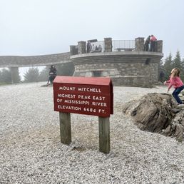
Great state park! Free entrance fee is always a nice perk when exploring with the kids. The state park isn't open year round because it's the HIGHEST POINT EAST OF THE MISSISSIPPI! It was so cold! In mid April, our car temperature read 24 degrees outside. Great views in all directions. Bundle up!

I've now been to the highest point in South Carolina https://www.yelp.com/biz/sassafras-mountain-sunset?hrid=St8tVb76NuHP3DLBgxSuCA and Delaware https://www.yelp.com/biz/ebright-azimuth-historical-marker-wilmington?hrid=AhR9IxuQ90worDYC5HMNSA. Highest point in 47 more states to go? Mount Mitchell is easily accessible by vehicle along the Blue Ridge Parkway. It's maybe 45 minutes from Asheville on a good day. I would not recommend the drive at night as the roads are extremely curvy and there is wildlife. But the view! Oh, the view! Totally worth it to see for miles and miles. Someone said that they could see the Charlotte skyline from here, but I couldn't see it. [Review 12709 overall, 21 of 2020.]

A must see very cool "And Free" destination. One hour drive north of Asheville on the Blue Ridge Parkway! The highest elevation on this side of the Mississippi. No worries about getting up and walking around. Very easy walk to the top, took about 10 minutes from the parking lot. Even saw a person in a wheelchair and walker. Also Dog friendly. My round trip with numerous stops at lookouts from downtown Asheville was 4 hours.

What a gorgeous sight to see! Hubby and I came up on a Sunday afternoon. It was quite a drive from Asheville. We drove up to the summit and then walked to the top. My goodness it was pretty chilly being over 6,000 feet in the sky! About 45° but also with it being so windy it felt like an October in Maine. It was so beautiful seeing the fog move so fast over the trees. It took my breath away (literally and figuratively). The conservatory was a perfect place to see the views and for photo ops. Elisha Mitchell, a scientist and professor died proving that Mt Mitchell is the highest peak east of the Mississippi River. Her tomb sits at the top of the mountain.

Great views and multiple treks on top of this state park mountain! Park Rangers and visitor center on the top allowing for easy information about park and trails. Souvenir shop with simple snacks and beverages closes early, try to get up here before 4pm to enjoy the longer hikes & Breathtaking views.


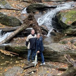
If you're not in shape or you're new to hiking, this trail might not be the best to start on. If that's the case with you, you can still visit the peak via a road off of the Blue Ridge Parkway. I'm not going to talk about that road though. I'm going to talk about my hike up the mountain. We decided to hike from the campground area up the mountain. While we typically go for longer distances, we were curious about why this path was only 5.6 miles. Afterall, this is apparently the highest point east of the Mississippi. After getting on the trail it didn't take us long to realize just how much of a beast this trail can be. It's not that it's hard. We've been on plenty of trails longer with similar or greater elevation climbs. The problem with this trail is we weren't expecting that elevation climb to kill us in such a short distance. The elevation climb is crammed into those 5 miles and you feel it. You're climbing almost the entire way and it drains the life out of you. We should've brought more food. We should've brought more water and we should've started two or three hours earlier than we did. The Trail: The trail is worth every second. It does seem like it takes longer to reach nature's natural air conditioner wall. I think I broke that wall right around the 4.5-mile mark. Once you reach that mark, you can stare at the heat in your rearview mirror. You'll run into a lot of people. I was quite surprised at just how many people were on this trail. You'll see plenty of flowers and other plants. There are a couple of streams along the trail. The views won't come into play until later on in the trail. Eventually, you'll reach a campground area. During our hike, there were boy scouts and other groups settling in for the evening. If I do the hike again, I might make it an overnighter just to enjoy that little area the next morning. Once you reach that area, you have just a little while longer to go and you'll reach the peak. The Peak: The peak area is like most other state and national parks. You have dozens of people that drive up. You have restrooms and a gift shop. I did notice there was another trail to take at the peak. After investigating further, that trail is apparently 12 miles and takes you to the 2nd highest peak/onward. You'll also see a sign for the scientist that discovered this mountain. At one point on the trail, I said, "I don't know who this Mitchell guy is but he needs to die." As it turns out, Elisha Mitchell is that guy and he died near a waterfall located on the mountain! One other interesting thing is that Mitchell's tomb is located at the peak. On the way back down, it was much easier. So much so, that I decided to run most of the way. I'm not much of a trail runner and I'm always curious when I see others trail running. I mean, seriously, what are you running from? It might've taken a while to get up the mountain, but running back down went smoothly. In closing, I can't stress this enough. Whether you're new to hiking or a seasoned backpacker... if it's going to be a hot day, take more water and high energy snacks than you think you need. After reaching the car, I was very uncomfortable with how dehydrated I was.

Come see the highest peak east of the Mississippi This is one of the stops off the north side of the Blue Ridge Parkway. If you are traveling the parkway this should be one of your stops along the way for several reasons. 1) It is the highest point east of the Mississippi. 2) You can drive most of the way to the peak. 3) There is a good amount of parking near the top. 4) The walkway, though a little steep at the beginning, is smoother than many other trails. And 5) Mostly, the view from the top is very nice and had an inset in the platform. The drive is a north turn off the parkway onto 128. Follow that road for about 4 miles, all the way to a large parking lot that would fit about 100 cars. There are several buildings on the west side of the lot. The trailhead is at the southern end of the lot and ascends fairly gradually with a good surface to the path. There are informational signs about Elisha Mitchell, a scientist who died in an attempt to prove that the site was the highest peak. His grave is at the summit. There is a panoramic view from the top pedestal as well as concrete benches, informational signs, and a compass rose set into the concrete with the shape state set in the middle. Overall, it is a must-see if you traveling this way. Enjoy!


This place is truly the top of the world. Highest point on the East Coast--and the freezing temps and bone-chilling winds confirmed it! We actually stumbled upon this site on accident, as the Blue Ridge Parkway on the way to Catawba Falls was CLOSED and we had to take a u-turn to head back to Asheville. We sure were glad that the parkway was closed! The visitor station is full of friendly park rangers who were more than helpful with showing us how to get back to Asheville, and the best hiking route for the mountain. We started a hike and only made it a mile or so before turning back since the steep elevation and serious black ice made it a challenge for us and our dog. The trails are absolutely stunning and some of the best I've seen on the East Coast. There are numerous picnic facilities and nature trails as well, great for families or small groups. The hike up to the overlook was fairly steep but short, wouldn't recommend for those in a wheelchair or with problems ambulating. The overlook was amazing and the views were one of a kind. I wish we would have had the opportunity to visit this site in the Spring or Summer when the temperature wasn't hovering close to 0 degrees. It has so much to offer.

Mount Mitchell is the highest peak east of the Mississippi. We heard the sunrise was pretty awesome there so we just had to do it. Many roads were still closed offer Hurricane Helene so it literally took us 2 hours to drive about 20 miles to get there for sunrise. But, we made it. Driving up that high and then hiking up to the summit, the temperature dropped into the 20's. It was a brisk adventure, but it was a beautiful and peaceful experience. You can drive to a parking lot and then take about a 1/4 of a mile hike straight up on a semi paved path. read more


2 years ago
Today Tony Vanoy & I took adventure to play on Blue Ridge Parkway. We stopped at Mt Mitchell State Park, the highest point East of the Mississippi River over 6,600 in the air. We climbed all the way up to the top of the peak and up into the observation tower. Tony was a little light headed. Hard for him to breathe up that high! This park is free to enjoy! There was a lot of people there! There is a snack bar, bathrooms, museum & gift shop. Definitely recommend read more


10 months ago
I visited Mount Mitchell on a beautiful day! There is a concession stand in the parch where you can get coffee and snacks before your steep hike to the summit. I didn't have much time so I did the summit trail and the garden trail near it. The Mt Mitchell peak hike was short and steep. The Balsam nature trail near the summit was beautiful. It wasn't too difficult either. I saw lots of flower species and trees. There were lots of people on the trail, so I felt safe. I will be back. read more


5 years ago
Mount Mitchell State Park is a short, scenic, and winding drive from Asheville. We visited recently on a road trip through Western North Carolina. This is the highest point in North Carolina *and* east of the Mississippi River. At first, that sounded a bit gimmicky and like a tourist trap. If nothing else, we'd make the drive and say we visited. The drive is worth it- and the views on the drive are the best part. If you get motion sickness, be careful because the Blue Ridge Parkway and other roads have lots of turns. The parkway has few bathroom/amenities stops- but you'll find bathrooms at the visitor's center and potties in the parking lot just down from the observation area. We like hiking, but we did not hike Mount Mitchell. Some brave souls do, but we're thankful for a road and the short walk to the peak. Other stops on the Blue Ridge Parkway are shorter and easier hikes. Plan to dress for weather that's colder than Asheville. The temperature is easily 15-20 degrees cooler, with a wind chill making it feel even colder. We were not the only people underdressed, as we saw others wearing shorts and piling on the clothes for temperatures that felt like 30 degrees. With the chilly temperatures and the cloud cover preventing us from seeing as much as we liked, we didn't stay long. However, I would recommend visiting if you're in the area. read more


4 years ago
Great state park! Free entrance fee is always a nice perk when exploring with the kids. The state park isn't open year round because it's the HIGHEST POINT EAST OF THE MISSISSIPPI! It was so cold! In mid April, our car temperature read 24 degrees outside. Great views in all directions. Bundle up! read more


I've now been to the highest point in South Carolina https://www.yelp.com/biz/sassafras-mountain-sunset?hrid=St8tVb76NuHP3DLBgxSuCA and Delaware https://www.yelp.com/biz/ebright-azimuth-historical-marker-wilmington?hrid=AhR9IxuQ90worDYC5HMNSA. Highest point in 47 more states to go? Mount Mitchell is easily accessible by vehicle along the Blue Ridge Parkway. It's maybe 45 minutes from Asheville on a good day. I would not recommend the drive at night as the roads are extremely curvy and there is wildlife. But the view! Oh, the view! Totally worth it to see for miles and miles. Someone said that they could see the Charlotte skyline from here, but I couldn't see it. [Review 12709 overall, 21 of 2020.] read more


A must see very cool "And Free" destination. One hour drive north of Asheville on the Blue Ridge Parkway! The highest elevation on this side of the Mississippi. No worries about getting up and walking around. Very easy walk to the top, took about 10 minutes from the parking lot. Even saw a person in a wheelchair and walker. Also Dog friendly. My round trip with numerous stops at lookouts from downtown Asheville was 4 hours. read more


Took a little quick walk to the summit of Mt Mitchell from the parking lot. A bit steep but lasts only for a moment, good views at the top! There are signs too which show which mountain peaks are what, and there's a map of NC on the floor showing where the summit is, which was cool! read more

5 years ago
What a gorgeous sight to see! Hubby and I came up on a Sunday afternoon. It was quite a drive from Asheville. We drove up to the summit and then walked to the top. My goodness it was pretty chilly being over 6,000 feet in the sky! About 45° but also with it being so windy it felt like an October in Maine. It was so beautiful seeing the fog move so fast over the trees. It took my breath away (literally and figuratively). The conservatory was a perfect place to see the views and for photo ops. Elisha Mitchell, a scientist and professor died proving that Mt Mitchell is the highest peak east of the Mississippi River. Her tomb sits at the top of the mountain. read more


3 years ago
Great views and multiple treks on top of this state park mountain! Park Rangers and visitor center on the top allowing for easy information about park and trails. Souvenir shop with simple snacks and beverages closes early, try to get up here before 4pm to enjoy the longer hikes & Breathtaking views. read more


5 years ago
Love this place. It is on top of the world. Low 60's in the summer and low 50's at night. Bad weather could come Anytime and usually Does so be ready. Rain, 30 + wind. read more


If you're not in shape or you're new to hiking, this trail might not be the best to start on. If that's the case with you, you can still visit the peak via a road off of the Blue Ridge Parkway. I'm not going to talk about that road though. I'm going to talk about my hike up the mountain. We decided to hike from the campground area up the mountain. While we typically go for longer distances, we were curious about why this path was only 5.6 miles. Afterall, this is apparently the highest point east of the Mississippi. After getting on the trail it didn't take us long to realize just how much of a beast this trail can be. It's not that it's hard. We've been on plenty of trails longer with similar or greater elevation climbs. The problem with this trail is we weren't expecting that elevation climb to kill us in such a short distance. The elevation climb is crammed into those 5 miles and you feel it. You're climbing almost the entire way and it drains the life out of you. We should've brought more food. We should've brought more water and we should've started two or three hours earlier than we did. The Trail: The trail is worth every second. It does seem like it takes longer to reach nature's natural air conditioner wall. I think I broke that wall right around the 4.5-mile mark. Once you reach that mark, you can stare at the heat in your rearview mirror. You'll run into a lot of people. I was quite surprised at just how many people were on this trail. You'll see plenty of flowers and other plants. There are a couple of streams along the trail. The views won't come into play until later on in the trail. Eventually, you'll reach a campground area. During our hike, there were boy scouts and other groups settling in for the evening. If I do the hike again, I might make it an overnighter just to enjoy that little area the next morning. Once you reach that area, you have just a little while longer to go and you'll reach the peak. The Peak: The peak area is like most other state and national parks. You have dozens of people that drive up. You have restrooms and a gift shop. I did notice there was another trail to take at the peak. After investigating further, that trail is apparently 12 miles and takes you to the 2nd highest peak/onward. You'll also see a sign for the scientist that discovered this mountain. At one point on the trail, I said, "I don't know who this Mitchell guy is but he needs to die." As it turns out, Elisha Mitchell is that guy and he died near a waterfall located on the mountain! One other interesting thing is that Mitchell's tomb is located at the peak. On the way back down, it was much easier. So much so, that I decided to run most of the way. I'm not much of a trail runner and I'm always curious when I see others trail running. I mean, seriously, what are you running from? It might've taken a while to get up the mountain, but running back down went smoothly. In closing, I can't stress this enough. Whether you're new to hiking or a seasoned backpacker... if it's going to be a hot day, take more water and high energy snacks than you think you need. After reaching the car, I was very uncomfortable with how dehydrated I was. read more


4 years ago
Come see the highest peak east of the Mississippi This is one of the stops off the north side of the Blue Ridge Parkway. If you are traveling the parkway this should be one of your stops along the way for several reasons. 1) It is the highest point east of the Mississippi. 2) You can drive most of the way to the peak. 3) There is a good amount of parking near the top. 4) The walkway, though a little steep at the beginning, is smoother than many other trails. And 5) Mostly, the view from the top is very nice and had an inset in the platform. The drive is a north turn off the parkway onto 128. Follow that road for about 4 miles, all the way to a large parking lot that would fit about 100 cars. There are several buildings on the west side of the lot. The trailhead is at the southern end of the lot and ascends fairly gradually with a good surface to the path. There are informational signs about Elisha Mitchell, a scientist who died in an attempt to prove that the site was the highest peak. His grave is at the summit. There is a panoramic view from the top pedestal as well as concrete benches, informational signs, and a compass rose set into the concrete with the shape state set in the middle. Overall, it is a must-see if you traveling this way. Enjoy! read more


2 years ago
7 years ago
This place is truly the top of the world. Highest point on the East Coast--and the freezing temps and bone-chilling winds confirmed it! We actually stumbled upon this site on accident, as the Blue Ridge Parkway on the way to Catawba Falls was CLOSED and we had to take a u-turn to head back to Asheville. We sure were glad that the parkway was closed! The visitor station is full of friendly park rangers who were more than helpful with showing us how to get back to Asheville, and the best hiking route for the mountain. We started a hike and only made it a mile or so before turning back since the steep elevation and serious black ice made it a challenge for us and our dog. The trails are absolutely stunning and some of the best I've seen on the East Coast. There are numerous picnic facilities and nature trails as well, great for families or small groups. The hike up to the overlook was fairly steep but short, wouldn't recommend for those in a wheelchair or with problems ambulating. The overlook was amazing and the views were one of a kind. I wish we would have had the opportunity to visit this site in the Spring or Summer when the temperature wasn't hovering close to 0 degrees. It has so much to offer. read more


3 years ago
5 years ago
Mount Mitchell is the highest point east of the Mississippi. It is absolutely a must see when riding on the Blue Ridge Parkway. It's a lovely trip, but the ride up is a steep grade. read more


8 years ago
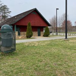
This is a great Park! Super accessable for those who are not avid hikers, or who like us, didn't bring the right clothing for a hike. It is a little windy to get up there, so keep that in mind in the winter. There is an easy path up to the peak and quite an incredible view. The parking lot is large and holds a lot of cars, plus there is a station available with restrooms. read more


Mt Mitchell is the highest point in North Carolina and east of the Mississippi. It is located inside a state park and the summit is easily accessible via a short, paved trail. The overlook at the top offers stunning vistas of the Blue Ridge Mountains and placards help identify what you can see in the distance. Mt Mitchell also has a restaurant and snack bar. Due to the elevation, it will be a bit colder than other areas of the Parkway, so be sure you bring a long sleeved shirt (perhaps even during early summer). read more


HIGHEST US POINT EAST OF THE MISSISSIPPI! Fooooock. So hard! Worth the climb, or if you can't make it...worth the out of the way drive to the summit! Ok...so. The Fella and I have hiked mountains before. So we felt ready and prepared to take on Mount Mitchell. He was...me, not so much. Or really, if we had started earlier in the day and I had brought more food and water with me....I could have made it. The hike from the trailhead at the campground is beautiful and brutal! The elevation climb happens over a mere 5.6 miles...but because of incline, there are almost no straight-aways and very little chance to make up time. Based on our usual hiking speed, and thinking I had factored in enough time to account for the incline, I expected the round trip hike might take us 5 hours (because coming down certainly goes faster than going up!) But with about a mile and a half yet to go before reaching the summit...I was exhausted, nearly out of water, ravenous but had already eaten all the food I brought, and was getting clumsy. I unfortunately had to make the decision to turn around and head down the mountain back to the car. I am so disappointed in myself, but very likely would have ended up hurt if I had pushed through. The Fella completed it, running the rest of the way to the summit and running back down to meet me at the car (ending up very dehydrated in the process). I know better for next time (I hope there is a next time! Because I really want to complete the whole thing!). That said, I love hiking difficult trails. The other hikers you encounter are the nicest, they share food and stories, and encourage you when you are struggling. Since I didn't make it to the tippy-top, we hopped on the Blue Ridge Parkway and drove to the main entrance of Mount Mitchell State Park and visited the summit the easy way, so I could at least get to see the vistas! If nothing else, going the "easy" route will provide your eyes with spectacular views! Learn from my mistakes: -Bring more water than you think you need. Now bring even more. -Start as early as you can. The climb eats up the time! -Bring extra high-energy food than you think you will need. -Expect it to take longer than expected, even with grace time. -There is no shame is doin' an early turn around. You can still drive to the summit to see the view! But remember, unless you have arranged for a shuttle or pick up at the top, you have to go the same distance back down! Near the summit is a sign that states "Elisha Mitchell 1793-1857. Scientist and professor. DIED in attempt to prove this mountain highest in Eastern US." To which I wearily (and eloquently) responded "...no shit." Still...I gotta tell you...WORTH IT. read more


7 years ago
Beautiful views and only a short, steep walk to get there! Amazing to see views from the highest peak east of the Mississippi. We just happened to be there on the anniversary of Elisha Mitchell's death (which also happened to be our wedding anniversary). If you go late June, beware of the yellow poplar weevils. They look kind of like ticks, but thankfully there were signs to let us know they are not. They are annoying little bugs that stuck all over us, but they are harmless. I think they are only an issue a few weeks out of the year. read more


6 years ago
Amazing! Got there at 6:45am. Great views from the parking lot. Walked up the paved path to the summit. It is up hill. Beautiful views from the summit. Beautiful sunrise! read more


6 years ago
Bring your sleeves and pants! It was a beautiful 70 degrees at the bottom of the mountain but by the time we reached the top it was low 50's and super windy. It's a short walk to the summit when you get out of the car. There were a lot of people so this isn't a place to find solitude unless maybe one of the other paths offers that. It's worth the trip especially on a clear day just to see out over all the other peaks in the area, which are nicely labeled by plaques. read more


4 years ago
What's not to like? Highest point west of Mississippi. Nice hiking trails, including the Appalachian and Mountain to Coast Trail. There are picnic tables along the lower parking area that are kind of private as they are tucked in among the plant growth at edge of parking. the large main parking area has a snack bar, restrooms and a small museum. A pretty good uphill but paved walkway leads to the summit and a new observation deck. It has compass and small message boards in front of where you are looking to give some info on what you're looking at. read more


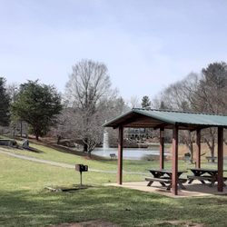
Update: The Old Mitchell trail from the summit path to the junction of the Campground Spur trail is cool, if a bit steep. The Campground Spur trail is also a good hike and not quite as steep. Mt Mitchell's campground boasts nine really nice camp sites, some with great views, and has a restroom facility. The parking lot is not huge but is enough for campers. Not sure if non-campers take any spots - the campground wasn't open at the time (opens May 1), read more


Excellent hiking trails and views of Blue Ridge Mountains. There are a cluster of campsites that are a little separated from the main trailheads and have a nice bathroom with running water, so this is luxury camping material. Having lived in Oregon before moving to the South, this park was where I went to feel the comfort of mountains and different terrain. read more


North Carolina's first state park! And the highest peak east of the Mississippi River. It's right off the Blue Ridge Parkway, actually at the very end of a North Carolina Scenic Byway. The restaurant was 5 star. It's open May-October, in July , 10am-8pm. Great views, excellent service, and great iced tea (no alcohol as it's a state park). The service was fast, friendly and very attentive. Grilled cheese sandwiches and soup rule the menu. Great stuff. Corn bread was not stellar, but it's only a small square that comes with your soup--chicken chili for me, beef chili for him. He claims his mashed potatoes were instant. He ate them all. The peach cobbler with ice cream was awesome and plenty for two or more to share. Gift shop at the summit was very nice, lots of choices, including warm jackets and long sleeve t-s, if you need one. It was 55 degrees on July, 22. Plan on the temperature being lots cooler--easily 20 degree difference from Asheville and 55 degrees cooler than TX. read more


 fried green tomatoes. $9.99 - Parks Near Me - Burnsville, North Carolina")
4 years ago
4 years ago
7 years ago
Loved this place! The drive was our favorite part... bring an extra jacket or two because it WILL be colder than you think. It would be more fun if less people were there. The main parking leads to the short trail which is 1/4 a mile but it will take some people's breath away (literally) but really not hard at all. Perfect place to be proposed to! Saw two while we were there! read more


13 years ago
Mount Mitchell is the tallest mountain summit east of the Mississippi in the United States and for that reason it served as a MUST SEE destination for hikers like me. THE SCENE Although I would have loved to claim a hike to the top from its base, I was highly restricted on time and chose to utilize the gas power of my automobile along the 4.6 mile road to Mt. Mitchell State Park. Forgive me fellow hikers, for I have sinned! But in my defense, it was a cold December day and the weather all weekend was horrid with rain, thick fog, Blue Ridge Parkway road closings and ice storm advisories. I was worried I wouldn't be able to see anything one at the top since 1,000 feet of our climb by car was through thick low lying clouds. We could barely see 30 feet and visibility at some of the scenic overlooks was ZERO. http://www.yelp.com/biz_photos/mount-mitchell-state-park-burnsville?select=bdHwZz69Kq0DvUJV7UQp8A Around 6,000 feet we burst out of the clouds and into bright daylight and I nearly cried. Seriously, it was majestic and beautiful beyond my wildest dreams and we hadn't yet made it to the 6,578 foot parking area. I was disappointed like a pouty child not getting his way my entire ride up the mountain from fear it would be all for not. Yet in an ironic twist, the clouds below us made the views even more dramatic than it would have been on a clear day were you would be able to see the valleys below. It felt like we were standing on Mount Everest, or some peak much higher in elevation. THE SUMMIT From the parking area you ascend an additional 146 feet by foot to the top of the beautiful stone/concrete observation deck complete with engraved directional compass. I have no words for the beauty and wonder of our view on this day, but both my wife and also my yelp buddy Bill G were completely fascinated. The Mountain was named after educator, geologist and Presbyterian minister Elisha Mitchell, who's geological studies determined the height of the mountain and whom later fell to his death @ nearby Mitchell Falls. His tomb is memorialized near the observation deck on the mountain summit. ---------- TIPS * Weather here is significantly different that nearby Asheville, so be sure to always check for closures, especially in the winter: http://ncparks.gov/mount-mitchell-state-park * Warm weather months allow the opening of a mountaintop restaurant just above the Ranger Station. ---------- THE VERDICT Go! If you love nature, hiking and significant destinations in the USA, this is a must. Not anywhere as tall as the peaks within the Rocky Mountain chain, but beautiful and majestic in its own right. read more


 - Parks Near Me - Burnsville, North Carolina")


 - Parks Near Me - Burnsville, North Carolina")
I really enjoyed my time here with my husband & friend Bill. It was a nice drive from Asheville, (where we were staying for the weekend) over to Mount Mitchell. My husband had really been wanting to go for a while and the opportunity finally came. I will admit driving up the 6,578 ft mtn. was a little scary, more so for the fellas than myself. I had to keep my cool so they wouldn't freak out!!! LOL We drove through thick low clouds for long stretches at a time, where you could only see right in front of the car. Finally around 6,000 ft. we were above the clouds and it was the most beautiful views I think I've ever seen of the mountains. Our pictures don't even look real! It is pretty windy and cool up on top so I advise you to bring a jacket. There is a restroom and ranger station, partially the way up, which I would recommend you take advantage of, because depending on the time and season the restaurant and restroom at the top may not be open (our experience). Some people hike this mountain, but because I'm a wimp & it was really cold out we drove up to the top. Once you reach the top parking area you can walk up an additional 5-10 minutes tops to a beautiful stone observation deck. Once I got my breath back from that quick walk in the brisk air, I could not believe the views! AMAZING!!! read more


I am standing on a top of the world. Well, close to it, or at least I am feeling like it. Standing on top of Mount Mitchell, 6684 ft above sea level, at the highest point south of Canada and east of Mississippi puts things in perspective. Literally and figuratively. Panoramic view of the mountains. All 360. Makes my head spin. Those mountains formed billions years ago. They changed, they mellowed, but they still the most majestic thing ever. Pine tree needles whisper to me in mountain breeze, and I cannot get enough if those views. Something about those slopes and peaks that stays with you forever. You always come back for more. Take a wild trail. Or just walk to observation deck. Does not matter, you will understand what this all about. You must see it. Just must. read more


11 years ago
Since this is the highest point east of the Mississippi, we had to make a stop while on our Blue Ridge Parkway tour. We went in September so it was a bit foggy at the higher elevation. You make your way up the windy roads and there is a parking lot with a restaurant and restrooms. After you park, you make the last journey to the top of the 6, 578 elevation mark by foot. The smell of the fir and spruce trees on the hike up to the summit is something I will never forget. The trees were so beautiful and it smelled better than any aromatic candle that bottled the scent of fir or balsam. Once you make your way to the top, there is a sign that lists the elevation and some peak iconography to show you where you are relative to the rest of the country in latitude and peak elevation. read more


Page 1 of 2
More info about Mount Mitchell State Park
2388 State Hwy 128
Burnsville, NC 28714
Directions
(828) 675-4611
Call Now
Visit Website
http://ncparks.gov/Visit/parks/momi/main.php
Hours
Indoor Amenities
Outdoor Amenities
Ask the Community - Mount Mitchell State Park
Are there nearby restaurants to Mount Mitchell?
Is it best to sunrise or sunset?
Review Highlights - Mount Mitchell State Park


Why does Yelp recommend reviews?
Mount Mitchell State Park - parks - Updated July 2026
Best of Burnsville
People found Mount Mitchell State Park by searching for…
Hiking in Burnsville, North Carolina
Campgrounds in Burnsville, North Carolina
Watch Sunset in Burnsville, North Carolina
Scenic Overlook in Burnsville, North Carolina
Dog Parks in Burnsville, North Carolina
Hiking Trails in Burnsville, North Carolina
Things to Do in Burnsville, North Carolina
Sunset View in Burnsville, North Carolina
Scenic Drive in Burnsville, North Carolina
Scenic Views in Burnsville, North Carolina
Lookout Points in Burnsville, North Carolina
State Parks Camping in Burnsville, North Carolina
Places to Take Pictures in Burnsville, North Carolina
Waterfall Hike in Burnsville, North Carolina
Sunrise View in Burnsville, North Carolina
Picnic Spots in Burnsville, North Carolina
Playgrounds in Burnsville, North Carolina
Hiking With Kids in Burnsville, North Carolina
Photo Spots in Burnsville, North Carolina
Running Trails in Burnsville, North Carolina
National Parks in Burnsville, North Carolina
Parks for Kids in Burnsville, North Carolina
Trending Searches in Burnsville, NC
Black Owned Nail Salons in Burnsville, NC
Cliff Jumping in Burnsville, NC
Fishing Spots in Burnsville, NC
Jet Ski Rental in Burnsville, NC
Kayak Rental in Burnsville, NC
Kids Activities Outdoor in Burnsville, NC
Paddle Boat Rentals in Burnsville, NC
Places To Swim in Burnsville, NC
Places To Walk Around in Burnsville, NC
Public Pools in Burnsville, NC
River Swimming in Burnsville, NC
Soccer Store in Burnsville, NC
Strawberry Picking in Burnsville, NC
Swimming Holes in Burnsville, NC
Swimming Lakes in Burnsville, NC
Things To Do With Kids in Burnsville, NC
Browse Articles
Browse Nearby
BEST of Burnsville, North Carolina Restaurants near Mount Mitchell State Park
BEST of Burnsville, North Carolina Coffee near Mount Mitchell State Park
BEST of Burnsville, North Carolina Breakfast near Mount Mitchell State Park
BEST of Burnsville, North Carolina Campgrounds near Mount Mitchell State Park
BEST of Burnsville, North Carolina Mini Golf near Mount Mitchell State Park
BEST of Burnsville, North Carolina Thrift Stores near Mount Mitchell State Park
BEST of Burnsville, North Carolina Wineries near Mount Mitchell State Park
Browse Brands
Related Searches in Burnsville, NC
Best Fishing Locations and Guides in Burnsville, North Carolina
Best Fun Things to Do in Burnsville, North Carolina
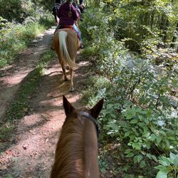
Best Places for Horseback Riding in Burnsville, North Carolina
Best Places for Stunning Views in Burnsville, North Carolina
Check Out Off Road Trails in Burnsville, North Carolina
Discover Kids Indoor Play Area Venues in Burnsville, North Carolina
Discover the Best Beaches in Burnsville, North Carolina
Dog-Friendly Hikes With Dogs in Burnsville, North Carolina
Enjoy Tent Camping Spots Around Burnsville, North Carolina
Enjoy a Beautiful Waterfall Hike in Burnsville, North Carolina
Enjoy the Best Tubing Experiences in Burnsville, North Carolina
Enjoy the Best Walking Trails in Burnsville, North Carolina
Explore Beautiful Botanical Gardens in Burnsville, North Carolina
Explore Family-Friendly Zoos and Wildlife in Burnsville, North Carolina
Explore Fun Activities to Do in Burnsville, North Carolina
Explore Landmarks & Historical Buildings in Burnsville, North Carolina
Explore Parks With Pull Up Bars in Burnsville, North Carolina
Explore Popular Campgrounds Near Burnsville, North Carolina
Explore Popular RV Parks Around Burnsville, North Carolina
Explore Popular Recreation Centers Around Burnsville, North Carolina
Explore Popular Scenic Overlook Points in Burnsville, North Carolina
Explore Scenic Lakes to Visit in Burnsville, North Carolina
Explore Secret Spots Worth Visiting in Burnsville, North Carolina
Explore Summer Camps for All Ages in Burnsville, North Carolina
Explore Top Dog Parks in Burnsville, North Carolina Near You
Explore Top Gyms in Burnsville, North Carolina Now
Explore Top Water Parks in Burnsville, North Carolina Today
Explore Volleyball Courts Available in Burnsville, North Carolina
Explore the Best Swimming Holes Around Burnsville, North Carolina
Find Batting Cages Near You in Burnsville, North Carolina
Find Fun Kids Activities Outdoor in Burnsville, North Carolina
Find Fun Things to Do With Kids in Burnsville, North Carolina
Find Picnic Tables for Outdoor Fun in Burnsville, North Carolina
Find Top Skate Parks in Burnsville, North Carolina for All Skill Levels
Find Top Skating Rinks in Burnsville, North Carolina for All Ages
Find the Best Swimming Pools in Burnsville, North Carolina Today
Fun Indoor Activities to Try in Burnsville, North Carolina
Hiking Trails With Waterfalls in Burnsville, North Carolina
Host the Perfect Kids Birthday Party in Burnsville, North Carolina
Must-See Tourist Attractions Around Burnsville, North Carolina
Popular Kids Activities in Burnsville, North Carolina
Popular Places to Take Pictures in Burnsville, North Carolina
Popular Things to Do in Burnsville, North Carolina
Safe River Swimming Areas in Burnsville, North Carolina
Tennis Courts and Clubs Near Burnsville, North Carolina
Top Hiking Trails to Explore in Burnsville, North Carolina
Top Indoor Swimming Pools to Visit in Burnsville, North Carolina
Top Running Trails to Explore in Burnsville, North Carolina
People who viewed Mount Mitchell State Park also viewed
Linville Falls Visitor Center and Hiking Trails
22 reviews
Blue Ridge Parkway
185 reviews
Pack Square Park
17 reviews
Veterans Park
2 reviews
Catawba Falls
99 reviews
Wiseman's View
5 reviews
Crabtree Falls Campground
19 reviews
Tanbark Ridge Overlook
3 reviews
Beaver Lake Bird Sanctuary
13 reviews
Roaring Fork Falls
3 reviews