
MILL RUINS PARK · YELP ASSISTANT
Ask Yelp Assistant
Mill Ruins Park Photos
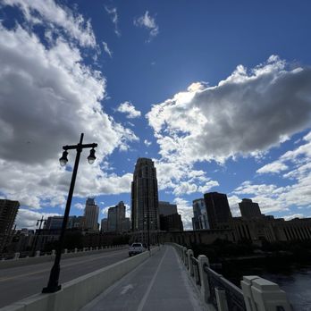


More like Mill Ruins Park
Recommended Reviews - Mill Ruins Park
Start your review...


Reviews With Photos


While walking on Stone Arch Bridge for the first time, I noticed what looked like remnants of old factories scattered down the west side of the Mississippi River. It was so different that I needed to learn more about it. On the bridge, I learned that this side of the river had mills that were powered by Saint Anthony Falls during the 19th century. Flour was being milled, which made Minneapolis known for being a flour exporter around the States and beyond. It makes sense that these mills would be right by the river. It likely made transporting the flour accessible. Mills Ruins Park opened on October 1st, 2001. It was to celebrate the milling district. I walked over to take a look once I left the bridge. There is a sign in the park with rocks at street level. There is a sloped roadway, but cars aren't allowed to drive down. I walked down a level and looked down. You can walk down some more and you end up just above the river. I didn't go down that far. There was some sort of high school prom photo session happening. I didn't want to be that weirdo tourist photobombing folks in nice formalwear. There are paved walkways, so you're not walking on ruins in a park with ruins. It was nice seeing how happy they were, which made me happy for them. Mill Ruins Park was an unexpected, cool find with a history that I didn't know about until my visit. There is a museum that I found out about. However, it is open till 4 pm on Fridays and that's when I was done discovering this park this particular Friday. I'll need to return and check it out. (132)


Beautiful spot and a Minnesota Treasure! I've always loved the Stone Arch Bridge and of course the Mighty Mississippi River...then last Friday I was off work, and I decided to partake in "Walk with a Naturalist" part of a FREE series of afternoon strolls on and near the Mississippi River. This series is currently running Fridays, March 4 through May 27, 1 to 2pm. Walks begin at the Water Works Pavilion, 425 West River Parkway, at the foot of the Stone Arch Bridge. Loved the leisurely pace and it was so wonderful to observe the history of the falls and mills and to learn about bird migration on the river. Highly recommend! Sign up on bit.ly/NatureWalk-TalkSpring-22.


What a great outdoor place to walk around after a full meal! Nice view of St. Anthony's fall with a stone bridge trail for jogging and biking. Across the street is gold medal flour company. On the bridge, there's also a few view of Pillsbury company sign. A lot of historical buildings and history behind. Parking is $2/hour with parking lot available right by the park.


Although we did not get a chance to spend much time here, the time that we did was memorable. Walking across the stone arch bridge, we were able to enjoy the awesome views, including the Mississippi River. This is a definite must if you are in Minneapolis.


Very cool park with lots of history. The waterfront is really pretty and you feel like you're in a different period in history. It feels safe to walk around during the day time alone. I saw lots of people out jogging and biking.


Certainly a unique park. It's not often that contemporary man made ruins can be made so effortlessly into a part of the city, but Minneapolis nailed it.


Stopped by Mill Ruins Park to go for a walk and get some fresh air and see some of the local sights. I checked out a number of interpretive signs and learned a bit about the history of the Stone Bridge. Also, the U.S. Army Corps of Engineers has a facility here to manage a lock on the river - apparently at times they offer tours, but the facility appeared to be closed while I was there. The area is part of the Mississippi National River & Recreation Area: http://www.nps.gov/miss/index.htm The Stone Bridge offers a nice walk across the river and includes a couple of spots with mounted binoculars that allow one to get a closer look at the surrounding river.


If you want a little history of the water front by the Stone Arch Bridge, take a few minutes and go back in time as gaze into the cliff side at the Mill city ruins park. You could also walk along the path and read the various placks and learn of different individuals who helped develop down town Minneapolis.


Minneapolis is a city for shopping so as an outsider looking for sightseeing things to do, I didn't come up with a lot in my research. Sure, there are watersports, but I wanted something free or cheap, easy to access, historical, etc. This is a great place to start. And, you can spend a lot of time here or just a little. It's close to downtown (it is basically downtown) and they have a parking lot (paid parking). There are walking trails, you can walk across the historical Stone Arch bridge, you can visit the museum, you can see St. Anthony's Falls. Great place! As a photographer, I was actually here looking for a specific 'spot' where you can see the lights of the bridge (at night it's lit up. I was here during the day but in case I had time to return) and the skyline of downtown. I stopped a couple of people and one lady was very clear that for a single woman that's a picture/area I didn't want to mess with. It's a long winding trail under the bridge and a popular hangout for druggies and the homeless population. I hope to someday get the picture but I'll likely only return with a local photographer or a friend or two. :)


Just beautiful and they have signs all over the park giving you the history about the area


This place makes me ridiculously happy, even with its links to disaster. Modern ruins being preserved, a waterfall (alas also being preserved, long story), beautiful stone-arch bridge, science lab across the river, great neighborhood (incl. the Saturday market)... There's something about combining the beauty of nature with the attempts of humanity that appeals to me deeply. This park exhibits both in its own way.


This is a very unique park, and is such a creative use of old Mill Ruins, it's got such an ancient feel to it. I've never seen ruins utilized like this before, it's almost like the Minneapolis version of the Roman Forum. You can get right up next to the ruins and the old water canals that powered the mills thanks to catwalk - like crossings. The park has got alot of riverfront frontage that goes down quite a ways from the actual ruins. The river is almost at ground level in most of the park, and thanks to St Anthony Falls upstream the water is usually flowing. This results in a relaxing enviroment from the sound and breeze of the waves. Between the Ruins and the lower end of the park are all kinds of different observation areas and places where you can sit and have a picnik , study or do whatever. Mill Ruins Park is one of the most spectacular places at night in Minneapolis (see my photos). The arches of the Stone Arch Bridge are illuminated and it reflects off the water. The River close to this area is majestically lit up with the blue lights of the 35W Bridge, and the Mill Ruins are illuminated and can be seen from a considerable distance. You can even drive down to this spot if you desire, and there is a small parking lot at that end which I believe is free for a limited amount of time.


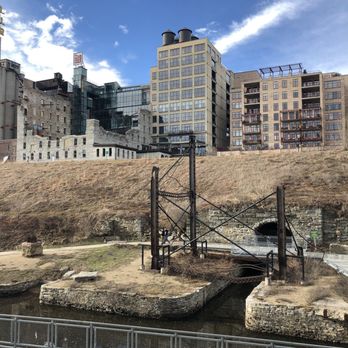
Beautiful little spot right next the the stone arch bridge. You get to walk right under the stone arch and emerge to see this area of twisted old metal and caves with barred doors. So erie, old, and mysterious. This is not to be confused with the mill city museum which is right next to it and also worth visiting but costs money while this park is free. I've taken my dogs here and then continued our walk across the stone arch bridge as well. Would also be a fun picnic spot. I did a little fun photo shot here with a friend and the pix came out great. I've often seen people do wedding photos down here as you have a great water view here. Ride your bike, walk your dogs, or bring your out of town guests here and you'll have a great day out. There is a small parking lot here that charges by the hour but is cheap like a buck or something. Every time I've been here it's been broken so it just says park for free, even better!


This is so cool! The city easily could have demolished this whole area and created a new riverfront, but instead they chose to honor these 19th century ruins. Flour is what put Minneapolis on the map as an export, and these ruins were once mills that used the power of St Anthony Falls to run. Definitely worth a visit if you're into archaeology, city history, or just want a place to walk with a pleasant view. read more


Mill Ruins Park in downtown Minneapolis is so named because it still contains the remnants of the floor mills (powered by the Mississippi River) that made 19th century Minneapolis the 'Flour Milling Capitol of the World', opening in 2001. It overlooks the Mississippi River, has the Mill City Museum, and is the South gateway for the Stone Arch Pedestrian Bridge. I stopped by on a cold March afternoon, and had a chance to explore it a bit, making note of places I would look at more closely on a warmer (and less wet) day. read more


4 years ago
Really cool park that's a bit alternative to a "normal" park. There's rich history here that is really interesting if you're into that kind of stuff. I certainly am and found this place really cool, no pun intended as it was covered in snow. I bet it's really gorgeous and magnificent in the summer time. We went in December so the falls weren't really falls and most everything was covered in snow. There's also a lot of construction happening right across from the Gold Medal silos so there's some impediment of the views. Even so, I'd highly suggest visiting and walking across the bridges if you can. read more


While walking on Stone Arch Bridge for the first time, I noticed what looked like remnants of old factories scattered down the west side of the Mississippi River. It was so different that I needed to learn more about it. On the bridge, I learned that this side of the river had mills that were powered by Saint Anthony Falls during the 19th century. Flour was being milled, which made Minneapolis known for being a flour exporter around the States and beyond. It makes sense that these mills would be right by the river. It likely made transporting the flour accessible. Mills Ruins Park opened on October 1st, 2001. It was to celebrate the milling district. I walked over to take a look once I left the bridge. There is a sign in the park with rocks at street level. There is a sloped roadway, but cars aren't allowed to drive down. I walked down a level and looked down. You can walk down some more and you end up just above the river. I didn't go down that far. There was some sort of high school prom photo session happening. I didn't want to be that weirdo tourist photobombing folks in nice formalwear. There are paved walkways, so you're not walking on ruins in a park with ruins. It was nice seeing how happy they were, which made me happy for them. Mill Ruins Park was an unexpected, cool find with a history that I didn't know about until my visit. There is a museum that I found out about. However, it is open till 4 pm on Fridays and that's when I was done discovering this park this particular Friday. I'll need to return and check it out. (132) read more


Beautiful spot and a Minnesota Treasure! I've always loved the Stone Arch Bridge and of course the Mighty Mississippi River...then last Friday I was off work, and I decided to partake in "Walk with a Naturalist" part of a FREE series of afternoon strolls on and near the Mississippi River. This series is currently running Fridays, March 4 through May 27, 1 to 2pm. Walks begin at the Water Works Pavilion, 425 West River Parkway, at the foot of the Stone Arch Bridge. Loved the leisurely pace and it was so wonderful to observe the history of the falls and mills and to learn about bird migration on the river. Highly recommend! Sign up on bit.ly/NatureWalk-TalkSpring-22. read more


What a great outdoor place to walk around after a full meal! Nice view of St. Anthony's fall with a stone bridge trail for jogging and biking. Across the street is gold medal flour company. On the bridge, there's also a few view of Pillsbury company sign. A lot of historical buildings and history behind. Parking is $2/hour with parking lot available right by the park. read more


Although we did not get a chance to spend much time here, the time that we did was memorable. Walking across the stone arch bridge, we were able to enjoy the awesome views, including the Mississippi River. This is a definite must if you are in Minneapolis. read more


4 years ago
Very cool park with lots of history. The waterfront is really pretty and you feel like you're in a different period in history. It feels safe to walk around during the day time alone. I saw lots of people out jogging and biking. read more


4 years ago
Certainly a unique park. It's not often that contemporary man made ruins can be made so effortlessly into a part of the city, but Minneapolis nailed it. read more


Stopped by Mill Ruins Park to go for a walk and get some fresh air and see some of the local sights. I checked out a number of interpretive signs and learned a bit about the history of the Stone Bridge. Also, the U.S. Army Corps of Engineers has a facility here to manage a lock on the river - apparently at times they offer tours, but the facility appeared to be closed while I was there. The area is part of the Mississippi National River & Recreation Area: http://www.nps.gov/miss/index.htm The Stone Bridge offers a nice walk across the river and includes a couple of spots with mounted binoculars that allow one to get a closer look at the surrounding river. read more


If you want a little history of the water front by the Stone Arch Bridge, take a few minutes and go back in time as gaze into the cliff side at the Mill city ruins park. You could also walk along the path and read the various placks and learn of different individuals who helped develop down town Minneapolis. read more




11 years ago
Minneapolis is a city for shopping so as an outsider looking for sightseeing things to do, I didn't come up with a lot in my research. Sure, there are watersports, but I wanted something free or cheap, easy to access, historical, etc. This is a great place to start. And, you can spend a lot of time here or just a little. It's close to downtown (it is basically downtown) and they have a parking lot (paid parking). There are walking trails, you can walk across the historical Stone Arch bridge, you can visit the museum, you can see St. Anthony's Falls. Great place! As a photographer, I was actually here looking for a specific 'spot' where you can see the lights of the bridge (at night it's lit up. I was here during the day but in case I had time to return) and the skyline of downtown. I stopped a couple of people and one lady was very clear that for a single woman that's a picture/area I didn't want to mess with. It's a long winding trail under the bridge and a popular hangout for druggies and the homeless population. I hope to someday get the picture but I'll likely only return with a local photographer or a friend or two. :) read more


8 years ago
Just beautiful and they have signs all over the park giving you the history about the area read more


This place makes me ridiculously happy, even with its links to disaster. Modern ruins being preserved, a waterfall (alas also being preserved, long story), beautiful stone-arch bridge, science lab across the river, great neighborhood (incl. the Saturday market)... There's something about combining the beauty of nature with the attempts of humanity that appeals to me deeply. This park exhibits both in its own way. read more


This is a very unique park, and is such a creative use of old Mill Ruins, it's got such an ancient feel to it. I've never seen ruins utilized like this before, it's almost like the Minneapolis version of the Roman Forum. You can get right up next to the ruins and the old water canals that powered the mills thanks to catwalk - like crossings. The park has got alot of riverfront frontage that goes down quite a ways from the actual ruins. The river is almost at ground level in most of the park, and thanks to St Anthony Falls upstream the water is usually flowing. This results in a relaxing enviroment from the sound and breeze of the waves. Between the Ruins and the lower end of the park are all kinds of different observation areas and places where you can sit and have a picnik , study or do whatever. Mill Ruins Park is one of the most spectacular places at night in Minneapolis (see my photos). The arches of the Stone Arch Bridge are illuminated and it reflects off the water. The River close to this area is majestically lit up with the blue lights of the 35W Bridge, and the Mill Ruins are illuminated and can be seen from a considerable distance. You can even drive down to this spot if you desire, and there is a small parking lot at that end which I believe is free for a limited amount of time. read more


15 years ago
Beautiful little spot right next the the stone arch bridge. You get to walk right under the stone arch and emerge to see this area of twisted old metal and caves with barred doors. So erie, old, and mysterious. This is not to be confused with the mill city museum which is right next to it and also worth visiting but costs money while this park is free. I've taken my dogs here and then continued our walk across the stone arch bridge as well. Would also be a fun picnic spot. I did a little fun photo shot here with a friend and the pix came out great. I've often seen people do wedding photos down here as you have a great water view here. Ride your bike, walk your dogs, or bring your out of town guests here and you'll have a great day out. There is a small parking lot here that charges by the hour but is cheap like a buck or something. Every time I've been here it's been broken so it just says park for free, even better! read more


11 years ago
Love this park... Not sure why I forgot it even existed. Glad I went last week. The weather was amazing and the fall colors refreshing! Makes for a perfect sunset walk! Bring a tea or coffee and enjoy a fall stroll before everything ices over. Breathtaking views of the mill district and the Mississippi River. I remember visiting here about 10 years ago in the summer, live music was hosted here right on the ruins. read more


9 years ago
What a cool little park! Blends history, nature, and architecture in a great city. Factor an hour to see everything. The views of the Mill Museum are nice from the bridge. read more


6 years ago
Super cool place to checkout if you're into abandoned places or history! The historical information signs need redone but are still readable for now! read more


12 years ago


8 years ago

12 years ago


15 years ago


13 years ago

9 years ago

18 years ago

18 years ago


Page 1 of 2
More info about Mill Ruins Park
Ask the Community - Mill Ruins Park
Review Highlights - Mill Ruins Park












Why does Yelp recommend reviews?
1 review that is not currently recommended
The reviews below are not factored into the business's overall star rating.

15 years ago


