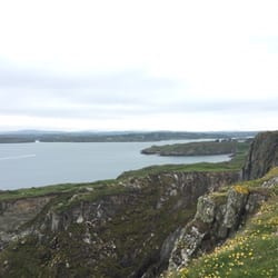
I'd read that it was difficult to find the lonely minor road in West Cork, through the valley of…read moreflowers or Béal na mBláth, as it is known, where on Tuesday 22nd August 1922 Michael Collins leader of the Irish Free State was ambushed & killed in the course of a 20 minute gun battle.
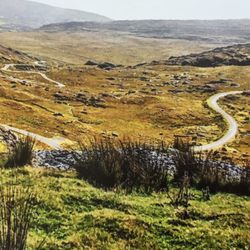
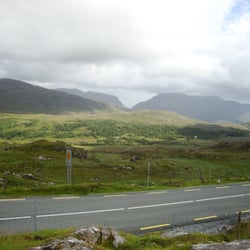
A party of friends & I were coming from Macroom heading south towards Cork City on the N22 road. We were following a reasonably good road map to the area which had Béal na mBláth clearly marked, but on unnamed country roads.
About 10 minutes along the road we turned right at the sign for the R585 towards Crookstown.
Follow this road, and be careful not to get diverted, because a couple of times there are false turnings to other roads that don't appear to be on the map. You'll eventually come to a noticeable group of terraced houses where the road goes either straight on, or to the right with no signs. TURN RIGHT
You'll have come about 5 mins or just over 4km from the main road now, and suddenly you'll come to a crossroads where there's a garage, but again absolutely no signs. Despite it looking like the more likely road, DON'T TURN RIGHT, (thats the R585), nor should you go straight on. The unnamed road off to the LEFT is your man here!
Of course we didn't have a clue, and it was only doing what no doubt everyone else does and ask directions at the garage, (judging by the books, postcards & souvenirs of Michael Collins on sale), that we discovered that the site was not very far long the road to the left.
Apparently all the signs saying Béal na mBláth or Michael Collins memorial keep getting stolen & ending up in bars in New York!
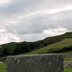
Indeed not far along on what is a surprisingly wide road for a nameless minor road, as the road bends you'll see clearly on the left hand side, a fenced off red podium on top which stands a grey stone cross.
At around 8pm, just as it was beginning to go dark, on that fateful day, Michael Collins' small convoy of 4 vehicles was attacked, he determined to get out and fight despite advice to "drive like hell!"
Maybe it was both disbelief & anger that he could be targetted by his own people in his own county, (and just 32km from his birthplace), when apparently he was on a mission to end the fighting, that made him get out. He'd himself instigated these flying columns of resistance in the war of independence only a few years earlier.
He was the only one to die.
It was pouring with rain, as I gazed up the steep embankment to positions where doubtless the flying columnists would have fired from.
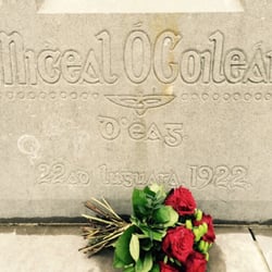
The cross which is simply inscribed in gaelic: miceal Ocolleain and the date, still had a faded wreath left over from the annual commemoration at the site.
Just to the right of the podium a small white pillar marks the exact spot where he died.
As we drove on we all voiced our differing views of the political situation at the time that drove Ireland to civil war, and this is a more than thought provoking symbol of those turbulent times.