Jack Hill State Park Photos


More like Jack Hill State Park
Recommended Reviews - Jack Hill State Park
Start your review...

Reviews With Photos

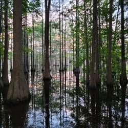
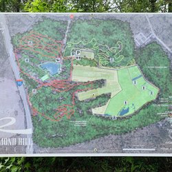
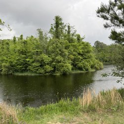
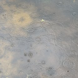
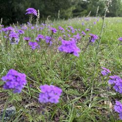
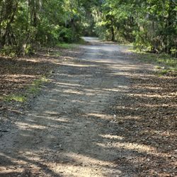
So this park is right in town and I believe it may be underappreciated. I've gone twice in passed years and I wasn't impressed. But as we have drove further into the park it seems much nicer. A gorgeous 18 hole golf course. Beautiful cottages in the back of the park. A short nature trail, but watch your step because there are many tree roots sticking out from the ground. The trail just abruptly stops at the lake which seemed odd to me, no loop around or anything, just a turn around and go back. There are many pavilions for birthday parties or other events, a playground for the kids, a mini golf section which looks like they updated recently, and I can't be sure but it looks like a little water area is being put in now. And of course a camping area. This park is definitely worth a look. I bet the majority of the people in this town don't even realize we have these things right in our back yard....I know I didn't. SIDE NOTE: stop dumping trash on the trails people!!

10 months ago


6 years ago
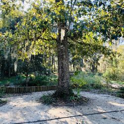
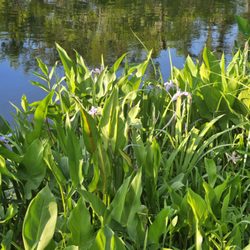
I have only been here in the heat of early August when it is hot and muggy and the gnats are around. My mother's family used to have an annual family reunion here. There is now a much larger and air conditioned building for large groups and meetings. There is a separate screened building for cooking. New and nicer bathrooms have been provided. We have stayed in one of the cabins and they are simple and comfortable places to stay. At least one cabin is handicap accessible. There is a lake and a golf course as well. The park sits on the edge of Reidsville just past the DQ. read more


3 years ago
12 years ago
So this park is right in town and I believe it may be underappreciated. I've gone twice in passed years and I wasn't impressed. But as we have drove further into the park it seems much nicer. A gorgeous 18 hole golf course. Beautiful cottages in the back of the park. A short nature trail, but watch your step because there are many tree roots sticking out from the ground. The trail just abruptly stops at the lake which seemed odd to me, no loop around or anything, just a turn around and go back. There are many pavilions for birthday parties or other events, a playground for the kids, a mini golf section which looks like they updated recently, and I can't be sure but it looks like a little water area is being put in now. And of course a camping area. This park is definitely worth a look. I bet the majority of the people in this town don't even realize we have these things right in our back yard....I know I didn't. SIDE NOTE: stop dumping trash on the trails people!! read more

4 years ago
8 years ago
Went camping there over the Labor Day weekend. Very quiet and comfort stations were exceptionally clean. The RV sites were small and a tight fit. Some you couldn't even open your awning if you wanted too. We went with another couple so the close spaces were not an issue for us but if you didn't know the people camping next to you, you would become fast friends. The mini golf was inexpensive but the course was in desperate need of repair. Very friendly staff. read more

8 years ago
More info about Jack Hill State Park
Ask the Community - Jack Hill State Park


Why does Yelp recommend reviews?
2 reviews that are not currently recommended
The reviews below are not factored into the business's overall star rating.
4 years ago
Jack Hill State Park - parks - Updated May 2026
Best of Reidsville
People found Jack Hill State Park by searching for…
Things to Do in Reidsville, GA
Places to Take Pictures in Reidsville, GA
Swimming Holes in Reidsville, GA
Places to Swim in Reidsville, GA
Swimming Lakes in Reidsville, GA
Walking Trails in Reidsville, GA
Fun Things to Do With Kids in Reidsville, GA
Parks for Kids in Reidsville, GA
Fishing Spots in Reidsville, GA
Hiking Trails in Reidsville, GA
Camping Cabins in Reidsville, GA
River Swimming in Reidsville, GA
Beautiful Views in Reidsville, GA
Trending Searches in Reidsville, GA
Browse Articles
Browse Nearby
BEST of Reidsville, Georgia Coffee near Jack Hill State Park
BEST of Reidsville, Georgia Things to Do near Jack Hill State Park
BEST of Reidsville, Georgia Restaurants near Jack Hill State Park
BEST of Reidsville, Georgia Hiking near Jack Hill State Park
BEST of Reidsville, Georgia Beaches near Jack Hill State Park
BEST of Reidsville, Georgia Breakfast near Jack Hill State Park
BEST of Reidsville, Georgia Campgrounds near Jack Hill State Park
Browse Brands
Related Searches in Reidsville, GA
Best Fishing Locations and Guides in Reidsville, Georgia
Best Places for Horseback Riding in Reidsville, Georgia
Best Waterfalls and Swimming Holes in Reidsville, Georgia
Check Out Great Playgrounds in Reidsville, Georgia
Check Out Off Road Trails in Reidsville, Georgia
Discover Lakes & Ponds to Explore in Reidsville, Georgia
Discover Popular Bike Trails in Reidsville, Georgia
Discover Popular Photo Spots in Reidsville, Georgia
Discover Soccer Fields in Reidsville, Georgia Near You
Discover Stunning Skyline View Spots in Reidsville, Georgia
Discover the Best Running Track in Reidsville, Georgia
Enjoy Scenic Night View Experiences in Reidsville, Georgia
Enjoy the Best Night View Spots in Reidsville, Georgia
Enjoy the Best Picnic Spots and Ideas in Reidsville, Georgia
Enjoy the Best Walking Trails in Reidsville, Georgia
Experience Stunning Sunset Views in Reidsville, Georgia
Explore Easy Hikes Perfect for All in Reidsville, Georgia
Explore Landmarks & Historical Buildings in Reidsville, Georgia
Explore Popular Campgrounds Near Reidsville, Georgia
Explore Popular Picnic Areas Around Reidsville, Georgia
Explore Popular RV Parks Around Reidsville, Georgia
Explore Popular Scenic Overlook Points in Reidsville, Georgia
Explore Popular Scenic Views Near Reidsville, Georgia
Explore Scenic Lakes to Visit in Reidsville, Georgia
Explore Secret Spots Worth Visiting in Reidsville, Georgia
Explore Top Dog Parks in Reidsville, Georgia Near You
Explore Top Gyms in Reidsville, Georgia Now
Explore Volleyball Courts Available in Reidsville, Georgia
Find Beautiful Views in Reidsville, Georgia
Find Fun Kids Activities Outdoor in Reidsville, Georgia
Find Parks and Recreation Activities in Reidsville, Georgia
Find Picnic Tables for Outdoor Fun in Reidsville, Georgia
Find a Public Running Track in Reidsville, Georgia
Find the Best Parks for Picnics in Reidsville, Georgia
Have Fun at a Splash Pad in Reidsville, Georgia
Must-See Tourist Attractions Around Reidsville, Georgia
Perfect Spots to Watch Sunset in Reidsville, Georgia
Picnic Areas With BBQ Pits Available in Reidsville, Georgia
Plan a Scenic Drive Route Near Reidsville, Georgia
Popular Fishing Spots to Explore in Reidsville, Georgia
Popular Kids Activities in Reidsville, Georgia
Popular Things to Do in Reidsville, Georgia
Relax at Natural Hot Springs Near Reidsville, Georgia
Safe River Swimming Areas in Reidsville, Georgia
See Top Fireworks Events in Reidsville, Georgia
Top Swimming Lakes to Enjoy in Reidsville, Georgia
Top-Rated Hikes in Reidsville, Georgia to Explore
Uncover the Best Secluded Spots Around Reidsville, Georgia
Visit Top Toddler Playgrounds in Reidsville, Georgia for Playtime