Cancel

    Open app

    Search

    Guadalupe Peak Trail Hike

    4.6 (8 reviews)

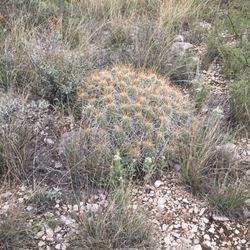
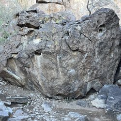
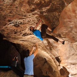
    Guadalupe Peak Trail Hike Photos

    More like Guadalupe Peak Trail Hike

    Recommended Reviews - Guadalupe Peak Trail Hike

    Your trust is our priority, so businesses can't pay to alter or remove their reviews. Learn more about reviews.
    Yelp app icon
    Browse more easily on the app
    Review Feed Illustration

    Reviews With Photos

    David C.

    Everything Seth said. Wow Seth way to discourage all other writers from ever wanting to write anything ever! Jk, great review. What I will add is high ankle boots may help because the trail is largely comprised of small rocks Vice sand and rolling an ankle is very easy. There can be very high gust wind days so be prepared for that as well and have a windbreaker.

    Top of Guadalupe Peak Trail
    Savannah S.

    My father and I hiked Guadalupe Peak Trail the first weekend of March. The air was cool, and the wind was very strong! The hike was challenging, and the altitude got to me. The last bit was the most challenging for me due to the elevation, but we accomplished the summit! We started early, 6:30 a.m. and finished around 3:00 p.m., I highly recommend starting early!! We used walking sticks and they were very helpful through some of the steeper steps and scrabble of rocks. I highly recommend this hike, it was beautiful and gratifying!! Please go prepared. We did see a few people running the trail in admirable time, I'm still in awe of their athleticism!! Cheers, Sav

    Monument at the top
    Shane C.

    Start early, take your time. Bring plenty of water and snacks, check the local weather conditions for the day, take as many breaks as you want, it's not a race. Hike your own hike. Bring your camera but not your dog. Park rules. No Pets. It's a hard / difficult trail but so rewarding at the top. It takes about 6 to 8 hours for an average person to complete. Going up is the booger coming down is not bad at all. It's a must do. Not a lot of people can say they've been to the very top of Texas. Get out and explore. Happy hiking.

    Entrance

    See all

    1 month ago

    Helpful 1
    Thanks 1
    Love this 0
    Oh no 0

    1 year ago

    Helpful 16
    Thanks 9
    Love this 14
    Oh no 0

    7 months ago

    Helpful 1
    Thanks 0
    Love this 1
    Oh no 0

    5 years ago

    Helpful 2
    Thanks 0
    Love this 1
    Oh no 0
    Photo of Seth A.
    46
    1077
    9626

    6 years ago

    Helpful 7
    Thanks 4
    Love this 2
    Oh no 0

    2 years ago

    Helpful 0
    Thanks 0
    Love this 0
    Oh no 0

    3 years ago

    Helpful 0
    Thanks 2
    Love this 0
    Oh no 0

    5 years ago

    Helpful 2
    Thanks 0
    Love this 1
    Oh no 0

    Ask the Community - Guadalupe Peak Trail Hike

    Verify this business for free

    Get access to customer & competitor insights.

    Verify this business

    Guadalupe Mountains National Park - McKittrick Canyon

    Guadalupe Mountains National Park

    4.5(77 reviews)
    0.5 mi

    So I spent part of the week here exploring and I really enjoyed my time here. It is the smaller…read moreNational Park in Texas on about 85,000 acres (compared to Big Bend National Park which is 800,000 acres) but still plenty to explore. This park is more for folks that really like to hike, explore and camp. There are a few entry points into the park but there really is no scenic routes through the park. You are expected to park somewhere and walk to your destination instead which I find very interesting to do (can see alot more too). I've visiting the frijole ranch that had a small museum inside explaining the history of the park. Attach to it there are a few trails you can take off to do. I did the smith springs and it was very pretty to see. Once you manage to get up the hill there were some seats and rails you can hang onto and relax while watching the spring. I also did the Guadalupe Mountain Peak trail, which is the highest peak in Texas. That one takes about 6 to 8 hours to hike (round trip) and it had amazing views. There was also a mark at the to there you can take a picture too which was cool. Definitely need to be prepped to do this or any of the hikes (water, food, first aid, hiking stick and good hiking boots). The Salt Basin Dunes were also really nice to explore but expect to do half a day here. That one you drive over dirt road to get to but very nice views of the mountain. It also had a place you can use the restroom and sit down to eat. The place is exactly what you expect...alot of sand hills you can climb but very soft and cooling (just watch your step). I didn't get to explore all the park since there was a government shut down and closed one of the trails I wanted to do but overall It was definitely worth the trip to visit. I plan to come back next year when it's not too hot (best time for fall colors and cool air for tough hikes). I would absolutely recommend anyone to at least check this park out at least once in your life. Make sure do your research and bring what you need.

    My husband and I visited in December 2025 and decided to climb Guadalupe Peak. It was amazing…read more The trail was maintained. A search and rescue ranger was walking the trail to keep a count of the hikers, which made me feel safe. I was so stoked that we were able to summit. We went to the ranger station afterwards to buy souvenirs and share our achievements. The rangers just looked deadpan at us after sharing our news. It left me disheartened. They could have pretended to care about our little victory. Would have liked to hike Devils Hall, but we were beat after the peak.

    Photos
    Guadalupe Mountains National Park - Smith Springs Trail

    Smith Springs Trail

    Guadalupe Mountains National Park - Guadalupe Mountains National Park

    Guadalupe Mountains National Park

    Guadalupe Mountains National Park - Guadalupe Mountains National Park

    See all

    Guadalupe Mountains National Park

    Devil's Hall Trail - That's the gap at The Devil's Staircase.

    Devil's Hall Trail

    4.3(4 reviews)
    0.1 mi

    Whew! This was a tough little hike. The National Park Service has changed the rating of this hike…read morefrom difficult to strenuous and I can totally understand why. You will definitely be rock scrambling and bouldering during many parts of this hike and the portion that runs along the wash is extremely hard to follow. If I didn't download a map ahead of time, I would have been completely lost. There were times that I was literally looking up at huge rocks and wondering if I had hit a dead end, but ended up having to climb them to continue the trail. Don't be fooled by the AllTrails description of this hike. 3.6 miles and 577 feet of elevation gain really ends up being more like 4.2 miles and almost 700 feet of elevation gain. Although that's not a very difficult amount of elevation, what makes this hard is the fact that most of it includes rock climbing. I should also mention that it's an out and back hike, so most of the elevation is gained during the first half of the hike. You will use your entire body to get through this trail (upper and lower). The trail begins at the parking lot behind Pine Springs campground and visitor center. It starts off gradually inclining up a sandy single track hiking path through desert vegetation and alongside the wash. You'll hit a part of the trail where it'll actually meet the wash, and this is where you'll hike through the wash to finish the out portion of the trail. This is where it starts to get rocky and tricky. This portion where it follows the wash is so hard to follow. Make sure that you download a map ahead of time so that you have something to help you navigate. Reception is very spotty, so download the map so that's its ready for offline use. After scrambling through rocks, you'll reach the natural staircase. It's so stunning to look at but also terrifying to try and navigate through. I did see a few people actually climb in front of it and my anxiety went out the roof watching them do it. Most people just took the "shortcut" and hiked behind the staircase which is a bit longer to do but also much safer. And trust, I took that shortcut. I was not trying to die that day being extra adventurous. The shortcut is a bit nerve racking too, but there are places where you can put your hands and feet to climb up the rock (you can see the slits in the rocks). After passing the natural staircase, you'll reach the infamous "pool". It's nothing special folks; just a small puddle of water with hella mosquitoes inside. Eeeck! After passing the pool, you'll do some soft rock scaling and then you'll find yourself at Devil's Hall. There's no signage or anything, and I actually kept going past it at first because I wasn't sure if that was the end of the hike. Luckily there was another group of people up there who told me that I had made it. And then, the photo ops! Hiking back down all of those rocks is almost as brutal as climbing them. Trying to get your footing right while coming down loose gravel and boulders is killer. I slipped a couple of times. Witnessed a few people along the trail who slipped too. High ankle hiking boots are highly recommended. The ankle support will really come in handy. My feet were on fire at this point too, but I'm also out of shape and that's clearly my fault. The heat didn't help either. This trail has zero shade and I was burning up. Bring more water than you think you'll need and lather up on the sunscreen. From start to finish with breaks, it took me about 3 hours to complete this hike. Again, I wasn't in my best shape, but this hike ain't easy either. The nice views and the photo ops at the natural staircase and Devil's Hall pretty much made up for that though. It was surely an excellent workout too. I just wished that it was marked better, but I'm happy that I came prepared and downloaded the offline map. So, this hike probably wouldn't be too difficult for an avid hiker who hikes higher elevations and rock scrambles pretty regularly. But for the occasional hiker or the average Joe, get ready for a serious climb.

    Amazing Trail. About 4 MI total. Wear proper shoes, this one's a rocky one, lots of boulders to…read moreclimb and scramble over but fun and rewarding. You will start from the parking lot using the same Trail for Guadalupe Peak, then it splits. The peak one way the devil's hall or the other. You will follow the little Trail all the way to the creek wash, then you head up the wash the remainder of the way. You just walk the wash till you get to what they call The Devil's Staircase. You can't miss it. You'll climb and enter that and immediately you run into a tank filled with water hopefully and from there you keep going forward into the wash. Don't give up you're almost there. It looks sketchy I know but keep going. Then before you know it you come to the slot canyon known as The Devil's Hall. Amazing hike. Go do it. Get out and explore. Happy hiking

    Photos
    Devil's Hall Trail - Instagram: @telephonesmoothie

    Instagram: @telephonesmoothie

    Devil's Hall Trail - Devil's Hall

    Devil's Hall

    Devil's Hall Trail - Instagram: @telephonesmoothie

    See all

    Instagram: @telephonesmoothie

    Carlsbad Caverns National Park - Carlsbad Caverns National Park

    Carlsbad Caverns National Park

    4.7(502 reviews)
    29.6 mi

    I'm always impressed at the lengths NPS goes to accommodate all visitors, from infants and toddlers…read moreto the elderly; from hardcore hikers to people with mobility issues. How cool is it that they installed elevators in a cavern this deep (750+ feet underground) just to help everyone enjoy the natural wonder? The park is small but packs a big punch. The cavern is obviously the main attraction, make reservations in advance if at all possible to secure your spot. There's a lot to see down there; just a walk to and around the big room will take 90-120 minutes round trip (take the elevator back up). The path is dimly lit and has guard rails throughout, so it's not particularly challenging. And there are restrooms at the very bottom in case nature calls. The cave is really unique, and there are lots of cool formations to learn about throughout the entire descent and in the big room. Well worth a visit!

    Free for active duty military!…read more Beautiful drive to the facility and wonderful inside. There's lots to do/look at while you wait for your elevator down to the cavern. They had sculptures, information about the caverns, and even a junior ranger section stocked with books, coloring pages (upon request), and things you could touch. Bathrooms were excellent and super clean. It's easier to make an online reservation to secure your spot, as tickets sell out quickly. The only downside was there was no separate line for online purchases vs in house ones and we ended up missing our 10:00 elevator and had to wait for the next one down. They have several cave tour options-- a descent from the surface, bat show, self guided, etc. We chose the self guided, as we had small children and it seemed easiest. Strollers are not allowed in the caverns (some-- most-- of it is wheelchair accessible though), so we carried our youngest in a hiking backpack. Inside the actual cavern, there are bathroom facilities, a small cafe, and gift shop. You can only eat in the area provided, otherwise you can bring water into the cave. The entire tour took about an hour and a half and was absolutely wonderful. Our kids are pretty young, so they weren't as impressed, but I thoroughly enjoyed it. The cave was well lit in most places and there were emergency phones scattered throughout. The path was walkable and had guard railings. I let my 20 month old son walk around for some of our time there, but occasionally picked him up because some spots he could duck under the railing and get into trouble/hurt. They recommend that all children be kept within arms length reach and for good reason. During our stay, a little boy got separated from his family. The rangers were extremely kind to him during his wait for his parents' return. Luckily, he didn't have to wait long, but the whole situation seemed to be handled well, especially communication between rangers to locate the boy's family. The gift shop is huge and stocked with everything from pressed pennies, magnets, ornaments, to shirts, gear, and jams/jellies. Outside, there's ample parking and even picnic areas/senic overlooks. If you're in the area, I would make a stop!

    Photos
    Carlsbad Caverns National Park - Fairy Land

    Fairy Land

    Carlsbad Caverns National Park - Carlsbad Caverns National Park

    Carlsbad Caverns National Park

    Carlsbad Caverns National Park - Bigggf cave

    See all

    Bigggf cave

    Living Desert Zoo & Gardens State Park - Living Desert Zoo & Gardens State Park

    Living Desert Zoo & Gardens State Park

    4.7(61 reviews)
    49.5 mi

    I wanted a hiking and an outlook experience and this place did not disappoint. Meandering through…read morethe grounds, there are is an aviary, pond, creature cave, outdoor elk & sheep pen, gardens and more. Lots of panoramic views. Indoors, there are a bunch of displays, restrooms and a gift shop. An easy 1 hour exploration of the grounds. Lots of free parking.

    *** mountain lions and a bobcat are here now! ***…read more My young daughters and I loved seeing black bear "Maggie" open her 20th birthday present on 1.18.2025. We had no idea this event was happening prior to our visit that Saturday, so it was a special treat. Adult admission is now $10. Kids ages 7-12 are $5. I will always be a fan of this park because of certain staff members and the animals... Chihuahuan desert animals are the absolute best! Note, this go around we did not see the bison or a single scorpion. In saying this, I would NOT plan a trip just for this state park. It's not where it should be. The map they handed us clarifies that a new Framework Plan is in the works, but its implementation has seemingly been prolonged. There needs to be certain renovations and maintenance done before I would ever recommend this as a key destination. Before you visit, check out their hours ahead of time and set aside at least an hour for a self-guided tour. The signage going to this place absolutely still sucks. I'll never understand why New Mexico is like this. How do non-natives of this area even find this place without a GPS? Seriously. Ample free parking for RVs, trucks, my Jeep, and the usual boring cars. Bring water, a hat, & comfy walking shoes.

    Photos
    Living Desert Zoo & Gardens State Park - Living Desert Zoo & Gardens State Park

    Living Desert Zoo & Gardens State Park

    Living Desert Zoo & Gardens State Park - Living Desert Zoo & Gardens State Park

    Living Desert Zoo & Gardens State Park

    Living Desert Zoo & Gardens State Park - Living Desert Zoo & Gardens State Park

    See all

    Living Desert Zoo & Gardens State Park

    Hueco Tanks State Historic Site

    Hueco Tanks State Historic Site

    4.3(42 reviews)
    71.2 mi

    This small state park ROCKS!!!…read more We attended the second day of the 2025 Hueco Tanks Community Fair Day, it was pretty nice. They had Gozo ice cream and other local vendors in attendance, but the biggest thing was that the park showed out it rare side. We went out on an afternoon hike of Mescalero Canyon with volunteers Phil and Courtney, they were great at getting us out as far as the pond enroute to Tabloid Pass. It was rare to see how green the Tanks were. We got to see one of the major pictographs on the Atlaloc Pass that looked like a frog and a tortoise. We zoomed back to the interpretive center. We were able to explore a little on the Las Tinajas side of the North Mountain. Great time today, and looking forward to some good camping on the next visit to Hueco Tanks.

    Hueco Tanks is an incredibly beautiful and special state park! You have to do your research before…read morecoming here though as the logistics are more complicated than most parks. We called in order to get a permit for a self-guided tour at North Mountain and you have to stop at the visitor center to pick up the permits and watch an 11 minute orientation video. It costs $7/person to enter the park. We hiked the chain trail and Laguna prieta trail to kiva cave. Both trails are rather short, but give great overlooks of the park! The kiva trail has some remarkable yellow and red pictographs if you can find them (we had to belly crawl into the cave)! I've also gone bouldering on East mountain with a guide. The climbing here is AMAZING and I hope to return again soon to check out more of the climbs!

    Photos
    Hueco Tanks State Historic Site - Natural pond from the rocks that store water.

    Natural pond from the rocks that store water.

    Hueco Tanks State Historic Site
    Hueco Tanks State Historic Site - Mescalero Canyon

    See all

    Mescalero Canyon

    Blue Lizard Climbing and Yoga - Beth Marek bouldering in Hueco Tanks, Moonshine Roof.

    Blue Lizard Climbing and Yoga

    5.0(6 reviews)
    72.0 mi

    I had a great experience bouldering with Blue Lizard Climbing and Yoga in Hueco Tanks. They…read moreprovided guiding services for my partner, two friends, and me (4 people total). Our guide Steve support us with hauling pads and setting up below climbs. He shared beta (only when we wanted it and without spraying), taught us about the historic significance of the park, and helped us respect the land's integrity while we were climbing together. Steve has a positive spirit and love for climbing that made the experience extra special. I recommend Blue Lizard Climbing & Yoga to anyone who wants to boulder at Hueco Tanks.

    I cannot stress enough how top notch Blue Lizzard Climbing and Yoga is!…read more Myself and three friends went out bouldering with Stephen in Heuco tanks. I have worked previously for guide companies, so I say this with a certain level of authority. Stephen was knowledgeable, professional, personable and an over all incredible guide. He went far above and beyond what I would a have expected of a single guide. I fully expected to more or less just be paying for access to the park and maybe someone to show us where certain problems were. Not only did they manage all permit issues, but Stephen joined in humping pads, knew not only where the climbs were but also about the geology and history of the park, knew where the cave art was, was knowledgeable about beta when we got stuck, led in managing pads to ensure safety, and on top of that he took pictures and was a fun guy to spend a day with. Superb service! I'll be looking them up again next time I'm around.

    Photos
    Blue Lizard Climbing and Yoga - Yoga classes include hikes through Hueco Tanks.

    Yoga classes include hikes through Hueco Tanks.

    Blue Lizard Climbing and Yoga - Apache pictographs in Comanche Cave, Hueco Tanks.

    Apache pictographs in Comanche Cave, Hueco Tanks.

    Blue Lizard Climbing and Yoga - Steve Marek working Dry Heaves, Hueco Tanks.

    See all

    Steve Marek working Dry Heaves, Hueco Tanks.

    Guadalupe Peak Trail Hike - hiking - Updated May 2026

    Loading...
    Loading...
    Loading...