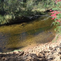
Deadman's Hill Photos


More like Deadman's Hill
Recommended Reviews - Deadman's Hill
Start your review...


7 months ago


8 months ago
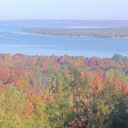
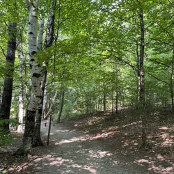
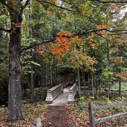
There is a lower and upper level you can park at when you arrive. The upper parking does have one outhouse style restroom if needed. It was clean for being an outhouse. I appreciate that. It was a short gravel walk to the overlook. You could push a buggie or wheelchair if needed. There is a walking path that is clear. The area is established so there are large tree and tree roots to contend with while you walk about so watch your step. Maps are posted and trails are marked. We completed the 3 mile loop and loved every minute. Definitely a must see during the fall. This place would be spectacular for color! We will be back read more


10 months ago
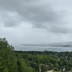
Deadman's Hill has many many beautiful senic views of the Elmira area. Standing and looking out over the valley is just a great experience, this is a bucket lister. read more


5 years ago
Great 3 mile trail. They have some other longer 2-3 day trails. The trail took our group of 11 only about 2.5 hours. Not a super easy trail, but great trail. read more

11 years ago
Nice overlook view with nice trails for all to enjoy. The story behind the area is cool too. Definitely worth visiting if you haven't been here before. The place has camping available as well. It is nice to come here during a day with nice weather. read more

More info about Deadman's Hill
Elmira, MI 49730
Directions
Hours
Outdoor Amenities


Why does Yelp recommend reviews?
Deadman's Hill - hiking - Updated May 2026
Best of Elmira
People found Deadman's Hill by searching for…
Things to Do in Elmira, Michigan
Scenic Overlook in Elmira, Michigan
Hiking Trails in Elmira, Michigan
Scenic Views in Elmira, Michigan
Beautiful Views in Elmira, Michigan
Walking Trails in Elmira, Michigan
Places to Take Pictures in Elmira, Michigan
Running Trails in Elmira, Michigan
Easy Hikes in Elmira, Michigan
Off Road Trails in Elmira, Michigan
Dog Friendly Trails in Elmira, Michigan
Parks for Kids in Elmira, Michigan
Tent Camping in Elmira, Michigan
Hiking With Kids in Elmira, Michigan
Tourist Attractions in Elmira, Michigan
Scenic Restaurants in Elmira, Michigan
Bike Paths in Elmira, Michigan
Lookout Points in Elmira, Michigan
Fun Things to Do With Kids in Elmira, Michigan
View Points in Elmira, Michigan
Browse Brands
Browse Articles
People who viewed Deadman's Hill also viewed
Pigeon River Country State Forest Area
2 reviews
Young State Park
12 reviews
East Park
1 review
Gaylord's City Elk Park
18 reviews
Barnes Park Campground
27 reviews
Depot Beach
1 review
East Jordan Tourist Park
4 reviews
Otsego Lake State Park
8 reviews
Jordan River Fish Hatchery
1 review
Otsego County Dog Park
1 review