Colebrook Historical Marker Photos


More like Colebrook Historical Marker
Recommended Reviews - Colebrook Historical Marker
Start your review...

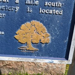
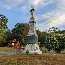
Cool Colebrook trivia: It was the last town settled in colonial Connecticut. It was named after a town in England for an unknown reason. The first baby born in Colebrook was named "Alpha". Cannons used in the Revolutionary War were made here. At one time, Colebrook had a scythe factory! This is a two-sided marker from the CT Historical Commission, with the familiar white lettering on a blue background. It has the a different inscription on each side.. The marker dates to 1980 and is in pretty good shape with no chipping or peeling and just a little fading observed. It's located on the side of the road in front of a huge white colonial in a pretty part of town The full inscription reads: The last town in colonial Connecticut to be settled, Colebrook was named after a town in Devonshire, England. The reason is now unknown. The year 1765 saw Benjamin Horton, leader of a trickle of settlers, arrive amid virgin forests. Samuel Rockwell, among those who shortly followed, two years afterward built one of the outpost's first houses. Here, before long, was born Colebrook's first child, a boy whose parents fittingly named him Alpha. Iron forges soon developed, ore being drawn by oxen from Salisbury for smelting with the plentiful local wood. Cannon for use in the Revolution were made and lugged where needed. A story connects one of these with the piece on exhibit in Quebec whose label states: "Taken by the British at Bunker Hill." Notable structures from the past crowd about this marker. Northward, on the left is the Samuel Rockwell House (1767); below it is the Colebrook Store (1812), a Greek revival gem and a federally registered historic building. To the left stands the combined Historical Society quarters and Town Hall (1816), built as the Colebrook Tavern to serve the needs of travelers on the old New Haven Turnpike, the road just to the right. On the west side of the church in front of the viewer is the Martin Rockwell House (1793) and, lastly the church itself rises serenely above the nearby conifers and maples. Its measurements precisely like the one attributed to Charles Bullfinch, an architect of the United States Capitol. The whole forms a setting that has been declared the best-preserved example of a small post-Revolutionary village center that has survived in the State of Connecticut, and perhaps in all New England. The Town's population peaked just before the Civil War. So did its commercial importance, which was marked by mills, a scythe factory, tanneries, and woolen and wooden-ware works. Today its cool, airy climate and rural quiet each year attract a sizeable summer colony. Erected by the Town of Colebrook The Colebrook Historical Society and the Connecticut Historical Commission 1980 read more
More info about Colebrook Historical Marker


Colebrook Historical Marker - landmarks - Updated July 2026
Best of Colebrook
People found Colebrook Historical Marker by searching for…
Scenic Overlook in Colebrook, CT
Arts & Entertainment in Colebrook, CT
Romantic Views in Colebrook, CT
Places to Take Pictures in Colebrook, CT
Fun Places to Go in Colebrook, CT
Public Services & Government in Colebrook, CT
Indoor Public Space in Colebrook, CT
Fun Things to Do With Kids in Colebrook, CT
Browse Nearby
BEST of Colebrook, Connecticut Things to Do near Colebrook Historical Marker
BEST of Colebrook, Connecticut Restaurants near Colebrook Historical Marker
BEST of Colebrook, Connecticut Coffee near Colebrook Historical Marker
BEST of Colebrook, Connecticut Parks near Colebrook Historical Marker
BEST of Colebrook, Connecticut Hiking near Colebrook Historical Marker
BEST of Colebrook, Connecticut Breakfast near Colebrook Historical Marker
Browse Brands
Browse Articles
People who viewed Colebrook Historical Marker also viewed
Warren Historical Marker
1 review
Glastonbury Historical Marker
1 review
Farmington Veterans Memorial
1 review
Rocky Hill Historical Marker
1 review
Pent Road Marker
1 review
George Washington Monument
1 review
Downtown
Simsbury Historical Marker
2 reviews
Wethersfield Settlers Memorial
1 review
Riverton Historical Marker
1 review
Connecticut Veteran's Memorial
2 reviews