Bicycle and Pedestrian Path - Bay Bridge Photos


More like Bicycle and Pedestrian Path - Bay Bridge
Recommended Reviews - Bicycle and Pedestrian Path - Bay Bridge
Start your review...


Reviews With Photos


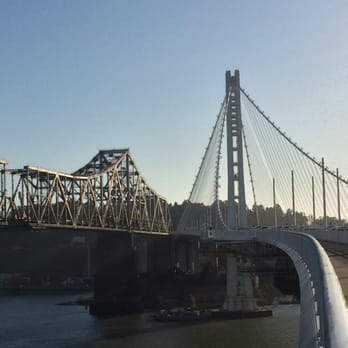
THE GOOD * You can now walk (or bike or run) halfway across the new span of the Bay Bridge. * The views as you walk are unique and photo-worthy. I kept feeling like I was someplace other than the Bay Area (New York? Seattle?). There's a point at which you see Yerba Buena Island, the old unused span of the Bay Bridge, the old in-use span, the new span, and San Francisco. It's trippy and cool and worth viewing. * Free, easy parking beside the Bay Trail path in Oakland (Burma Street). Follow this trail straight to the bridge entrance (1.25 miles). * Benches, should you wish to sit a while. THE NOT SO GOOD * The path is LOUD. There's a ton of cars racing by and you won't forget it. You might even get a splitting headache as a result. Oddly, the sound level seems more manageable when you reach the portion of the span with the bridge cables. It's much nicer once that happens. * The path isn't very wide. There's a lane for inbound bikers, a lane for outbound bikers, and a lane for all pedestrians. The pedestrian lane is just big enough for 2 people to walk in side by side but not if you both walk with your hands on your hips and not if your dog wants to walk beside you both. * There's no restrooms on the path. There's some port-a-potties on the trail before you reach the bridge. Use them. * Your dog might not adore this path. There's the noise thing but also no trees, bushes, or plants. * No skating, no skateboarding, no motorized bikes. * The path has a closing time. Plan accordingly. You can be ticketed if you're not off the path by closing time. * No suicide barrier. I honestly don't know which category this observation belongs in. ACCESS The Bay Bridge Trail is accessible via the Bay Trail from Emeryville and Oakland. Beginning in Emeryville adds one mile each way to your journey, resulting in an 8+ mile round-trip hike. Parking in Oakland shaves off 2 miles. There's a designated "Bay Trail Parking" area beside the Bay Trail on Burma Road in Oakland. The parking area is easy to get to, free, and seemed safe. Signs directing you to the bridge are well placed and clearly marked. The path stops short of Yerba Buena Island and, from there, you turn around and retrace your steps. Signs posted at the beginning of the path say it's 2.4 miles in each direction and takes about 2 hours to walk to the end and back. Those signs proved accurate. MISCELLANY As you walk, ponder all of the possible uses for the old Bay Bridge span: A bay area High Line perhaps? For me, this is a 1&done journey. It's interesting and worth doing but I won't be doing it again, on foot, until I can walk the length of the bridge into the City. When it goes all the way into SF I imagine it'll have a horde of bicycle commuters. Here's hoping they widen the next portion of the path they open.
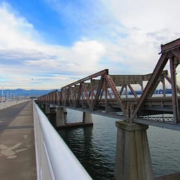

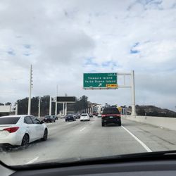
Wow, super tough to navigate to due to the construction on Burma Road, which is the parking location near the bridge. Good thing I'm a former Bay Area resident and kinda knew where to go since GPS was trying to route me to Treasure Island only to U-turn and come back. But ... I found my way through the train tracks and eventually found a sign for the Bay Bridge trail. Then it was an easy drive to the parking lot. I'm glad I did the walk although I don't think it's worth repeating. Why? It's just plain loud once you're parallel to the new bridge due to road traffic. Of course I expected the noise but thought I might be able to ignore it a bit. Didn't work. I went on a Sunday afternoon and there were only a handful of other walkers/bikers present. Maybe I saw 30 people total? It's about 2.6 miles each way to the turn around point. There's decent views of Oakland and San Francisco from the walkway. I have to say it's interesting to see the old bridge, that I drove over thousands of times, so close up and in such a state of destruction. The birds are digging living below the old bridge now that there's no traffic! Go and check it out. Definitely worth a one-time walk.


Hah !!! Finally 4 months after the Bike and Pedestrian Path opened to the public i was able to experience it. Weather was perfect for a nice Sunday walk. Getting there is easy. We parked at Burma Rd. parking lot where they have easy access to the entrance of the trail. Parking is free for 5 hrs. Before you can even get to the Bridge itself you will have to walk for about 2miles then another 2miles to walk to the Bridge. The path does not run through the entire bridge. It stops right before yerba buena / treasure island . Probably couple more years before they can add the additional path. They need to clear the old bridge first before they can build the new path. There is another access point near the Ikea / Emeryville area. I might try that path next time. Ikea / Emeryville to Maritime Path --- 1.5 miles Maritime to end of Path --- 3.4 miles It was indeed a very nice and relaxing walk (the noise from the cars crossing the bridge did not bother me) Amazing view of the new tower on the bridge. A lot of walkers and bikers of all ages. Although the rules said that skateboards are not allowed there are still people who does not follow. Benches are available for people who needs to take a rest. (2 benches per call box) I would definitely walk again here. But make sure that you go to the bathroom first before you start your walk. There are no restrooms on the bridge path only the portable ones before you get on the bridge (which can be very dirty, smelly and filthy by the end of the day). Bring a bottle of water, use sunblock, and bring sunglasses with you.


Good place to go for a casual stroll on a nice day or an early morning run/bike ride. You'll definitely get your workout in for the day, since a round-trip starting from Ikea is a little over 8 miles. That's like doing a 10k and then some! We were sneaky and parked at Ikea, but that probably isn't the best idea for avoiding tickets. We found out that there was free parking for the bay trail at Burma/Ward Ave, so I'll definitely make not of that for next time. Some negatives - the smell from the wastewater treatment plant at the beginning of the trail isn't the very pleasant. And it can get pretty loud with all the cars zooming by you. It's also not a very wide trail, so beware of speedy bikers if you're walking. But! They have benches all along the trail in case you need a short break or want to take in the view more.
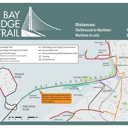

This is a great walk but there are a few things you need to know: (1) You will not get any sweeping vistas of the city, the bay, the Golden Gate Bridge, Angel Island, or any of those other postcard views. The path is on the southeast side of the bridge, so mostly what you will see is whatever remains of the old bridge, the Oakland skyline, and the East Bay hills. Why some genius put the path on that side of the bridge is beyond me. The cars get all the best views. (2) The walk across the bridge from the Emeryville entrance point (which you will have to use when the parking lot is closed, as it often is, at the Oakland entrance) is about 10 miles round trip, more than half of which is walking along next to the freeway until you get to the toll plaza. (People refer to it as a 4-mile path, but is 4.9 miles EACH WAY from Emeryville. I am posting a photo of the trail sign.) (3) The only bathrooms are porta-potties near the toll plaza. Remember, you will be walking 10 miles, which means you need to drink water. And when you drink water, you need to pee. Plan accordingly. (4) Bring earplugs. The noise from the traffic, especially when you are on the actual bridge, is deafening. Having whined about all of the above, I must say that I am not sorry I did it and I would do it again -- with better planning.


One of the most disappointing outings I can remember. They put the path on the wrong side of the bridge!!! The entire pedestrian bike path leading up to the new Bay Bridge is surrounded on one side by 16 lanes of highway and on the other by barbed wire, CalTrans infrastructure and the industrial port of Oakland There isn't even the birding allure of a garbage dump or wastewater treatment facility. It's kinda like walking/biking along a busy highway through an industrial hellhole. No, wait, it's not like that, it IS that. And then, when you actually get on the bridge, you get a view of ... Yes more of the port of Oakland! Woohoo! And you'll get to see even more paved tarmac with idling diesel trucks once they remove the rusting hulk of the old bridge. Why oh why didn't they put this on the other side of the bridge??!? You'd have the same highway noise/air, but at least the north side of the approach to bridge is ringed with wide open salt marshes, so you'd get an expansive view of the whole northern half of the Bay, with Angel Island, Mt, Tam, and even the Golden Gate in the near distance, and you would have gotten close up views of lots of wildlife, especially at low tide. Add this to the LONG list of tragic misuses of public funds, hopes, and dreams with this new bridge. Can we get them to build another one, please? (Yeah right).


I'm glad a pedestrian and bike trail were added to the design of the new Bay Bridge. The Golden Gate bridge has had one from the beginning, and it gives you the ability to be up close and feel the weight and art in a way that just doesn't kick in as you wiz by in your car (or creep as sometimes happens). The trail won't get you all the way to the island yet, they can't do that until the old bridge is removed, but it's still a good trip as far as it will go. I especially like watching the old bridge in various stages of deconstruction. After driving across the old span for so many years it's almost surreal to be alongside it. Once you are on the bridge itself the path is marked off into three sections. East and west bound bicycles and foot traffic. If you are on a bike be wary of the pedestrians, I've found they walk darn near anywhere and stop in clumps to look at the sights. According to RunKeeper starting from the Maritime parking lot, going up to the end of the trail on the bridge, riding back along the trail and all the way to Ikea, and then turing around and going back to the parking lot is just about 9 miles. That's a pleasant ride. Just remember that this is a tall unprotected structure across a very cold waterway. Even on hot days the breeze can get quite cold. So layer up!


So a couple of days after the Napa quake, thought it was time to try the new, improved Bay Bridge via cycle. There's a route which starts at the IKEA in Emeryville but don't park there; they hate it. Either that or bring grandma to sit in the IKEA restaurant for an hour or so while you go cycling. An easier alternative is the mall next door which costs $3 for 4 hours. (It's got a large AMC sign on it) Once you get going, the route is very well marked, taking you past some exciting looking industrial plants and whatnot. They have made a lovely effort with planting mainly drought resistant plants along the route to beautify it. According to the sign, it takes 3.5 hours round trip to walk it. We cycled, taking less than an hour for a leisurely jaunt. There are both dedicated walking and cycling lanes so don't worry if walking, about getting hit by an errant cyclist, too much. There is a bathroom or two about halfway of the 4 mile journey for those with excitable dispositions. At approximately the 2 mile mark, the slope goes up continuously which is a slight effort for the casual cyclist. You'll know when you reach the end as there is a posted Guard and Gate. The views are good but, Madam, you are no Goldengate. The freewheel down at the end is spectacular fun, especially on the day we went free of traffic. And at the end there's the promise of those IKEA meatballs....


I only write this for the scenery alone...hate the traffic etc of the Bay Area but every time I get across this bridge after the toll gates of course nothing but beauty and cool stuff to look at....it is very peaceful to see the ships out in the water or the golden gate either way it brings a portion of calmness to all the crazy people that drive through here.


Hiked starting at new parking lot 210 Burma Rd, Oakland did the new Judge John Sutter Regional Shoreline then continued into the Bay Bridge Trail. Trail is 2.25 miles one way. Good for Pedestrians & bikes only. We walked to the end which is the Yerba Buena Island Vista Point. They have bathrooms there. One day when construction is over we can hike into Treasure a island, bikes can go to Treasure Island Weekends & Holidays only due to construction. Then we returned the same way back. read more


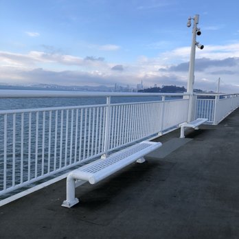


Since this bridge opened in 2013, I was eyeing the pedestrian pathway that was located right in plain view from the car to run it one day! Fast forward 5 years and having had moved to the bay area a year ago, I finally ran this with my sister a couple months ago! Since my sister lives nearby in Oakland, we ran from her place to the bridge trail head. We got confused and ran to the shipyard on Burma Road towards the ocean when we realized we had run back to find the trail head. We finally made our way to the bay bridge trail where there were clear signs and many bicyclists and runners on the path. From the beginning of the trail head to the end of the bridge, it was about 2.5 miles with minimal incline. The views were amazing and it wasn't too windy surprisingly. There were clear marks for which side to stay on for runners and bicyclists and the view from Yerba was amazing! A great surprise at the end of the bridge were these clean bathrooms and a water fountain, so if you don't need to drink too much water or you don't like carrying water, there is a water fountain at the end. Like many have mentioned, you can take a free shuttle from the end of the bridge to a view point in Yerba Island. No it won't take you to the city but it's a cool thing to do if you have time. I didn't go since my sister and I had to run back, but definitely would try it one of these days! read more


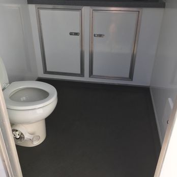


YEEEEEAAAAA I finally ran the new span of the bay bridge!!! **AMAZING/THERAPEUTIC** How many miles did I run? 8.12 Starting from Ikea one way it's 4.05 miles and the turn about = 8.12 according to the Nike app. LOL Would I do it again? Hell ya!!! Tips-Go early, before it get's too crowded. We started around 745a and ran all the way to the end, if you are not a runner you can always ride your bike or just walk it. Be aware of bikers, you may get run into!! Where to park? Inside the lot of Bay street, do not park at IKEA-you will get a ticket!!! CHP in full effect BTW!!! -Toodles read more


THE GOOD * You can now walk (or bike or run) halfway across the new span of the Bay Bridge. * The views as you walk are unique and photo-worthy. I kept feeling like I was someplace other than the Bay Area (New York? Seattle?). There's a point at which you see Yerba Buena Island, the old unused span of the Bay Bridge, the old in-use span, the new span, and San Francisco. It's trippy and cool and worth viewing. * Free, easy parking beside the Bay Trail path in Oakland (Burma Street). Follow this trail straight to the bridge entrance (1.25 miles). * Benches, should you wish to sit a while. THE NOT SO GOOD * The path is LOUD. There's a ton of cars racing by and you won't forget it. You might even get a splitting headache as a result. Oddly, the sound level seems more manageable when you reach the portion of the span with the bridge cables. It's much nicer once that happens. * The path isn't very wide. There's a lane for inbound bikers, a lane for outbound bikers, and a lane for all pedestrians. The pedestrian lane is just big enough for 2 people to walk in side by side but not if you both walk with your hands on your hips and not if your dog wants to walk beside you both. * There's no restrooms on the path. There's some port-a-potties on the trail before you reach the bridge. Use them. * Your dog might not adore this path. There's the noise thing but also no trees, bushes, or plants. * No skating, no skateboarding, no motorized bikes. * The path has a closing time. Plan accordingly. You can be ticketed if you're not off the path by closing time. * No suicide barrier. I honestly don't know which category this observation belongs in. ACCESS The Bay Bridge Trail is accessible via the Bay Trail from Emeryville and Oakland. Beginning in Emeryville adds one mile each way to your journey, resulting in an 8+ mile round-trip hike. Parking in Oakland shaves off 2 miles. There's a designated "Bay Trail Parking" area beside the Bay Trail on Burma Road in Oakland. The parking area is easy to get to, free, and seemed safe. Signs directing you to the bridge are well placed and clearly marked. The path stops short of Yerba Buena Island and, from there, you turn around and retrace your steps. Signs posted at the beginning of the path say it's 2.4 miles in each direction and takes about 2 hours to walk to the end and back. Those signs proved accurate. MISCELLANY As you walk, ponder all of the possible uses for the old Bay Bridge span: A bay area High Line perhaps? For me, this is a 1&done journey. It's interesting and worth doing but I won't be doing it again, on foot, until I can walk the length of the bridge into the City. When it goes all the way into SF I imagine it'll have a horde of bicycle commuters. Here's hoping they widen the next portion of the path they open. read more

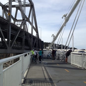


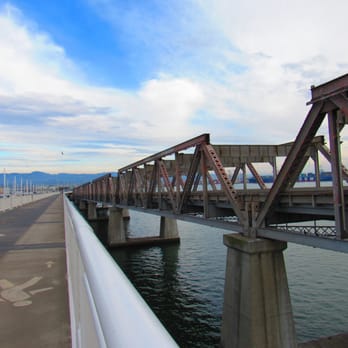
Wow, super tough to navigate to due to the construction on Burma Road, which is the parking location near the bridge. Good thing I'm a former Bay Area resident and kinda knew where to go since GPS was trying to route me to Treasure Island only to U-turn and come back. But ... I found my way through the train tracks and eventually found a sign for the Bay Bridge trail. Then it was an easy drive to the parking lot. I'm glad I did the walk although I don't think it's worth repeating. Why? It's just plain loud once you're parallel to the new bridge due to road traffic. Of course I expected the noise but thought I might be able to ignore it a bit. Didn't work. I went on a Sunday afternoon and there were only a handful of other walkers/bikers present. Maybe I saw 30 people total? It's about 2.6 miles each way to the turn around point. There's decent views of Oakland and San Francisco from the walkway. I have to say it's interesting to see the old bridge, that I drove over thousands of times, so close up and in such a state of destruction. The birds are digging living below the old bridge now that there's no traffic! Go and check it out. Definitely worth a one-time walk. read more


12 years ago

12 years ago
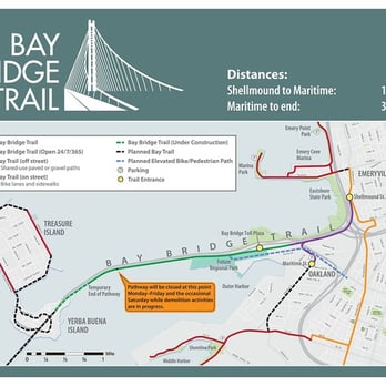
Hah !!! Finally 4 months after the Bike and Pedestrian Path opened to the public i was able to experience it. Weather was perfect for a nice Sunday walk. Getting there is easy. We parked at Burma Rd. parking lot where they have easy access to the entrance of the trail. Parking is free for 5 hrs. Before you can even get to the Bridge itself you will have to walk for about 2miles then another 2miles to walk to the Bridge. The path does not run through the entire bridge. It stops right before yerba buena / treasure island . Probably couple more years before they can add the additional path. They need to clear the old bridge first before they can build the new path. There is another access point near the Ikea / Emeryville area. I might try that path next time. Ikea / Emeryville to Maritime Path --- 1.5 miles Maritime to end of Path --- 3.4 miles It was indeed a very nice and relaxing walk (the noise from the cars crossing the bridge did not bother me) Amazing view of the new tower on the bridge. A lot of walkers and bikers of all ages. Although the rules said that skateboards are not allowed there are still people who does not follow. Benches are available for people who needs to take a rest. (2 benches per call box) I would definitely walk again here. But make sure that you go to the bathroom first before you start your walk. There are no restrooms on the bridge path only the portable ones before you get on the bridge (which can be very dirty, smelly and filthy by the end of the day). Bring a bottle of water, use sunblock, and bring sunglasses with you. read more


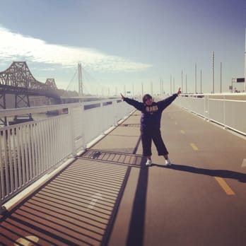


Good place to go for a casual stroll on a nice day or an early morning run/bike ride. You'll definitely get your workout in for the day, since a round-trip starting from Ikea is a little over 8 miles. That's like doing a 10k and then some! We were sneaky and parked at Ikea, but that probably isn't the best idea for avoiding tickets. We found out that there was free parking for the bay trail at Burma/Ward Ave, so I'll definitely make not of that for next time. Some negatives - the smell from the wastewater treatment plant at the beginning of the trail isn't the very pleasant. And it can get pretty loud with all the cars zooming by you. It's also not a very wide trail, so beware of speedy bikers if you're walking. But! They have benches all along the trail in case you need a short break or want to take in the view more. read more


11 years ago
This is a great walk but there are a few things you need to know: (1) You will not get any sweeping vistas of the city, the bay, the Golden Gate Bridge, Angel Island, or any of those other postcard views. The path is on the southeast side of the bridge, so mostly what you will see is whatever remains of the old bridge, the Oakland skyline, and the East Bay hills. Why some genius put the path on that side of the bridge is beyond me. The cars get all the best views. (2) The walk across the bridge from the Emeryville entrance point (which you will have to use when the parking lot is closed, as it often is, at the Oakland entrance) is about 10 miles round trip, more than half of which is walking along next to the freeway until you get to the toll plaza. (People refer to it as a 4-mile path, but is 4.9 miles EACH WAY from Emeryville. I am posting a photo of the trail sign.) (3) The only bathrooms are porta-potties near the toll plaza. Remember, you will be walking 10 miles, which means you need to drink water. And when you drink water, you need to pee. Plan accordingly. (4) Bring earplugs. The noise from the traffic, especially when you are on the actual bridge, is deafening. Having whined about all of the above, I must say that I am not sorry I did it and I would do it again -- with better planning. read more

12 years ago
One of the most disappointing outings I can remember. They put the path on the wrong side of the bridge!!! The entire pedestrian bike path leading up to the new Bay Bridge is surrounded on one side by 16 lanes of highway and on the other by barbed wire, CalTrans infrastructure and the industrial port of Oakland There isn't even the birding allure of a garbage dump or wastewater treatment facility. It's kinda like walking/biking along a busy highway through an industrial hellhole. No, wait, it's not like that, it IS that. And then, when you actually get on the bridge, you get a view of ... Yes more of the port of Oakland! Woohoo! And you'll get to see even more paved tarmac with idling diesel trucks once they remove the rusting hulk of the old bridge. Why oh why didn't they put this on the other side of the bridge??!? You'd have the same highway noise/air, but at least the north side of the approach to bridge is ringed with wide open salt marshes, so you'd get an expansive view of the whole northern half of the Bay, with Angel Island, Mt, Tam, and even the Golden Gate in the near distance, and you would have gotten close up views of lots of wildlife, especially at low tide. Add this to the LONG list of tragic misuses of public funds, hopes, and dreams with this new bridge. Can we get them to build another one, please? (Yeah right). read more


I'm glad a pedestrian and bike trail were added to the design of the new Bay Bridge. The Golden Gate bridge has had one from the beginning, and it gives you the ability to be up close and feel the weight and art in a way that just doesn't kick in as you wiz by in your car (or creep as sometimes happens). The trail won't get you all the way to the island yet, they can't do that until the old bridge is removed, but it's still a good trip as far as it will go. I especially like watching the old bridge in various stages of deconstruction. After driving across the old span for so many years it's almost surreal to be alongside it. Once you are on the bridge itself the path is marked off into three sections. East and west bound bicycles and foot traffic. If you are on a bike be wary of the pedestrians, I've found they walk darn near anywhere and stop in clumps to look at the sights. According to RunKeeper starting from the Maritime parking lot, going up to the end of the trail on the bridge, riding back along the trail and all the way to Ikea, and then turing around and going back to the parking lot is just about 9 miles. That's a pleasant ride. Just remember that this is a tall unprotected structure across a very cold waterway. Even on hot days the breeze can get quite cold. So layer up! read more


11 years ago

7 years ago


12 years ago
So a couple of days after the Napa quake, thought it was time to try the new, improved Bay Bridge via cycle. There's a route which starts at the IKEA in Emeryville but don't park there; they hate it. Either that or bring grandma to sit in the IKEA restaurant for an hour or so while you go cycling. An easier alternative is the mall next door which costs $3 for 4 hours. (It's got a large AMC sign on it) Once you get going, the route is very well marked, taking you past some exciting looking industrial plants and whatnot. They have made a lovely effort with planting mainly drought resistant plants along the route to beautify it. According to the sign, it takes 3.5 hours round trip to walk it. We cycled, taking less than an hour for a leisurely jaunt. There are both dedicated walking and cycling lanes so don't worry if walking, about getting hit by an errant cyclist, too much. There is a bathroom or two about halfway of the 4 mile journey for those with excitable dispositions. At approximately the 2 mile mark, the slope goes up continuously which is a slight effort for the casual cyclist. You'll know when you reach the end as there is a posted Guard and Gate. The views are good but, Madam, you are no Goldengate. The freewheel down at the end is spectacular fun, especially on the day we went free of traffic. And at the end there's the promise of those IKEA meatballs.... read more


6 years ago

8 years ago

9 years ago

I only write this for the scenery alone...hate the traffic etc of the Bay Area but every time I get across this bridge after the toll gates of course nothing but beauty and cool stuff to look at....it is very peaceful to see the ships out in the water or the golden gate either way it brings a portion of calmness to all the crazy people that drive through here. read more


9 years ago
TIP: To get the latest status of the Bay Bridge Path visit http://www.baybridgeinfo.org/path. The website has a calendar, trail map, and more information regarding access points and parking. Just a heads up the path is currently open on the weekends and additional days are sometimes added to accommodate the holidays. I decided to visit the Bay Bridge Pedestrian Path on 1/22/17 to get in a long run and experience the Eastern Span of the Bay Bridge up close (note that the pathway does not take you across the main span of the Bay Bridge). I started my run on the Oakland/Emeryville side of the bridge at roughly 8:30a.m. and there was relatively minimal foot traffic/bike traffic. The total length of the Bay Bridge trail is roughly 4.5 miles, but you can extend your distance by ending at Treasure Island or starting a bit earlier(I started at Public Market in Emeryville). The first 2.25 miles are flat and take you underneath the I-80. You also run by a wastewater treatment facility. The smell on this stretch is a bit repulsive. In addition to the stench you'll know you hit this point when you see a fleet of birds hovering around a facility as if they're scavenging for wastewater treasures. After this first stretch you finally hit the Bay Bridge Trailhead(not to be confused with the Bay Bridge Path Trailhead). This is where you begin a graduated climb along side the Bay Bridge. The incline is roughly a 2% grade until you hit the end(2.25 miles). Grab a porta potty break here if you think you can't make it to the end. The weather can be blustery along this stretch so I would recommend dressing in layers. You'll see vestiges of the old Eastern span along this stretch. Finally when you get to the end you can continue on to Treasure Island or loop back. There is also a shuttle that picks you up here. Overall, this path is a relatively easy path for running/biking! The views are uniquely urban and you get to experience the Bay Bridge up close. Deducting a star for the repugnant wastewater treatment plant along the path. read more


Oh my gosh I love the amazing view on this bridge. You get cars on the right (loud), the old bridge/ ocean to the left. And then further down you will get a close up amazing view of the bridge itself. I don't know how my boyfriend found the parking for this area, it's probably through other yelpers but there's this nice parking area for people who wants to bike/ walk up the bridge. It looks new and surrounded by a little gate so I trust it. We went biking on one of the hottest days of the week. I was beginning to regret it when we got the the start of the bridge because the sun was pointing directly in our face so it was hard to even look up. I was surprised the little trail leading up to the bridge was very nice with little flowers and bushes on the sides. Then we go past a guard and then up the bridge. I mean UP. It was steady incline all the way. To be honest it seemed bad because I haven't biked in months and I am very out if shape but it is totally do-able. We took breaks to take pictures. It was the best to make it to the end of that trail. We got an amazing view of the bridge (one of my favorite photos) and going back down made the trip worth it. Basically flying down. I felt like i was flying and it's such a good feeling. I realized it wasn't a bad day to go since I wasn't freezing up on this bridge, and we had wind. Also, remember to bring water and probably sunglasses on a nice day like when I went. Idk bout cold days, most likely gloves and a hoddie as well. I definitely want to bike up and down here a few times for a real work out next time. Warning tho, the sign when we got to the bridge says it would take around 2 hours if you walk up there. read more


Great place for a short bike ride! We parked near the Emeryville public market and biked over. About 8- 9 miles round trip. The trail begins in an industrial area, and it's a gradual uphill slope on the bridge. I look forward to when the trail continues to Treasure Island! read more


13 years ago

12 years ago

10 years ago


A really nice path on the side of the eastern span Bay Bridge. I can't wait until the finish the section to Yerba Buena Island so you also ride around there and Treasure Island. It's a great place to ride of walk the bridge with great views of the bay and old bridge as long as it's here. read more


13 years ago

13 years ago


12 years ago
Quite a nice addition to the East Bay. A good time to go for a stroll is in the morning during the week . Since most people are at work during those hours you wont have to worry about making way for lots of cyclists so you pretty much have both the bike and pedestrian lanes to yourself. Since it's not too crowded other passerby's are generally friendly , greeting you a friendly Good Morning. Once the old section of the other bridge is completely demolished the views should be more impressive, assuming the morning fog permits it.... read more


12 years ago



13 years ago

9 years ago

9 years ago

10 years ago
Page 1 of 2
More info about Bicycle and Pedestrian Path - Bay Bridge
Ask the Community - Bicycle and Pedestrian Path - Bay Bridge
Review Highlights - Bicycle and Pedestrian Path - Bay Bridge

















Why does Yelp recommend reviews?
4 reviews that are not currently recommended
The reviews below are not factored into the business's overall star rating.

12 years ago
10 years ago
12 years ago

11 years ago
Bicycle and Pedestrian Path - Bay Bridge - localflavor - Updated May 2026
Best of Oakland
People found Bicycle and Pedestrian Path - Bay Bridge by searching for…
Pier Fishing in Oakland, California
Bike Paths in Oakland, California
Running Trails in Oakland, California
Sunrise View in Oakland, California
Skyline View in Oakland, California
Theme Parks in Oakland, California
Sunbathing in Oakland, California
Restaurants With a View in Oakland, California
Things to Do at Night in Oakland, California
Scenic Places to Walk in Oakland, California
Things to Do in Oakland, California
Playground in Oakland, California
Sunday Fun Things to Do in Oakland, California
Bathroom in Oakland, California
Stroller Walk in Oakland, California
Scenic View in Oakland, California
Tourist Attractions in Oakland, California
Must See in Oakland, California
Bike Trail in Oakland, California
Browse Articles
Browse Nearby
BEST of Oakland, California Restaurants near Bicycle and Pedestrian Path - Bay Bridge
BEST of Oakland, California Coffee near Bicycle and Pedestrian Path - Bay Bridge
BEST of Oakland, California Things to Do near Bicycle and Pedestrian Path - Bay Bridge
BEST of Oakland, California Arts & Entertainment near Bicycle and Pedestrian Path - Bay Bridge
BEST of Oakland, California Breakfast near Bicycle and Pedestrian Path - Bay Bridge
BEST of Oakland, California Shopping near Bicycle and Pedestrian Path - Bay Bridge
BEST of Oakland, California Hotels near Bicycle and Pedestrian Path - Bay Bridge
BEST of Oakland, California Ferry near Bicycle and Pedestrian Path - Bay Bridge
BEST of Oakland, California Limos near Bicycle and Pedestrian Path - Bay Bridge
Browse Brands
Trending Searches in Oakland, CA
Boat Rental near Bicycle and Pedestrian Path - Bay Bridge
Botanical Gardens near Bicycle and Pedestrian Path - Bay Bridge
Bounce House Rentals near Bicycle and Pedestrian Path - Bay Bridge
Campgrounds near Bicycle and Pedestrian Path - Bay Bridge
Flower Shop near Bicycle and Pedestrian Path - Bay Bridge
Hair near Bicycle and Pedestrian Path - Bay Bridge
Hidden Gems near Bicycle and Pedestrian Path - Bay Bridge
Movie Theatre near Bicycle and Pedestrian Path - Bay Bridge
Night View near Bicycle and Pedestrian Path - Bay Bridge
Nurseries & Gardening near Bicycle and Pedestrian Path - Bay Bridge
Outdoor Furniture Stores near Bicycle and Pedestrian Path - Bay Bridge
Party Equipment Rentals near Bicycle and Pedestrian Path - Bay Bridge
Pedicure near Bicycle and Pedestrian Path - Bay Bridge
Pick Your Own Farms near Bicycle and Pedestrian Path - Bay Bridge
Rainy Day Activities near Bicycle and Pedestrian Path - Bay Bridge
Romantic Activities near Bicycle and Pedestrian Path - Bay Bridge
Scenic Drive near Bicycle and Pedestrian Path - Bay Bridge
Strawberry Picking near Bicycle and Pedestrian Path - Bay Bridge
Things To Do Alone near Bicycle and Pedestrian Path - Bay Bridge
Things To Do On A Rainy Day near Bicycle and Pedestrian Path - Bay Bridge
Tourist Attractions near Bicycle and Pedestrian Path - Bay Bridge
People who viewed Bicycle and Pedestrian Path - Bay Bridge also viewed

Embarcadero Public Promenade
14 reviews
Embarcadero

The Embarcadero Waterfront
178 reviews
Embarcadero, North Beach/Telegraph Hill

Francisco Street Steps
3 reviews
North Beach/Telegraph Hill

The 16th Avenue Tiled Steps
664 reviews
Inner Sunset

Stockton Street Tunnel
30 reviews
Chinatown

Filbert Steps
251 reviews
North Beach/Telegraph Hill

Ferry Observation Deck
3 reviews
Jack London Square

Ohlone Way
4 reviews
Glen Park

Lombard Street
852 reviews
Russian Hill

22nd Street Jungle Stairs
2 reviews
Noe Valley