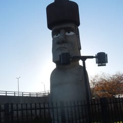
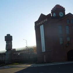
Beacon Falls Historical Marker Photos


More like Beacon Falls Historical Marker
Recommended Reviews - Beacon Falls Historical Marker
Start your review...

3 years ago
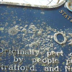
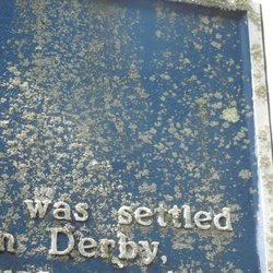
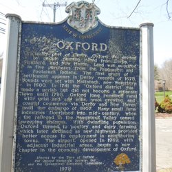
Things I learned from the Beacon Falls marker: 1) A freed Indian Slave named Toby named a local mountain after himself. 2) They made sulphur matches here in 1835 3) The town was named after a 'small but beautiful waterfall' 4) Ever see the word ''Nyumps '' in your life? I did here. This is a two-sided marker from the CT Historical Commission with the familiar white lettering on a blue background. There are different inscriptions on each side. It's located on a strip of grass near the Beacon Falls Town Hall. The sign dates to 1971 and is in pretty good condition with some minor fading of the white lettering. Sadly, although the sign is in good shape, the support posts are not. The concrete cores are rotting and the metal wrap around them are in states of accelerated failure and splitting. What a disgrace, I'm sure that would make Toby sad. The full inscription reads: The lands of Beacon Falls first appear in history when Milford was settled in 1639. Northern boundary of Milford was Beacon Hill Brook, separating the hunting grounds of the Paugasuck and Tunxis Indians. In 1675 the land became part of Derby. First landowner, Captain Ebenezer Johnson, purchased three parcels in the vicinity of Pinesbridge in 1678. Ensign Riggs and Jeremiah Johnson bought land in 1680. Toby's Mountain (High Rock) was purchased in 1693 by an Indian named Toby, for twelve years a slave of Captain Johnson, freed by him in 1688.The main part of town (called Nyumps) was purchased in 1709. About 1835, some of the earliest American made sulphur matches were manufactured here by Thomas Sanford. Beacon Falls is first mentioned in the Acts of the General Assembly in 1864, when a joint school district was formed and a two room schoolhouse was built on this site. The Town of Beacon Falls was incorporated June 30, 1871, from portions of the Towns of Naugatuck, Bethany, Seymour and Oxford. The name derived from Beacon Hill, where a small but beautiful waterfall descended. Erected 1971 by Town of Beacon Falls, Connecticut Historical Commission. read more

More info about Beacon Falls Historical Marker


Beacon Falls Historical Marker - landmarks - Updated July 2026
Best of Beacon Falls
People found Beacon Falls Historical Marker by searching for…
Things to Do in Beacon Falls, CT
Places to Take Pictures in Beacon Falls, CT
Waterfalls and Swimming Holes in Beacon Falls, CT
Scenic View in Beacon Falls, CT
Photo Spots in Beacon Falls, CT
Waterfalls in Beacon Falls, CT
Public Services & Government in Beacon Falls, CT
Scenic Overlook in Beacon Falls, CT
Party Venues in Beacon Falls, CT
Field Trips in Beacon Falls, CT
View Points in Beacon Falls, CT
Things to See in Beacon Falls, CT
State Park in Beacon Falls, CT
Historical Sites in Beacon Falls, CT
Attractions in Beacon Falls, CT
Sightseeing in Beacon Falls, CT
Tourist Attractions in Beacon Falls, CT
Baby Shower Locations in Beacon Falls, CT
DMV Road Test in Beacon Falls, CT
Browse Nearby
BEST of Beacon Falls, Connecticut Restaurants near Beacon Falls Historical Marker
BEST of Beacon Falls, Connecticut Coffee near Beacon Falls Historical Marker
BEST of Beacon Falls, Connecticut Things to Do near Beacon Falls Historical Marker
BEST of Beacon Falls, Connecticut Breakfast near Beacon Falls Historical Marker
BEST of Beacon Falls, Connecticut Parks near Beacon Falls Historical Marker
BEST of Beacon Falls, Connecticut Hiking near Beacon Falls Historical Marker
BEST of Beacon Falls, Connecticut Hotels near Beacon Falls Historical Marker
Browse Brands
Browse Articles
People who viewed Beacon Falls Historical Marker also viewed
Trumbull Historical Marker
2 reviews
Ancient Trading Path
1 review
Wilton Historical Marker
2 reviews
Wallingford World War I Monument
1 review
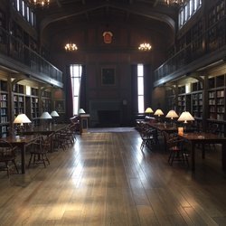
The Cushing Center
9 reviews
Woodbury Historical Marker
2 reviews
West Haven World War I Monument
1 review
Prospect Historical Society
1 review
Weir Farm National Historical Park
27 reviews
Gallaher Mansion & Cranbury Park
17 reviews